Skip navigation

Tag Archives: app

by Donald B. MacGowan


Afternoon sunlight makes the small kipuka at Alanui Kahiko glow, Hawaii Volcanoes National Park: Photo by Donnie MacGowan  New at iTunes: Hawaii Dream Vacation iPhone/iPod Touch App Puts the Magic of Hawaii in the Palm of Your Hand. Interactive maps, GPS and WiFi enabled, dozens of videos…available at iTunes or www.tourguidehawaii.com.

La Aloa Sunset Kailua Kona Hawaii: Graphic from Photo by Donnie MacGowan

There are many wondrous, enigmatic and fascinating attractions on the Big Island of Hawaii, some better known than others, many out of the way and generally off the beaten track. Tour Guide Hawaii has produced an encyclopedic collection of the most up-to-date information, presented as short GPS-cued videos, in an app downloadable to iPhone and iPod Touch that covers the entire Big Island, highlighting the popular and the uncrowded, the famous and the secluded, the adventurous and the relaxing.

Afternoon sunlight makes the small kipuka at Alanui Kahiko glow, Hawaii Volcanoes National Park: Photo by Donnie MacGowan  New at iTunes: Hawaii Dream Vacation iPhone/iPod Touch App Puts the Magic of Hawaii in the Palm of Your Hand. Interactive maps, GPS and WiFi enabled, dozens of videos…available at iTunes or www.tourguidehawaii.com.

Moon over Kahalu'u Beach, Kona Hawaii: Graphic From Photo by Donnie MacGowan

Best About Planning Your Hawaii Trip

Hawaii Lava Flow Update: August 2010 Viewing of Kilauea Lava Flows at Kaplapana on the Big Island: https://lovingthebigisland.wordpress.com/2010/08/08/hawaii-lava-flow-update-august-2010-viewing-of-kilauea-lava-flows-at-kaplapana-on-the-big-island/
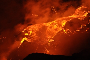
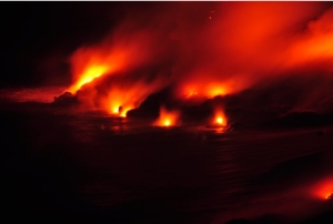
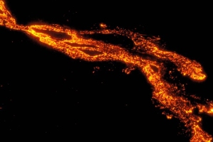
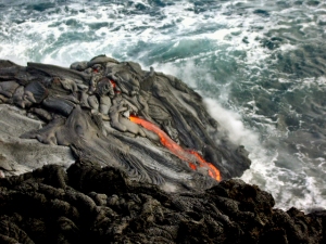
Lava Falls from Kilauea Volcano, near Kalapana, Hawaii, August 2010: Photograph by Donald B. MacGowan

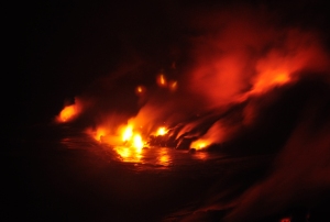
Lava Falls from Kilauea Volcano, near Kalapana, Hawaii, August 2010: Photograph by Donald B. MacGowan

What To Pack And Take To Hawaii: What You Need, What You Want, What You Can Leave Out Of Your Luggage: https://lovingthebigisland.wordpress.com/2009/07/13/what-to-pack-and-take-to-hawaii-what-you-need-what-you-want-what-you-can-leave-out-of-your-luggage/

Getting To Hawaii, Getting Around Hawaii, Getting the Most From Hawaii: https://lovingthebigisland.wordpress.com/2009/06/04/getting-to-and-getting-around-the-big-island-of-hawaii/

Frank’s Guide to Pronouncing Hawaiian Words: https://lovingthebigisland.wordpress.com/2009/07/01/franks-guide-to-pronouncing-the-hawaiian-langauge/

What sunglasses should I buy to go to Hawaii?: https://lovingthebigisland.wordpress.com/2010/01/11/what-sunglasses-should-i-buy-to-go-to-hawaii/

Going to Hawaii? Let’s Chat about Sunburn and Sunscreen…: https://lovingthebigisland.wordpress.com/2010/01/13/going-to-hawaii-lets-chat-about-sun-burn-and-sunscreen/

Afternoon sunlight makes the small kipuka at Alanui Kahiko glow, Hawaii Volcanoes National Park: Photo by Donnie MacGowan  New at iTunes: Hawaii Dream Vacation iPhone/iPod Touch App Puts the Magic of Hawaii in the Palm of Your Hand. Interactive maps, GPS and WiFi enabled, dozens of videos…available at iTunes or www.tourguidehawaii.com.

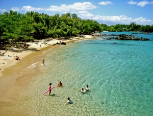
Beautiful Waialea Beach, Kohala Coast Hawaii: Photo by Donnie MacGowan

Best Beaches on Hawaii

A Quick Guide to The Best Beaches of Hawaii Island: Sun, Surf, Solitude: https://lovingthebigisland.wordpress.com/2009/06/25/the-top-beaches-of-hawaii-island/

Green, Black, White, Grey and Piebald: The Colored Sand Beaches of the Big Island of Hawaii: https://lovingthebigisland.wordpress.com/2009/12/10/bgreen-black-white-grey-and-piebald-the-colored-sand-beaches-of-the-big-island-of-hawaii/

The Best Beaches in Hawaii: Part 1, The Main Kohala Coast: https://lovingthebigisland.wordpress.com/2009/08/03/the-best-beaches-in-hawaii-part-1-the-main-kohala-coast/

The Best Beaches in Hawaii: Part 2, The Kona and South Kohala Coasts: https://lovingthebigisland.wordpress.com/2009/08/05/the-best-beaches-in-hawaii-part-2-the-kona-and-south-kohala-coasts/

Best Beaches in Hawaii: Part 3, Unusual, Uncrowded and Untamed Beaches of South Hawaii: https://lovingthebigisland.wordpress.com/2009/08/07/best-beaches-in-hawaii-part-3-unusual-uncrowded-and-untamed-beaches-of-south-hawaii/

Best Beaches in Hawaii: Part 4, Wilderness Beaches of the Big Island: https://lovingthebigisland.wordpress.com/2009/08/09/best-beaches-in-hawaii-part-4-wilderness-beaches-of-the-big-island/

Best Beaches in Hawaii Part 5–Best Beaches for Snorkeling: https://lovingthebigisland.wordpress.com/2009/08/11/best-beaches-in-hawaii-part-5-best-beaches-for-snorkeling/
Afternoon sunlight makes the small kipuka at Alanui Kahiko glow, Hawaii Volcanoes National Park: Photo by Donnie MacGowan  New at iTunes: Hawaii Dream Vacation iPhone/iPod Touch App Puts the Magic of Hawaii in the Palm of Your Hand. Interactive maps, GPS and WiFi enabled, dozens of videos…available at iTunes or www.tourguidehawaii.com.

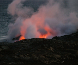
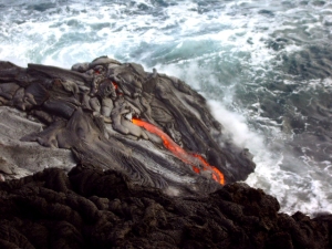
Lava from Kilauea Volcano Flowing into the Sea, Hawaii Volcanoes National Park: Photo by Donnie MacGowan

Best Scenic Drives on Hawaii

An Unforgettable Scenic Drive through Hawaii Volcanoes National Park and Puna on the Big Island of Hawaii: https://lovingthebigisland.wordpress.com/2010/01/18/an-unforgettable-scenic-drive-through-hawaii-volcanoes-national-park-and-puna-on-the-big-island-of-hawaii/

Kona Heritage Corridor Scenic Drive: An Exceptional Day Trip Exploration of Historical, Lovely, Up-Country Kona!:https://lovingthebigisland.wordpress.com/2009/06/14/kona-heritage-corridor-scenic-drive-an-exceptional-day-trip-exploration-of-historical-lovely-up-country-kona/

Best Scenic Drives on Hawaii #1: The Saddle Road…Kona to the Summit of Mauna Kea, Kaumana Cave and Hilo: https://lovingthebigisland.wordpress.com/2010/02/12/best-scenic-drives-on-hawaii-1-the-saddle-road-kona-to-the-summit-of-mauna-kea-kaumana-cave-and-hilo-2/

Best Scenic Drives on Hawaii #2: North Kona and Kohala, Ancient History, Sumptuous Beaches: https://lovingthebigisland.wordpress.com/2010/03/01/scenic-drive-2-north-kona-and-kohala-ancient-history-sumptuous-beaches/

Best Scenic Drives on Hawaii #3: Kona to Hamakua and Hilo: https://lovingthebigisland.wordpress.com/2010/02/09/best-scenic-drives-on-hawaii-3-kona-to-hamakua-and-hilo-2/

Best Scenic Drives in Hawaii #4: Kona Coast to South Point and Ka’u: https://lovingthebigisland.wordpress.com/2010/02/25/best-scenic-drives-in-hawaii-4-kona-coast-to-south-point-and-kau-2/
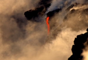
Lava from Kilauea Volcano flows into the ocean near Kalapana, Hawaii: Photograph by Donald B. MacGowan

Lava from Kilauea Volcano flows into the ocean near Kalapana, Hawaii: Photograph by Donald B. MacGowan

Best Scenic Drives in Hawaii #5: Kailua Kona to Hawaii Volcanoes National Park, Puna and Lava Viewing: https://lovingthebigisland.wordpress.com/2010/01/27/best-scenic-drives-in-hawaii-5-kailua-kona-to-hawaii-volcanoes-national-park-puna-and-lava-viewing-2/

Scenic Drive #6: Big Island Whirlwind Road Trip…I have to see the whole Big Island all in one day!https://lovingthebigisland.wordpress.com/2010/03/05/best-scenic-drives-in-hawaii-6-hawaii-whirlwind-road-trip-i-have-to-see-the-whole-big-island-all-in-one-day/

Exploring Hawaii Volcanoes National Park; The Most Interesting, Amazing and Diverse Scenic Drive in Hawaii: https://lovingthebigisland.wordpress.com/2009/11/22/a-scenic-drive-through-hawaii-volcanoes-national-park-the-most-interesting-amazing-and-diverse-place-in-hawaii/

What Do I Do on the Big Island? Explore Hawaii’s Incomparable, Fantastic and Wild South Coast!: https://lovingthebigisland.wordpress.com/2008/12/20/what-do-i-do-on-the-big-island-explore-hawaiis-incomparable-fantastic-and-wild-south-coast/

Road Trip Through Keauhou Historic District, Big Island, Hawaii: https://lovingthebigisland.wordpress.com/2008/07/10/wwwtourguidehawaicom-presents-a-road-trip-through-keauhou-historic-district-big-island-hawaii/

Explore Hawaii’s Hidden, Romantic and Mysterious Places: The South Coast of Hawaii: https://lovingthebigisland.wordpress.com/2009/09/18/new-iphoneipod-touch-app-helps-you-explore-hawaiis-hidden-romantic-and-mysterious-places-the-south-coast-of-hawaii/

New at iTunes: Hawaii Dream Vacation iPhone/iPod Touch App Puts the Magic of Hawaii in the Palm of Your Hand. Interactive maps, GPS and WiFi enabled, dozens of videos…available at iTunes or www.tourguidehawaii.com.

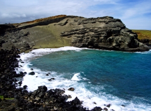
Papakolea: Green Sand (Mahana) Beach at South Point (Ka Lae), Hawaii: Photo by Donald B. MacGowan

Best About Hiking:

The Best Short Hikes on Hawaii Island: https://lovingthebigisland.wordpress.com/2009/06/29/the-best-short-hikes-on-hawaii-island/

The Adventure and Romance of Hiking To Kilauea Volcano’s Active Lava Flows: https://lovingthebigisland.wordpress.com/2008/07/20/tour-guide-hawaii-presents-the-adventure-and-romance-of-hiking-to-kilauea-volcanos-active-lava-flows/

Near Kalapana, Hawaii, Lava from Kilauea Volcano flows into the ocean: Photo by Donald B. MacGowan

Near Kalapana, Hawaii, Lava from Kilauea Volcano flows into the ocean: Photo by Donald B. MacGowan

Exploring the Summit Hikes of Mauna Kea: https://lovingthebigisland.wordpress.com/2009/10/23/exploring-the-summit-hikes-of-mauna-kea-hawaii/

South Point’s Justly Famous Green Sand Beach Hike, Hawaii: https://lovingthebigisland.wordpress.com/2009/10/29/south-points-justly-famous-green-sand-beach-hike-papakolea-bay-and-mahana-beach-hawaii/

Hiking to Captain Cook Monument on the Big Island of Hawaii: https://lovingthebigisland.wordpress.com/2009/10/16/hiking-to-captain-cook-monument-on-the-kona-coast-of-hawaii/

Hiking the Kilauea Iki Trail: https://lovingthebigisland.wordpress.com/2009/09/24/hiking-the-kilauea-iki-trail-new-iphoneipod-touch-app-helps-you-find-all-the-unique-secluded-unusual-destinations-on-hawaii/

Hiking Hawaii’s Magnificent Waipi’o Valley: https://lovingthebigisland.wordpress.com/2009/10/18/hiking-hawaiis-magnificent-waipio-valley/

Hike to Kamehameha’s Birthplace and the Forbidding Temple of Human Sacrifice, Mo’okini Heiau, on the Big Island of Hawaii: https://lovingthebigisland.wordpress.com/2009/11/21/hike-to-kamehamehas-birthplace-and-the-forbidding-temple-of-human-sacrifice-mookini-heaiau-on-the-big-island-of-hawaii/

Ka’u Desert’s Unearthly Hike to the Eerie Warrior Footprint Casts: https://lovingthebigisland.wordpress.com/2009/11/05/2965/

Hiking Down Into Pololu Valley, Big Island, Hawaii: https://lovingthebigisland.wordpress.com/2009/10/20/hiking-down-into-pololu-valley-big-island-of-hawaii/

Kiholo Bay Beach Hike: https://lovingthebigisland.wordpress.com/2009/10/21/kiholo-bay-beach-hike/

Hiking to Honomalino Bay, Big Island, Hawaii: https://lovingthebigisland.wordpress.com/2009/10/19/hiking-to-honomalino-bay-big-island-hawaii/

Historic Kailua Kona Town on the Big Island of Hawaii: A Walking Tour: https://lovingthebigisland.wordpress.com/2009/05/03/historic-kailua-kona-town-on-the-big-island-of-hawaii-a-walking-tour/

Hiking and Camping at Hawaii’s Last Wilderness Beach: La’amaomao the Wind God and Makalawena Beach: Advice: https://lovingthebigisland.wordpress.com/2009/02/21/hiking-and-camping-at-hawaiis-last-wilderness-beach-laamaomao-the-wind-god-and-makalawena-beach/

Driving and Hiking to the Summit of Mauna Kea, Big Island of Hawaii: https://lovingthebigisland.wordpress.com/2009/07/26/advice-driving-and-hiking-to-the-summit-of-mauna-kea-big-island-of-hawaii/

Hidden Secrets of Hawaii: The Golden Ponds of Ke-awa-iki: https://lovingthebigisland.wordpress.com/2009/04/21/hidden-secrets-of-hawaii-the-golden-ponds-of-ke-awa-iki/

Near Kalapana, Hawaii, Lava from Kilauea Volcano flows into the Ocean: Photo by Donald B. MacGowan

Near Kalapana, Hawaii, Lava from Kilauea Volcano flows into the Ocean: Photo by Donald B. MacGowan

Hiking at Kilauea Volcano on the Big Island of Hawaii: https://lovingthebigisland.wordpress.com/2009/01/07/hiking-at-kilauea-volcano-on-the-big-island-of-hawaii/

New at iTunes: Hawaii Dream Vacation iPhone/iPod Touch App Puts the Magic of Hawaii in the Palm of Your Hand. Interactive maps, GPS and WiFi enabled, dozens of videos…available at iTunes or www.tourguidehawaii.com.

Liz Fuller at Honaunau Bay, Hawaii: Photo by Donald B. MacGowan

Best About Snorkeling

The Best Snorkeling Spots on Hawaii Island: https://lovingthebigisland.wordpress.com/2009/06/27/the-best-snorkeling-spots-on-hawaii-island/

Discovering Kona: Snorkeling at the Incomparable Two-Step Beach at Honaunau Bay: https://lovingthebigisland.wordpress.com/2010/01/22/discovering-kona-snorkeling-at-the-incomparable-two-step-beach-at-honaunau-bay/

Exploring Kona: Discover hidden, beautiful, special Ho’okena Beach Park: https://lovingthebigisland.wordpress.com/2010/01/24/exploring-kona-discover-hidden-beautiful-special-hookena-beach-park/

Hawaii Island Snorkeling Tips, Part I: Gear: https://lovingthebigisland.wordpress.com/2009/05/16/hawaii-island-snorkeling-tips-part-i-gear-2/

Hawaii Island Snorkeling Tips, Part II: Technique : https://lovingthebigisland.wordpress.com/2009/05/18/hawaii-island-snorkeling-tips-part-ii-technique-2/

Hawaii Island Snorkeling Tips, Part III: Protecting the Reef and Reef Animals: https://lovingthebigisland.wordpress.com/2009/05/20/hawaii-island-snorkeling-tips-part-iii-reef-etiquette-2/

Hawaii Island Snorkeling Tips, Part IV: Snorkeling Safety: https://lovingthebigisland.wordpress.com/2009/05/26/hawaii-island-snorkeling-tips-part-iv-snorkeling-safety-2/

Hawaii Island Snorkeling Tips, Part V: Best Snorkeling Beaches of the Big Island: https://lovingthebigisland.wordpress.com/2009/05/28/hawaii-island-snorkeling-tips-part-v-best-snorkeling-beaches-of-the-big-island-2/

Hawaii Island Snorkeling Tips Part VI: Wilderness Beaches of the Big Island!: https://lovingthebigisland.wordpress.com/2009/05/30/hawaii-island-snorkeling-tips-part-vi-wilderness-beaches-of-the-big-islanda/
New at iTunes: Hawaii Dream Vacation iPhone/iPod Touch App Puts the Magic of Hawaii in the Palm of Your Hand. Interactive maps, GPS and WiFi enabled, dozens of videos…available at iTunes or www.tourguidehawaii.com.

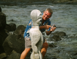
Frank Burgess giving travel advice at Pu'u Honua O Honaunau National Historic Park, Kona Hawaii: Photo by Donald B MacGowan

Frank’s Big Island Travel Hints

Frank’s Big Island Travel Hints #1: Introduction: Kona Coast: https://lovingthebigisland.wordpress.com/2009/09/26/franks-big-island-travel-hints-1-north-kona-and-kohala-ancient-history-sumptuous-beaches/

Frank’s Big Island Travel Hints #2: Kona South to Hawaii Volcanoes National Park Hilo:https://lovingthebigisland.wordpress.com/2009/09/27/franks-big-island-travel-hints-2-kona-coast-south-of-honaunau-to-kau/

Frank’s Big Island Travel Hints #3: Kona North to Waikoloa and the Kohala Coast:https://lovingthebigisland.wordpress.com/2009/09/29/1794/

Frank’s Big Island Travel Hints #4: Waikoloa to Pololu Valley; https://lovingthebigisland.wordpress.com/2009/10/01/franks-big-island-travel-hints-4-waikoloa-to-pololu-valley-4/

Frank’s Big Island Travel Hints #5: Hawi to Kona via the Kohala Mountain road, Waimea and Waikoloa: https://lovingthebigisland.wordpress.com/2009/10/03/franks-big-island-travel-hints-5-hawi-to-kona-via-kohala-mountain-road-waimea-and-waikoloa-4/

Frank’s Big Island Travel Hints #6: Waimea and the Hamakua Coast: https://lovingthebigisland.wordpress.com/2009/10/04/franks-big-island-travel-hints-6-waimea-and-the-hamakua-coast-4/

Frank’s Big Island Travel Hints # 7: Around Hilo: https://lovingthebigisland.wordpress.com/2009/10/06/franks-big-island-travel-hints-7-hilo-side-akaka-falls-to-panaewa-rainforest-zoo/

Frank’s Big Island Travel Hints #8: Mysterious Puna!: https://lovingthebigisland.wordpress.com/2009/10/08/franks-big-island-travel-hints-8-mysterious-puna/

Frank’s Big Island Travel Hints #9: Made for Adventure: The Jungles, Volcanoes, Hot Springs and Tidepools of Puna!: https://lovingthebigisland.wordpress.com/2009/10/09/franks-hawaii-travel-hints-9-made-for-adventure-the-jungles-volcanoes-hot-springs-and-tidepools-of-puna/

Kilauea Lava Flow Near Kalapana Hawaii, August 2010: Photo by Donald B MacGowan

Kilauea Lava Flow Near Kalapana Hawaii, August 2010: Photo by Donald B MacGowan

Frank’s Big Island Travel Hints #10: Hawaii Volcanoes National Park: https://lovingthebigisland.wordpress.com/2009/10/11/franks-big-island-travel-hints-10-hawaii-volcanoes-national-park/

Frank’s Travel Hints # 11: Exploring Deeper Into Hawaii Volcanoes National Park, Big Island, Hawaii: https://lovingthebigisland.wordpress.com/2009/10/13/franks-big-island-travel-hints-11-exploring-deeper-into-hawaii-volcanoes-national-park-big-island-hawaii/

Frank’s Big Island Travel Hints #12: More fun in Hawaii Volcanoes National Park, Big Island, Hawaii: https://lovingthebigisland.wordpress.com/2009/10/15/franks-big-island-travel-hints-12-more-fun-in-hawaii-volcanoes-national-park-big-island-hawaii-4/

Frank’s Big Island Travel Hints #13: Hawaii Volcanoes National Park: Chain of Craters Road: https://lovingthebigisland.wordpress.com/2009/10/17/franks-big-island-travel-hints-13-hawaii-volcanoes-national-park-chain-of-craters-road/
New at iTunes: Hawaii Dream Vacation iPhone/iPod Touch App Puts the Magic of Hawaii in the Palm of Your Hand. Interactive maps, GPS and WiFi enabled, dozens of videos…available at iTunes or www.tourguidehawaii.com.

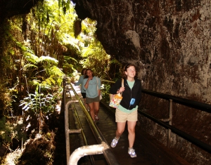
My Sister and Nieces Entering Thurston Lava Tube, Hawaii Volcanoes National Park: Photo by Donald B MacGowan

Best Exploration Information, Interesting Stories and General Reading about Hawaii

New at iTunes: Hawaii Dream Vacation iPhone/iPod Touch App Puts the Magic of Hawaii in the Palm of Your Hand. Interactive maps, GPS and WiFi enabled, dozens of videos…available at iTunes or www.tourguidehawaii.com.

Cliffs at Pololu Valley, North tip of Hawaii Island: Photo by Donnie MacGowan

-Kohala

Hawaii’s Most Famous Beach: Anaeho’omalu Bay on the Incomparable Kohala Coast: https://lovingthebigisland.wordpress.com/2010/02/19/hawaiis-most-famous-beach-anaehoomalu-bay-on-the-incomparable-kohala-coast/

Exploring the Wild Kohala Coast: Hapuna Beach, the Crown Jewel of Hawaii: https://lovingthebigisland.wordpress.com/2010/02/26/exploring-the-wild-kohala-coast-hapuna-beach-the-crown-jewel-of-hawaii/

Pu’ukohola Heiau National Historic Park: A Warrior becomes a King, an Island Archipelago Becomes a Kingdom: https://lovingthebigisland.wordpress.com/2009/11/28/puukohola-heiau-national-historic-park-a-warrior-becomes-a-king-and-island-archepelago-becomes-a-kingdom/

Dreamy, laid back Hawi and Kapa’au: The Joy of North Kohala: https://lovingthebigisland.wordpress.com/2010/02/28/dreamy-laid-back-hawi-and-kapaau-the-joy-of-north-kohala/

What’s Out There On The Western Tip of Hawaii Island? Kekaha Kai State Park!: https://lovingthebigisland.wordpress.com/2010/02/18/whats-out-there-on-thethe-western-tip-of-hawaii-island-kekaha-kai-state-park/

Delightful, beautiful Kua Bay on the Southern Kohala Coast, Hawaii: https://lovingthebigisland.wordpress.com/2010/02/10/delightful-beautiful-kua-bay-on-the-southern-kohala-coast-hawaii/

Fabulous, secluded, amazing Waialea Beach (Beach 69) on the Kohala Coast of Hawaii: https://lovingthebigisland.wordpress.com/2010/01/20/fabulous-secluded-amazing-waialea-beach-beach-69-on-the-kohala-coast-of-hawaii/

Exploring the Incredible Kohala Coast: Samuel Spencer Beach County Park and Mau’umae Beach: https://lovingthebigisland.wordpress.com/2010/03/02/exploring-the-incredible-kohala-coast-samuel-spencer-beach-county-park-and-mauumae-beach/

Exploring the Wild Kohala Coastline: Lapakahi State Historical Park and Koai’e Cove, Hawaii: https://lovingthebigisland.wordpress.com/2010/02/16/exporing-the-wild-kohala-coastline-lapakahi-state-historical-park-and-koai%E2%80%99e-cove-hawaii/

Exploring the Kohala Coast: Discover Maka O Hule Navigation Heiau: https://lovingthebigisland.wordpress.com/2010/01/08/4017/

Discovering Kohala: Driving the Scenic and Fabulous Kohala Mountain Road: https://lovingthebigisland.wordpress.com/2009/12/31/discovering-kohala-driving-the-scenic-and-fabulous-kohala-mountain-road/

New at iTunes: Hawaii Dream Vacation iPhone/iPod Touch App Puts the Magic of Hawaii in the Palm of Your Hand. Interactive maps, GPS and WiFi enabled, dozens of videos…available at iTunes or www.tourguidehawaii.com.

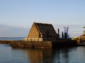
Morning at Ahu'ena Heiau, Kailua Kona Hawaii Photo by Donnie MacGowan

-Kona

Historic Kailua Kona Town on the Big Island of Hawaii: A Walking Tour: https://lovingthebigisland.wordpress.com/2009/05/03/historic-kailua-kona-town-on-the-big-island-of-hawaii-a-walking-tour/

Exploring Kona: Kahalu’u Beach, where people go to meet the fish!: https://lovingthebigisland.wordpress.com/2010/02/15/exploring-kona-kahaluu-beach-where-people-go-to-meet-the-fish/

Fabulous, Coastal Scenic Drive through Keauhou Historic District, North to South: https://lovingthebigisland.wordpress.com/2010/02/23/fabulous-coastal-scenic-drive-through-keauhou-historic-district-north-to-south/

Discovering Kona: Snorkeling at the Incomparable Two-Step Beach at Honaunau Bay: https://lovingthebigisland.wordpress.com/2010/01/22/discovering-kona-snorkeling-at-the-incomparable-two-step-beach-at-honaunau-bay/

Exploring Beautiful Kona, Hawaii: Magic Sands, La’aloa Beach Park and Haukalua Heiau: https://lovingthebigisland.wordpress.com/2010/02/14/explorng-beautiful-kona-hawaii-magic-sands-laaloa-beach-park-and-haukalua-heiau/

Exploring Kona: Discover hidden, beautiful, special Ho’okena Beach Park: https://lovingthebigisland.wordpress.com/2010/01/24/exploring-kona-discover-hidden-beautiful-special-hookena-beach-park/

Kona’s Fascinating History: Exploring Kealakekua Bay Archeological and Historical District, Captain Cook Monument and Hikiau Heiau, Perhaps the Most Important Historical Sites in Hawaii: https://lovingthebigisland.wordpress.com/2009/11/30/konas-fascinating-history-exploring-kealakekua-bay-archeological-and-historical-district-captain-cook-monument-and-hikiau-heiau-perhaps-the-most-important-historical-sites-in-hawaii/

Kona’s Fascinating History: Ahu’ena Heiau at Kamakahonu Beach: https://lovingthebigisland.wordpress.com/2009/11/04/konas-fascinating-history-ahuena-heiau-at-kamakahonu-beach/

Kona’s Fascinating History: Pu’u Honua O Honaunau, The Place Of Refuge, Hawaii: https://lovingthebigisland.wordpress.com/2009/11/24/konas-fascinating-history-puu-honua-o-honaunau-the-place-of-refuge/

Kona’s Fascinating History: The Ancient Temples and Villages, Fabulous Beaches and Scenic Hiking Trails of Koloko-Honokohau National Historic Park, Kona Hawaii: https://lovingthebigisland.wordpress.com/2009/12/02/3407/

Kona’s Fascinating History: Hulihe’e Palace: https://lovingthebigisland.wordpress.com/2009/11/01/konas-fscinating-history-hulihee-palace/

Kona’s Fascinating History: Moku’aikaua Church–the First Christian Church in Hawaii: https://lovingthebigisland.wordpress.com/2009/11/02/konas-fscinating-history-mokuaikawa-the-first-christian-church-in-hawaii/

Kona’s Fascinating History: Kamakahonu Rock, the Kailua Pier and Seawall: https://lovingthebigisland.wordpress.com/2009/10/30/konas-fascinating-history-kamakahonu-rock-the-kailua-pier-and-seawall/

Heartbreak of the Gods: Kuamo’o Battle Field and Lekeleke Graveyard: https://lovingthebigisland.wordpress.com/2009/04/29/heartbreak-of-the-gods-kuamoo-batlle-field-and-lekeleke-graveyard-big-island-of-hawaii/

Rising From The Past: The Rebirth of Hapaiali’i Heiau, a Hawaiian Temple for Honoring Royalty: https://lovingthebigisland.wordpress.com/2009/05/01/1118/

New at iTunes: Hawaii Dream Vacation iPhone/iPod Touch App Puts the Magic of Hawaii in the Palm of Your Hand. Interactive maps, GPS and WiFi enabled, dozens of videos…available at iTunes or www.tourguidehawaii.com.

The Green Sand Beach at South Point, Hawaii: Photo by Donald B MacGowan

-Ka’u

Exploring Hawaii’s South Point: Ka Lae And the Hike to the Green Sand Beach: https://lovingthebigisland.wordpress.com/2009/12/05/exploring-hawaiis-south-point-ka-lae-and-the-hike-to-the-green-sand-beach/

Exploring Punalu’u Black Sand Beach in Ka’u Hawaii: Hiking, Snorkeling, Ancient Temples and Endangered Sea Turtles: https://lovingthebigisland.wordpress.com/2009/12/22/exploring-punaluu-black-sand-beach-in-kau-hawaii-hiking-snorkeling-ancient-temples-and-endangered-sea-turtles/
New at iTunes: Hawaii Dream Vacation iPhone/iPod Touch App Puts the Magic of Hawaii in the Palm of Your Hand. Interactive maps, GPS and WiFi enabled, dozens of videos…available at iTunes or www.tourguidehawaii.com.

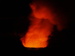
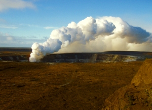
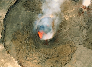
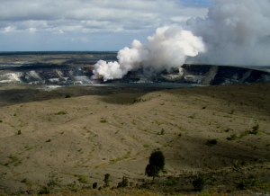
Halema'uma'u Eruption in Kilauea Crater from the Jagger Museum, Hawaii Volcanoes National Park: Photo by Donald B MacGowan

-Hawaii Volcanoes National Park

Hawaii Volcanoes National Park: The Beating Heart of the Big Island: https://lovingthebigisland.wordpress.com/2010/03/31/hawaii-volcanoes-national-park-the-beating-heart-of-the-big-island/

Exploring Hawaii Volcanoes National Park: The Most Interesting, Amazing and Diverse Scenic Drive in Hawaii: https://lovingthebigisland.wordpress.com/2009/11/22/a-scenic-drive-through-hawaii-volcanoes-national-park-the-most-interesting-amazing-and-diverse-place-in-hawaii/

Kalapana Coastline and Kilauea lava flow, Hawaii August 2010: Photo by Donald B MacGowan

Kalapana Coastline and Kilauea lava flow, Hawaii August 2010: Photo by Donald B MacGowan

Incredible, wonderful, mysterious Kilauea Volcano, Hawaii: https://lovingthebigisland.wordpress.com/2010/05/28/incredible-wonderful-mysterious-kilauea-volcano-hawaii/

Exploring Hawaii Volcanoes National Park: Along Crater Rim Drive: https://lovingthebigisland.wordpress.com/2010/03/27/explorng-hawaii-volcanoes-national-park-along-the-chain-of-craters-road/

Exploring Hawaii Volcanoes National Park: Down the Chain of Craters Road: https://lovingthebigisland.wordpress.com/2010/03/28/exploring-hawaii-volcanoes-national-park-down-the-chain-of-craters-road/

Lava Flow from Kilauea Volcano, Kalapana, Hawaii: Photo by Donnie MacGowan

Lava Flow from Kilauea Volcano, Kalapana, Hawaii: Photo by Donnie MacGowan

Exploring Hawaii Volcanoes National Park: Lava Viewing: https://lovingthebigisland.wordpress.com/2010/03/29/exploring-hawaii-volcanoes-national-park-lava-viewing/

Exploring Hawaii Volcanoes National Park: Alanui Kahiko: https://lovingthebigisland.wordpress.com/2010/02/20/chain-of-craters-road-hawaii-volcanoes-national-park-alanui-kahiko/

New at iTunes: Hawaii Dream Vacation iPhone/iPod Touch App Puts the Magic of Hawaii in the Palm of Your Hand. Interactive maps, GPS and WiFi enabled, dozens of videos…available at iTunes or www.tourguidehawaii.com.

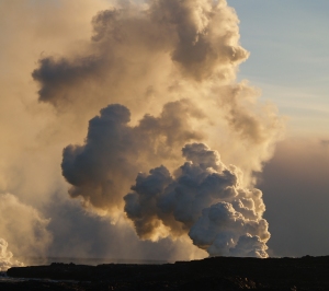
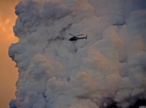
Littoral explosion plume at Waikupanaha lava ocean entry, Puna Hawaii: Photo by Donnie MacGowan

Exploring Hawaii Volcanoes National Park: Devastation Trail: https://lovingthebigisland.wordpress.com/2010/03/06/exploring-hawaii-volcanoes-national-park-devastation-trail/

Exploring Hawaii Volcanoes National Park: Devil’s Throat Collapse Crater: https://lovingthebigisland.wordpress.com/2010/03/07/exploring-hawaii-volcanoes-national-park-devils-throat-collapse-craterdevil%E2%80%99s-throat-less-than-110-of-a-mile-southwest-along-chain-of-craters-road-from-the-hilina-pali-road-turnoff-is-a-s/

Exploring Hawaii Volcanoes National Park: What’s at the End of Chain of Craters Road? Hiking! Mountain biking! Bird-watching!: https://lovingthebigisland.wordpress.com/2010/03/08/exploring-hawaii-volcanoes-national-park-whats-at-the-end-of-chain-of-craters-road/

Exploring Hawaii Volcanoes National Park: Hiking and Biking the Escape Road: https://lovingthebigisland.wordpress.com/2010/03/09/exploring-hawaii-volcanoes-national-park-hiking-and-biking-the-escape-road/

Exploring Hawaii Volcanoes National Park: Halema’uma’u Crater Overlook: https://lovingthebigisland.wordpress.com/2010/03/26/exploring-hawaii-volcanoes-national-park-halemaumau-crater-overlook/

Exploring Hawaii Volcanoes National Park: Halona Kahakai: https://lovingthebigisland.wordpress.com/2010/03/09/exploring-hawaii-volcanoes-national-park-halona-kahakai/

Exploring Hawaii Volcanoes National Park: Hi’iaka Crater and the Lava Flow of 1973: https://lovingthebigisland.wordpress.com/2010/03/10/exploring-hawaii-volcanoes-national-park-hiiaka-crater-and-the-lava-flow-of-1973/

Exploring Hawaii Volcanoes National Park: The incredible Hilina Pali Road: https://lovingthebigisland.wordpress.com/2010/03/10/exploring-hawaii-volcanoes-national-park-the-incredible-hilina-pali-road/
New at iTunes: Hawaii Dream Vacation iPhone/iPod Touch App Puts the Magic of Hawaii in the Palm of Your Hand. Interactive maps, GPS and WiFi enabled, dozens of videos…available at iTunes or www.tourguidehawaii.com.

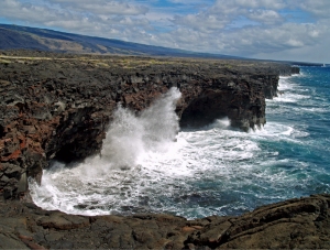
Sea arches, cliffs and wild ocean at the end of Chain of Craters Road, Hawaii Volcanoes National Park: Photo by Donald B MacGowan

Exploring Hawaii Volcanoes National Park: Holei Lava Tube: https://lovingthebigisland.wordpress.com/2010/03/11/exploring-hawaii-volcanoes-national-park-holei-lava-tube/

Exploring Hawaii Volcanoes National Park: Holei Pali: https://lovingthebigisland.wordpress.com/2010/03/11/exploring-hawaii-volcanoes-national-park-holei-pali/

Exploring Hawaii Volcanoes National Park: Holei Sea Arch: https://lovingthebigisland.wordpress.com/2010/03/11/exploring-hawaii-volcanoes-national-park-holei-sea-arch/

Kalapana Coastline: Lava Flow from Kilauea Volcano, Hawaii: Photo by Donnie MacGowan

Kalapana Coastline: Lava Flow from Kilauea Volcano, Hawaii: Photo by Donnie MacGowan

Exploring Hawaii Volcanoes National Park: Jagger Museum and Hawai’i Volcano Observatory: https://lovingthebigisland.wordpress.com/2010/03/12/exploring-hawaii-volcanoes-national-park-jagger-museum-and-hawai%E2%80%99i-volcano-observatory/

Exploring Hawaii Volcanoes National Park: Kealakomo Overlook: https://lovingthebigisland.wordpress.com/2010/03/13/exploring-hawaii-volcanoes-national-park-kealakomo-overlook/

Exploring Hawaii Volcanoes National Park: Keanakako’i Crater: https://lovingthebigisland.wordpress.com/2010/03/25/exploring-hawaii-volcanoes-national-park-keanakakoi-crater/

Exploring Hawaii Volcanoes National Park: Kilauea Iki Overlook: https://lovingthebigisland.wordpress.com/2010/03/13/exploring-hawaii-volcanoes-national-park-kilauea-iki-overlook/

Exploring Hawaii Volcanoes National Park: Kilauea Crater Overlook: https://lovingthebigisland.wordpress.com/2010/03/14/exploring-hawaii-volcanoes-national-park-kilauea-crater-overlook/

Exploring Hawaii Volcanoes National Park: Kilauea Military Camp: https://lovingthebigisland.wordpress.com/2010/03/14/exploring-hawaii-volcanoes-national-park-kilauea-military-camp/

Exploring Hawaii Volcanoes National Park: Kilauea Visitor’s Center: https://lovingthebigisland.wordpress.com/2010/03/15/exploring-hawaii-volcanoes-national-park-kilauea-visitors-center/

Exploring Hawaii Volcanoes National Park: Kipuka Kahali’i: https://lovingthebigisland.wordpress.com/2010/03/15/exploring-hawaii-volcanoes-national-park-kipuka-kahakihi/

Exploring Hawaii Volcanoes National Park: Ko’oko’olau Crater: https://lovingthebigisland.wordpress.com/2010/03/15/exploring-hawaii-volcanoes-national-park-kookoolau-crater/

Appeasing the goddess at Halema'uma'u Crater, Hawaii Volcanoes National Park: Photo by Donald B MacGowan

Exploring Hawaii Volcanoes National Park: Kulanaokuaiki Campground: https://lovingthebigisland.wordpress.com/2010/03/16/exploring-hawaii-volcanoes-national-park-kulanaokuaiki-campground/

Exploring Hawaii Volcanoes National Park: Mauna Loa Lava Tree Molds: https://lovingthebigisland.wordpress.com/2010/03/16/exploring-hawaii-volcanoes-national-park-mauna-loa-lava-tree-molds/

Exploring Hawaii Volcanoes National Park: Lua Manu Crater: https://lovingthebigisland.wordpress.com/2010/03/17/exploring-hawaii-volcanoes-national-park-lua-manu-crater/

Exploring Hawaii Volcanoes National Park: The Main Entrance: https://lovingthebigisland.wordpress.com/2010/03/17/exploring-hawaii-volcanoes-national-park-the-main-entrance/

Exploring Hawaii Volcanoes National Park: Mau Loa O Mauna Ulu: https://lovingthebigisland.wordpress.com/2010/03/18/exploring-hawaii-volcanoes-national-park-mau-loa-of-mauna-ulu/

Exploring Hawaii Volcanoes National Park: Along the Mauna Loa Scenic Road…Tree Molds, Kipuka Puaulu and Mauna Loa Summit Trailhead: https://lovingthebigisland.wordpress.com/2010/03/18/exploring-hawaii-volcanoes-national-park-along-the-mauna-loa-scenic-road%E2%80%A6tree-molds-kipuka-puaulu-and-mauna-loa-summit-trailhead/

Exploring Hawaii Volcanoes National Park: Mauna Ulu, the Growing Mountain: https://lovingthebigisland.wordpress.com/2010/03/19/exploring-hawaii-volcanoes-national-park-mauna-ulu-the-growing-mountain/

Exploring Hawaii Volcanoes National Park: Muliwai a Pele : https://lovingthebigisland.wordpress.com/2010/03/19/exploring-hawaii-volcanoes-national-park-muliwai-a-pele/

Exploring Hawaii Volcanoes National Park: Namakani Paio Campground: https://lovingthebigisland.wordpress.com/2010/03/20/exploring-hawaii-volcanoes-national-park-namakani-paio-campground/

Exploring Hawaii Volcanoes National Park: Pauahi Crater: https://lovingthebigisland.wordpress.com/2010/03/20/exploring-hawaii-volcanoes-nationa-park-pauahi-crater/

Exploring Hawaii Volcanoes National Park: Pu’u Pua’i: https://lovingthebigisland.wordpress.com/2010/03/21/exploring-hawaii-volcanoes-national-park-puu-puai/

Exploring Hawaii Volcanoes National Park: Puhimau Crater: https://lovingthebigisland.wordpress.com/2010/03/21/exploring-hawaii-volcanoes-national-park-puhimau-crater/

Exploring Hawaii Volcanoes National Park: Pu’u Loa Petroglyph Field: https://lovingthebigisland.wordpress.com/2010/03/22/exploring-hawaii-volcanoes-national-park-puu-loa-petroglyph-field/

Visitors inspect petroglyphs at Pu'u Loa, Hawaii Volcanoes National Park: Photo by Donald B MacGowan

Exploring Hawaii Volcanoes National Park: The Southwest Rift Zone: https://lovingthebigisland.wordpress.com/2010/03/25/exploring-hawaii-volcanoes-national-park-the-southwest-rift-zone/

Exploring Hawaii Volcanoes National Park: Sulfur Banks and Steaming Bluff: https://lovingthebigisland.wordpress.com/2010/03/22/exploring-hawaii-volcanoes-national-park-sulfur-banks-and-steaming-bluff/

Exploring Hawaii Volcanoes National park: The Thurston Lava Tube: https://lovingthebigisland.wordpress.com/2010/03/23/exploring-hawaii-volcanoes-national-park-the-thurston-lava-tube/

Exploring Hawaii Volcanoes National Park: The Volcano Art Center: https://lovingthebigisland.wordpress.com/2010/03/23/exporing-hawaii-volcanoes-national-park-thurston-lava-tube/

Exploring Hawaii Volcanoes National Park: Volcano House Hotel: https://lovingthebigisland.wordpress.com/2010/03/24/exploring-hawaii-volcanoes-national-park-volcano-house-hotel/

Picturesque Volcano Village: Food, gasoline and accommodations, just outside Hawaii Volcanoes National Park: https://lovingthebigisland.wordpress.com/2010/03/24/picturesque-volcano-village-food-gasoline-and-accomodations-just-outside-hawaii-volcanoes-national-park/

Exploring Hawaii Volcanoes National Park: Waldron Ledge Hike: https://lovingthebigisland.wordpress.com/2010/03/25/exploring-hawaii-volcanoes-national-park-waldron-ledge-hike/
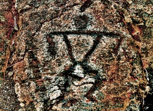
Visitors inspect petroglyphs at Pu'u Loa, Hawaii Volcanoes National Park: Photo by Donald B MacGowan

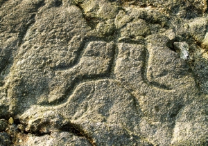
Anthropomorphic petroglyph at Pu'u Loa, Hawaii Volcanoes National Park: Graphic from Photo by Donald B MacGowan

-Puna

Exploring Mysterious, Magnificent, Unspoiled Puna: https://lovingthebigisland.wordpress.com/2010/01/02/exploring-mysterious-magnificent-unspoiled-puna/

Hawaii Lava Flow Update: August 2010 Viewing of Kilauea Lava Flows at Kaplapana on the Big Island: https://lovingthebigisland.wordpress.com/2010/08/08/hawaii-lava-flow-update-august-2010-viewing-of-kilauea-lava-flows-at-kaplapana-on-the-big-island/

Strange things seen at the lava flow, Kalapana, Hawaii: Photo by Donald B MacGowan

Strange things seen at the lava flow, Kalapana, Hawaii: Photo by Donald B MacGowan

Kalapana, Hawaii: From the Fires of Hades to the Eden of Rebirth: https://lovingthebigisland.wordpress.com/2009/01/17/kalapana-hawaii-from-the-fires-of-hades-to-the-eden-of-rebirth/

Exciting Puna: See flowing lava at Waikupanaha, Puna on the Big Island of Hawaii: https://lovingthebigisland.wordpress.com/2010/01/16/hiking-at-the-waikupanaha-lava-ocean-entry-in-puna-on-the-big-island-of-hawaii/

Discovering Puna: Exploring Lava Trees State Monument on the Big Island of Hawaii: https://lovingthebigisland.wordpress.com/2009/12/19/dicovering-puna-exploring-lava-trees-state-monument-on-the-big-island-of-hawaii/

Kupaianaha Vent on Kilauea Hawaii Volcanoes National Park: Photo by Donald B MacGowan

Exploring Puna: Ahalanui Pond at Pu’ala’a County Park in Puna, Hawaii: https://lovingthebigisland.wordpress.com/2009/12/29/exploring-puna-ahalanui-pond-at-pu%E2%80%99ala%E2%80%99a-county-park-in-puna-hawaii/

Exploring Puna: Discover Charming, Eclectic, Surprising Pahoa Town!: https://lovingthebigisland.wordpress.com/2010/01/07/3982/

Discovering Puna: Explore Isaac Hale Beach Park at Pohoiki Bay, Puna Hawaii: https://lovingthebigisland.wordpress.com/2010/01/03/discovering-puna-explore-isaac-hale-beach-park-at-pohoiki-bay-puna-hawaii/

Exploring Puna: Discovering the Majestic, Primeval Tree Tunnels of Puna: https://lovingthebigisland.wordpress.com/2010/01/01/exploring-puna-discovering-the-majestic-primeval-tree-tunnels-of-puna/

New at iTunes: Hawaii Dream Vacation iPhone/iPod Touch App Puts the Magic of Hawaii in the Palm of Your Hand. Interactive maps, GPS and WiFi enabled, dozens of videos…available at iTunes or www.tourguidehawaii.com.

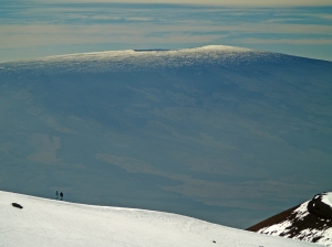
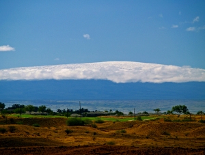
From Mauna Kea to Mauna Loa, Hawaii: Photo by Donnie MacGowan

-Hilo, Waimea, Saddle Road and Hamakua

Unimaginably beautiful, surprisingly engaging and fantastically fun Hilo, Hawaii!: https://lovingthebigisland.wordpress.com/2010/02/06/unimaginably-beautfiul-surprisingly-engaging-and-fantastically-fun-hilo-hawaii/

My Favorite Scenic Drive: Hawaii’s Wild and Scenic Saddle Road!: https://lovingthebigisland.wordpress.com/2010/02/12/best-scenic-drives-on-hawaii-1-the-saddle-road-kona-to-the-summit-of-mauna-kea-kaumana-cave-and-hilo-2/

The Heart of Paniolo Country on the Big Island of Hawaii: Scenic, Historic Waimea: https://lovingthebigisland.wordpress.com/2010/02/02/the-heart-of-paniolo-country-in-hawaii-scenic-historic-waimea/

Exploring the jungle trails of Akaka Falls on the Big Island of Hawaii: https://lovingthebigisland.wordpress.com/2009/12/18/exploring-the-jungle-trails-of-akaka-falls-on-the-big-island-of-hawaii/

Exploring Wailuku River Park and Rainbow Falls, Hilo Hawaii: https://lovingthebigisland.wordpress.com/2009/12/12/exloring-wailuku-river-park-and-rainbow-falls-hlio-hawaii/

Serene, lovely, enchanting Richardson Ocean Park, Hilo Hawaii: https://lovingthebigisland.wordpress.com/2010/02/08/serene-lovely-enchanting-richardson-ocean-park-hilo-hawaii/

Fabulous Hamakua: Discovering Honoka’a Town on the Big Island of Hawaii: https://lovingthebigisland.wordpress.com/2010/02/01/fabulous-hamakua-discovering-honokaa-town-on-the-big-island-of-hawaii/

The Magic of Hilo District: Pe’epekeo Scenic Drive and Onomea Bay Trail: https://lovingthebigisland.wordpress.com/2010/01/28/the-magic-of-hilo-district-peepekeo-scenic-drive-and-onomea-bay-trail/

Exploring Laupahoehoe Park, Hamakua Coast on the Big Island of Hawaii: https://lovingthebigisland.wordpress.com/2009/12/21/exploring-laupahoehoe-park-hamakua-coast-on-the-big-island-of-hawaii/

Exploring Kaumana Cave, Just Outside Hilo Along the Saddle Road on the Big Island of Hawaii: https://lovingthebigisland.wordpress.com/2009/12/20/exploring-kaumana-cave-just-outide-hilo-on-the-saddle-road-on-the-big-island-of-hawaii/

The Magic of Hilo District: Unforgettable, surprising, peaceful Kolekole Beach Park: https://lovingthebigisland.wordpress.com/2010/01/29/the-magic-of-hilo-district-unforgetable-surprising-peaceful-kolekole-beach-park/

Exploring the Hamakua Coast, North of Hilo, Hawaii: Hakalau Canyon: https://lovingthebigisland.wordpress.com/2009/12/27/exporng-the-hamakaua-coast-north-of-hilo-hawaii-hakalau-canyon/

Exploring Hawaii’s Saddle Road: Kipuka Pu’u Huluhulu Nature Trails and Kipuka Aina Hou Nene Sanctuary: https://lovingthebigisland.wordpress.com/2010/02/11/5130/

Hilo Askance: https://lovingthebigisland.wordpress.com/2009/10/10/hilo-askance/

New at iTunes: Hawaii Dream Vacation iPhone/iPod Touch App Puts the Magic of Hawaii in the Palm of Your Hand. Interactive maps, GPS and WiFi enabled, dozens of videos…available at iTunes or www.tourguidehawaii.com.

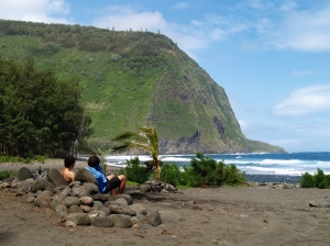
Hikers at the beach in Waipi'o Valley, Hamakua Coast Hawaii: Photo by Donald B MacGowan

-Big Island General

The Call of Aloha…:https://lovingthebigisland.wordpress.com/2009/08/13/the-call-of-aloha/
The Beautiful, Enigmatic and Cryptic Petroglyphs of Hawaii Island: https://lovingthebigisland.wordpress.com/2009/04/23/the-beautiful-enigmatic-and-cryptic-petroglyphs-of-hawaii-island/

Hawaiian Green Sea Turtles: Honu of the Big Island: https://lovingthebigisland.wordpress.com/2009/09/19/hawaiis-magnificent-honu-the-endangered-hawaiian-green-sea-turtle/

A Quick Geologic History of the Hawai’ian Islands: https://lovingthebigisland.wordpress.com/2010/05/16/a-quick-geologic-history-of-the-hawaiian-islands/

The Volcanoes of Hawaii Island: Mahukona, Kohala, Mauna Kea, Hualalai, Mauna Loa: https://lovingthebigisland.wordpress.com/2010/05/17/the-volcanoes-of-hawaii-island-mahukona-kohala-mauna-kea-hualalai-mauna-lor/

A Brief History of Kona Coffee…: https://lovingthebigisland.wordpress.com/2009/02/03/a-brief-history-of-kona-coffee/

A’a and Pahoehoe Lavas of Hawaii: https://lovingthebigisland.wordpress.com/2010/05/27/aa-and-pahoehoe-lavas-of-hawaii/

Hawaii’s Amazing Lava Fossils: https://lovingthebigisland.wordpress.com/2009/08/24/hawaiis-amazing-lava-fossils/

The Sugar Industry in Hawaii: Kona Sugar Company and West Hawai’i Railway Company: https://lovingthebigisland.wordpress.com/2009/04/25/the-sugar-industry-in-hawaii-kona-sugar-company-and-west-hawai%E2%80%99i-railway-company/

The Hawaiian Snow Goddess Poliahu and the Summit of Mauna Kea…: https://lovingthebigisland.wordpress.com/2009/02/05/the-hawaiian-snow-goddess-poliahu-and-the-summit-of-mauna-kea/

Why I love Hawaii…: https://lovingthebigisland.wordpress.com/2009/01/13/why-i-love-hawaii/

A Brief History of Ranching in Hawaii: https://lovingthebigisland.wordpress.com/2009/05/24/rodeo-to-rock-and-roll-a-brief-history-of-ranching-in-hawaii/

Conjuring Visions of Paradise: https://lovingthebigisland.wordpress.com/2009/02/19/conjuring-visions-of-paradise/
New at iTunes: Hawaii Dream Vacation iPhone/iPod Touch App Puts the Magic of Hawaii in the Palm of Your Hand. Interactive maps, GPS and WiFi enabled, dozens of videos…available at iTunes or www.tourguidehawaii.com.

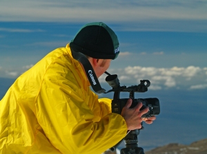
Eric Carr braves high altitude and low temperatures to shoot video on the summit of Mauna Kea, Hawaii: Photo by Donnie MacGowan

-Video

Kilauea’s Eruption Just Keeps Getting More Fantastic!: https://lovingthebigisland.wordpress.com/2008/07/31/wwwtourguidehawaiicom-presents-new-video-of-kilauea-volcano-erupting/

Pu’u Loa Petroglyph Field, Hawaii Volcanoes National Park: https://lovingthebigisland.wordpress.com/2009/03/17/823/

Volcano Art Center—A Kipuka of Creativity on the Rim of Madam Pele’s Home: https://lovingthebigisland.wordpress.com/2009/06/01/volcano-art-center-hawaii-volcanoes-national-park/

Jagger Museum, Hawaii Volcanoes National Park: https://lovingthebigisland.wordpress.com/2009/04/01/jagger-museum-hawaii-volcanoes-national-rark/

Captain Cook’s Legacy: Exploring the History and Waters of Kealakekua Bay: https://lovingthebigisland.wordpress.com/2009/04/07/949/

Mo’okini Heiau: Warrior Kings and Human Sacrifice on Hawai’i: https://lovingthebigisland.wordpress.com/2009/01/03/mookini-heiau-warrior-kings-and-human-sacrifice-on-hawaii-2/


New at iTunes: Hawaii Dream Vacation iPhone/iPod Touch App Puts the Magic of Hawaii in the Palm of Your Hand. Interactive maps, GPS and WiFi enabled, dozens of videos…available at iTunes or www.tourguidehawaii.com.

Bart Hunt Snorkeling at Kahalu'u Beach, Kona Hawaii: Graphic from Photo by Donnie MacGowan

To see the new iPhone/iPod Touch App, please visit http://www.tourguidehawaii.com/iphone.html. The best of Tour Guide Hawaii’s free content about traveling to, and exploring, the Big island, can be found here.


New at iTunes: Hawaii Dream Vacation iPhone/iPod Touch App Puts the Magic of Hawaii in the Palm of Your Hand. Interactive maps, GPS and WiFi enabled, dozens of videos…available at iTunes or www.tourguidehawaii.com.

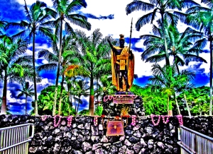
King Kamehameha Statue, Wailoa Park, Hilo Hawaii: Graphic from Photo by Donnie MacGowan

For more information on traveling to Hawaii in general and on touring the Big Island in particular, please also visit www.tourguidehawaii.com and www.tourguidehawaii.blogspot.com.

For independent reviews of our product, written by some of our legions of satisfied customers, please check this out.

All media copyright 2009 by Donald B. MacGowan. All rights reserved.

New at iTunes: Hawaii Dream Vacation iPhone/iPod Touch App Puts the Magic of Hawaii in the Palm of Your Hand. Interactive maps, GPS and WiFi enabled, dozens of videos…available at iTunes or www.tourguidehawaii.com.

Captain James Cook Monument from Manini Beach on Kealakekua Bay, Kona Hawaii: Graphic from Photo by Donald B MacGowan


by Donald B. MacGowan

New at iTunes: Hawaii Dream Vacation iPhone/iPod Touch App Puts the Magic of Hawaii in the Palm of Your Hand. Interactive maps, GPS and WiFi enabled, dozens of videos…available at iTunes or www.tourguidehawaii.com.

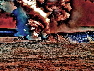
Kilauea erupting at Halema'uma'u Crater, Hawaii Volcanoes National Park: Graphic from Photo by Donald B MacGowan
There are many wondrous, enigmatic and fascinating attractions on the Big Island of Hawaii, some better known than others, many out of the way and generally off the beaten track. Tour Guide Hawaii has produced an encyclopedic collection of the most up-to-date information, presented as short GPS-cued videos, in an app downloadable to iPhone and iPod Touch that covers the entire Big Island, highlighting the popular and the uncrowded, the famous and the secluded, the adventurous and the relaxing.

New at iTunes: Hawaii Dream Vacation iPhone/iPod Touch App Puts the Magic of Hawaii in the Palm of Your Hand. Interactive maps, GPS and WiFi enabled, dozens of videos…available at iTunes or www.tourguidehawaii.com.

Kilauea lava flow from Kupaianaha Vent, Hawaii: Photo Courtesy of Big Island Air

Kilauea Volcano

Although it is the most active volcano on earth, many visitors to Hawaii Volcanoes National Park standing on the very summit of Kilauea Volcano often stare and wonder “Where’s the volcano?” Nestled snugly up against Mauna Loa, and not as vertically spectacular as either this near neighbor or Mauna Kea, Kilauea doesn’t even appear to be a bump on the landscape from the usual viewpoints. Even though it doesn’t standout visually, Kilauea is one of the most intriguing and fascinating volcanoes on earth…let’s just take a quick look at some of the reasons why.

New at iTunes: Hawaii Dream Vacation iPhone/iPod Touch App Puts the Magic of Hawaii in the Palm of Your Hand. Interactive maps, GPS and WiFi enabled, dozens of videos…available at iTunes or www.tourguidehawaii.com.

The Kilauea eruption at Halema'uma'u Crater from Jagger Museum at night: Photo by Donald B MacGowan

Comprising the entire southeastern portion of Hawaii Island, Kilauea Volcano is not only currently the world’s most active volcano, it is also the home of the fire-goddess Pele. Early geologists believed Kilauea was merely a satellite vent of Mauna Loa, as it lies directly on that mountain’s southern slopes. However, Kilauea is now recognized as its own, distinct, volcano which has its own, separate, magma source and unique plumbing.

New at iTunes: Hawaii Dream Vacation iPhone/iPod Touch App Puts the Magic of Hawaii in the Palm of Your Hand. Interactive maps, GPS and WiFi enabled, dozens of videos…available at iTunes or www.tourguidehawaii.com.

Looking over the shield of Kilauea, at some of the 760 billion tons of lava Mau Loa o Mauna Ulu, Hawaii Volcanoes National Park: Photo by Donald B MacGowan

Presenting the classic “Hawaiian Shield Volcano” shape, a basic oval with low, shallow slope angles, volume-wise Kilauea is one of the the world’s most massive mountains. Standing 1240 meters (4080) above sea level, the above-ocean part of the volcano is about 80 km (50 miles) long and 32 km, (20 miles) wide, along an axis trending roughly southwest to northeast. However, like all the other Hawaiian volcanoes, the great majority of its vast bulk lies below the sea, about 5.5 km (18,000 feet) deep here, making Kilauea’s true base-to-summit height about 7 km (23,000 ft).

New at iTunes: Hawaii Dream Vacation iPhone/iPod Touch App Puts the Magic of Hawaii in the Palm of Your Hand. Interactive maps, GPS and WiFi enabled, dozens of videos…available at iTunes or www.tourguidehawaii.com.

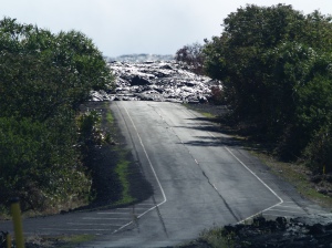
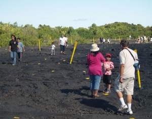
A lava flow from Kilauea blocks the highway at Kalapana Hawaii: Photo by Donald B MacGowan

Sometimes vying with Mts. Aetna and Stromboli for the title of “most active volcano on earth”, Kilauea has been erupting continuously since January 1983; between then and June 2009, nearly 700 acres of new land was created on Hawaii Island by Kilauea lava flows. As the time scale of human lives and human tragedy are so much shorter than geologic time scales, and thus human memories of past disasters grow dim rather rapidly, this volcanic growth has come at quite a cost because people insist on building villages, towns and roads on this highly active landscape. In recent decades, the towns of Kapoho (in 1960), Kalapana (in 1990), and Kaimu (in 1990) have all been burned, buried and destroyed by Kilauea, and now are seemingly all but abandoned except by a few hardy souls. Although popularly thought to be rather tame with fairly peaceable eruptions, Kilauea in the past has had its fair share of explosive, violent, phreatomagmatic eruptions, spewing great quantities of ash as well.

New at iTunes: Hawaii Dream Vacation iPhone/iPod Touch App Puts the Magic of Hawaii in the Palm of Your Hand. Interactive maps, GPS and WiFi enabled, dozens of videos…available at iTunes or www.tourguidehawaii.com.

The summit of Kilauea Volcano with the much more massive Mauna Loa looming in the background, Hawaii Volcanoes National Park: Photo by Donnie MacGowan

Kilauea owes its peculiar shape to two long rift systems, the currently active East Rift and the Southwest Rift. These rifts are comprised of huge, deep fractures through the bulk of the mountain. Magma rises from deep below the volcano to a pool just below the summit caldera, then flows through internal plumbing down either rift, causing flank eruptions at vents down-rift. These flank eruptions greatly enhance Kilauea’s exaggerated elongate shape. In recent times, many more eruptions have occurred along the East Rift, than the Southwest Rift.

New at iTunes: Hawaii Dream Vacation iPhone/iPod Touch App Puts the Magic of Hawaii in the Palm of Your Hand. Interactive maps, GPS and WiFi enabled, dozens of videos…available at iTunes or www.tourguidehawaii.com.

A patch of sunlight illuminates the nearly 1400 feet of throw on the Holei Pali fault scarp, Hawaii Volcanoes National Park: Photo by Donnie MacGowan

The orientation of these rifts is controlled by the geography of Mauna Loa and Kilauea, as well as by gravity. Because the north side of Kilauea is well buttressed by the huge mass of Mauna Loa and the unsupported south side slopes-off into the sea, the very mass of Kilauea is pulling it down slope, into the sea. Indeed, the sub-sea, southern slope of Kilauea is a vast, hummocky field of debris from enormous landslides. Above sea level, this slumping activity is evidenced by the several, sub-parallel ridges (or “Pali”, in Hawaiian) on the southern flank. With throws of much as 430 meters (1400 feet), these faults represent the massive fracturing of the volcano’s southern flank and the subsequent slumping of these giant blocks down slope. A drive down the Holei Pali along Chain of Craters Road will quickly demonstrate the magnitude of seaward movement as Kilauea erupts, slumps and grows.

New at iTunes: Hawaii Dream Vacation iPhone/iPod Touch App Puts the Magic of Hawaii in the Palm of Your Hand. Interactive maps, GPS and WiFi enabled, dozens of videos…available at iTunes or www.tourguidehawaii.com.

The Kilauea Iki Crater, within the much more massive Kilauea Caldera, Hawaii Volcanoes National Park: Photo by Donald B MacGowan

Seaward slumping is exacerbated by the volcanic activity itself; as Kilauea fills with magma, it swells and slumps southward, producing massive earthquakes and landslides. The slumping, however, also exacerbates the volcanic activity. By opening-up new voids in Kilauea’s internal plumbing, the slumping allows injection of even more magmatic material into Kilauea, which then causes more earthquakes and more slumping. Essentially spreading under its own enormous weight, the synergy between magma injection and slumping allows Kilauea to grow both by eruption of, and intrusion of, magma.

New at iTunes: Hawaii Dream Vacation iPhone/iPod Touch App Puts the Magic of Hawaii in the Palm of Your Hand. Interactive maps, GPS and WiFi enabled, dozens of videos…available at iTunes or www.tourguidehawaii.com.

A pahoehoe lava flow sizzles into the sea at La'epuki on Kilauea Volcano, Hawaii Volcanoes National Park: Photo by Donald B MacGowan

The supply of magma to the volcano is fairly consistent at 1.8 cubic km (1.0 cubic miles) per year, however forty to fifty per cent of the melt never makes its way to the surface. Called “endogenous growth”, nearly half the growth of Kilauea can be attributed to magma cooling and solidifying below ground, in the growing voids opened by the synergistic magma injection and seaward slumping of the mountain.

New at iTunes: Hawaii Dream Vacation iPhone/iPod Touch App Puts the Magic of Hawaii in the Palm of Your Hand. Interactive maps, GPS and WiFi enabled, dozens of videos…available at iTunes or www.tourguidehawaii.com.

Looking out over Kilauea Caldera from the back porch of Volcano House, Hawaii Volcanoes National Park: Photo by Donald B MacGowan

Conjoined on its northern flank by the vastly larger Mauna Loa, Kilauea doesn’t appear to the casual observer to have a true summit. However, the summit region, around which Crater Rim Drive circles, is comprised of a larger collapse crater (Kilauea Caldera), which contains three smaller collapse craters (Halema’uma’u, Keanakako’i and Kilauea Iki Craters). Collapse craters, such as here and those along Chain of Craters Road, are formed when magma is withdrawn from a reservoir during an eruption, and the suddenly unsupported land above simply collapses into the void. As you look out over the enormous cavity formed by Kilauea Caldera, imagine the immensity of the eruptive event that left enough of a void in the magma chamber to allow this huge crater to form.

New at iTunes: Hawaii Dream Vacation iPhone/iPod Touch App Puts the Magic of Hawaii in the Palm of Your Hand. Interactive maps, GPS and WiFi enabled, dozens of videos…available at iTunes or www.tourguidehawaii.com.

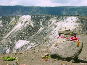
Offerings to the Goddess Pele at Halema'uma'u Crater in Kilauea Caldera, Hawaii Volcanoes National Park: Photo by Donald B MacGowan

Kilauea’s large magma pool lies just below the summit region, somewhat south of Halema’uma’u Crater, at a depth of about 1.5-5 km (1-3 miles). Forming a magma reservoir several kilometers wide, it acts as central storage for the entire summit-rift magma plumbing system. Partial melting in the mantle at a depth of 40-60 km (52-30 miles) produces magma which rises through the earth and pools within a couple kilometers or so of the surface, and which then flows almost immediately to the site of eruption (summit or flank), having very little residence time within the volcano itself. This “open door to the mantle” feature is a fairly unique to Kilauea Volcano.

New at iTunes: Hawaii Dream Vacation iPhone/iPod Touch App Puts the Magic of Hawaii in the Palm of Your Hand. Interactive maps, GPS and WiFi enabled, dozens of videos…available at iTunes or www.tourguidehawaii.com.

Pu'u O'o Vent on Kilauea in Hawaii Volcanoes National Park: Photo by Shannon Walker

Based on eruptive patterns in recorded history, Kilauea has been observed to follow three shifting modes of eruptive behavior. The first mode involves explosive volcanism at Kilauea’s summit. This activity contributed to the formation of past and present calderas in the summit area as well as having showered Ka’u with a cover of cinder and ash. The second mode is continuous effusive eruptive activity at the summit. This mode is typified by features such as the former lava lake at the summit which was present well into historic times, and events such as voluminous outpouring of lava from several summit vents. This mode tends to fill-in summit calderas and produce a landscape of broad, coalescing shields atop the various vents. The third mode of eruption is the continuous flank eruption, as seen today on the East Rift at vents such as Pu’u O’o and Kupaianaha.

New at iTunes: Hawaii Dream Vacation iPhone/iPod Touch App Puts the Magic of Hawaii in the Palm of Your Hand. Interactive maps, GPS and WiFi enabled, dozens of videos…available at iTunes or www.tourguidehawaii.com.

A view into the vent at Kupaianaha on Kilauea Volcano, Hawaii Volcanoes National Park: Photo by Donald B MacGowan

These modes are derived from observation of the volcano’s activity only during modern times, and almost certainly Kilauea’s behavior over geologic time must be much more complex. Rather than a view of the evolution of Kilauea Volcano, these modes may serve more as template through which to view what the volcano is capable of doing. It has been observed that periods of volcanic quiescence, or of small eruptions which shift location from summit to flank, may herald a shift in these eruptive modes. Further, it has been suggested based on recent observations that large, south-flank earthquakes initiating magma intrusion can greatly alter eruptive modes.

New at iTunes: Hawaii Dream Vacation iPhone/iPod Touch App Puts the Magic of Hawaii in the Palm of Your Hand. Interactive maps, GPS and WiFi enabled, dozens of videos…available at iTunes or www.tourguidehawaii.com.

Kilauea eruption at Halema'uma'u Crater from Steaming Bluff, Hawaii Volcanoes National Park: Photo by Donald B MacGowan

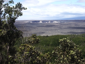
So, now that we understand a little of the mystery and complexity of Kilauea Volcano, where is the best place to see it from? For starters, one cannot beat the view off the back porch of Volcano House in Hawaii Volcanoes National Park, which encompasses much of Kilauea Caldera and Halema’uma’u Crater. Although currently closed between Jagger Museum and the intersection with Chain of Craters Road because of the ongoing eruption in Halema’uma’u Crater, the portion of Crater Rim Drive which is open provides a unique view of the volcano in a scenic loop around the entire summit region. Of particular interest are the stops at Steaming Bluff, Jagger Museum, Halema’uma’u Crater (closed), Southwest Rift Zone (closed), Keanakako’i Crater (closed), and Kilauea Iki Crater Overlook.

New at iTunes: Hawaii Dream Vacation iPhone/iPod Touch App Puts the Magic of Hawaii in the Palm of Your Hand. Interactive maps, GPS and WiFi enabled, dozens of videos…available at iTunes or www.tourguidehawaii.com.

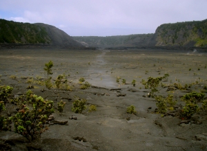
Looking at the trail across Kilauea Iki Crater, Hawaii Volcanoes National Park: Photo by Donald B MacGowan

Driving across the summit dome and down to the slump-block cliffs on Hilina Pali Road takes you on a fabulous backcountry exploration from a nether-world of volcanic destruction and to lush, tropical dryland forest and savanna. Hikes along Devastation Trail, through Kilauea Iki Crater and out to the caldera overlook at Waldron Ledge give fabulous insight to Kilauea Volcano and are particularly beautiful as well as fascinating, and fairly easy for those in reasonable physical condition.

New at iTunes: Hawaii Dream Vacation iPhone/iPod Touch App Puts the Magic of Hawaii in the Palm of Your Hand. Interactive maps, GPS and WiFi enabled, dozens of videos…available at iTunes or www.tourguidehawaii.com.

View down the slump blocks that comprise the Hilina Pali, Hawaii Volcanoes National Park: Photo by Donald B MacGowan

Aside from the summit region, the Chain of Craters Road travels through the most interesting geography of Kilauea, including lava flows from numerous recent eruptions. Although everywhere fascinating, stops at Pauahi Crater, Mauna Ulu and Muliwai O Pele are almost mandatory. As mentioned earlier, this drive gives stark perspective on the slump blocks and the slippage of Kilauea’s south flank toward the sea. Stops at Kealakomo Overlook, Halona Kahakai, Alanui Kahiko and Holei Pali illustrate the vast nature of the slow creep of Kilauea’s southern flank down-slope. A stop to see the amazing, ancient petroglyphs at Pu’u Loa Petroglyph Field provides a moving, human connection to the peoples of the past, the awe and respect they had for this Goddess and her mountain home. The end of Chain of Craters Road gives way to a playground of geological landscapes, booming sea cliffs and ancient villages, as well as providing the jumping-off point for hikes to see the flowing lava, when it is flowing within the Park boundaries.

New at iTunes: Hawaii Dream Vacation iPhone/iPod Touch App Puts the Magic of Hawaii in the Palm of Your Hand. Interactive maps, GPS and WiFi enabled, dozens of videos…available at iTunes or www.tourguidehawaii.com.

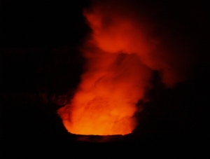
The eruption of Kilauea at Halema'uma'u from Jagger Museum, Hawaii Volcanoes National Park: Photo by Donald B MacGowan

A complete guide to exploring Hawaii Volcanoes National Park can be found here; you should plan to spend the better part of a full day in the park—unless you’ve been here before, it will be the most interesting place you’ve ever been to yet. Viewing the flowing lava, the spectacle of the earth remaking herself, is one of the most moving, soul-filling, surprisingly emotional experiences you can have. The current eruption in Halema’uma’u Crater, although it hasn’t yet produced any lava flows, is best viewed from the Jagger Museum; at times of peak activity, it is most spectacular when viewed after dark. Guides to Lava Viewing in the Park and at the County of Hawaii Lava Viewing platform east in Puna at Waikupanaha can be found here and here respectively. A general outline of the volcanoes of Hawaii Island is presented here, a brief discussion on the differences between a’a and pahoehoe lavas can be found here, and an overview geologic history of the Hawaiian Islands can be found here.

New at iTunes: Hawaii Dream Vacation iPhone/iPod Touch App Puts the Magic of Hawaii in the Palm of Your Hand. Interactive maps, GPS and WiFi enabled, dozens of videos…available at iTunes or www.tourguidehawaii.com.

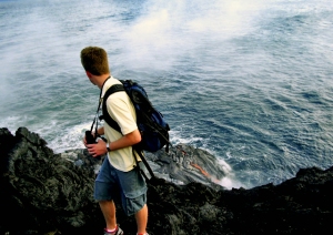
A hiker watches lava from Kilauea Volcano flow into the ocean at Hawaii Volcanoes National Park: Photo by Donnie MacGowan

Perhaps no other volcano in the world, certainly no active volcano, is so easy to explore, to touch, to experience. If you come to see Kilauea, home of the Goddess Pele, be sure to give yourself a lot of time—you’ll be more captivated than you expect; certainly you’ve never experienced anything like this before. Come, explore, enjoy, stand at her door and breath the breath of the Fire Goddess.

New at iTunes: Hawaii Dream Vacation iPhone/iPod Touch App Puts the Magic of Hawaii in the Palm of Your Hand. Interactive maps, GPS and WiFi enabled, dozens of videos…available at iTunes or www.tourguidehawaii.com.

The plume from littoral explosions where lava from Kilauea Volcano enters the sea at Waikupanaha, Hawaii: Photo by Donald B MacGowan

To see the new iPhone/iPod Touch App, please visit http://www.tourguidehawaii.com/iphone.html.

The best of Tour Guide Hawaii’s free content about traveling to, and exploring, the Big island, can be found here.

New at iTunes: Hawaii Dream Vacation iPhone/iPod Touch App Puts the Magic of Hawaii in the Palm of Your Hand. Interactive maps, GPS and WiFi enabled, dozens of videos…available at iTunes or www.tourguidehawaii.com.

Aerial view of the Mauna Ulu Crater, Kilauea Volcano, Hawaii: Photo by Donald B MacGowan

For more information on traveling to Hawaii in general and on touring the Big Island in particular, please also visit www.tourguidehawaii.com and www.tourguidehawaii.blogspot.com.

All media copyright 2010 by Donald B. MacGowan. All rights reserved.

New at iTunes: Hawaii Dream Vacation iPhone/iPod Touch App Puts the Magic of Hawaii in the Palm of Your Hand. Interactive maps, GPS and WiFi enabled, dozens of videos…available at iTunes or www.tourguidehawaii.com.

The steam cloud at Waikupanaha where lava fro,m Kilauea meets the sea, Hawaii: Photo by Donald B MacGowan

New at iTunes: Hawaii Dream Vacation iPhone/iPod Touch App Puts the Magic of Hawaii in the Palm of Your Hand. Interactive maps, GPS and WiFi enabled, dozens of videos…available at iTunes or www.tourguidehawaii.com.

The County of Hawaii Lava Viewing Platform at Waikupanaha, Hawaii: Photo by Donald B MacGowan

New at iTunes: Hawaii Dream Vacation iPhone/iPod Touch App Puts the Magic of Hawaii in the Palm of Your Hand. Interactive maps, GPS and WiFi enabled, dozens of videos…available at iTunes or www.tourguidehawaii.com.

Aerial view of Pu'u O'o Vent on Kilauea, Hawaii Volcanoes National Park: Photo by Shannon Walker

New at iTunes: Hawaii Dream Vacation iPhone/iPod Touch App Puts the Magic of Hawaii in the Palm of Your Hand. Interactive maps, GPS and WiFi enabled, dozens of videos…available at iTunes or www.tourguidehawaii.com.

Looking down into Kilauea Caldera from Waldron Ledge, Hawaii Volcanoes National Park: Photo by Donald B MacGowan

by Donald B. MacGowan

New at iTunes: Hawaii Dream Vacation iPhone/iPod Touch App Puts the Magic of Hawaii in the Palm of Your Hand. Interactive maps, GPS and WiFi enabled, dozens of videos…available at iTunes or www.tourguidehawaii.com.

The Mauna Ulu A'a and Pahoehoe Lava Flows at Alanui Kahiko, Hawaii Volcanoes National Park: Graphic from Photo by Donnie MacGowan

There are many wondrous, enigmatic and fascinating attractions on the Big Island of Hawaii, some better known than others, many out of the way and generally off the beaten track. Tour Guide Hawaii has produced an encyclopedic collection of the most up-to-date information, presented as short GPS-cued videos, in an app downloadable to iPhone and iPod Touch that covers the entire Big Island, highlighting the popular and the uncrowded, the famous and the secluded, the adventurous and the relaxing.

New at iTunes: Hawaii Dream Vacation iPhone/iPod Touch App Puts the Magic of Hawaii in the Palm of Your Hand. Interactive maps, GPS and WiFi enabled, dozens of videos…available at iTunes or www.tourguidehawaii.com.

Pahoehoe flow at night on Kilauea, Hawaii Volcanoes National Park: Photo Courtesy of Big Island Air

Pahoehoe, A’a, Pele’s Tears and Pele’s Hair

It is obvious to even the most causal observer that various lava formations and lava fields of Hawaii display two distinctly different types of lava flows. Some flows are very smooth, with obvious, well-preserved flow structures, looking almost like poured taffy that has hardened. Others appear more clunky, clinkery and jagged like a field of sharp boulders and cobbles. These two unique rock types result from two distinctly different types of lava flows, Pahoehoe and A’a.

New at iTunes: Hawaii Dream Vacation iPhone/iPod Touch App Puts the Magic of Hawaii in the Palm of Your Hand. Interactive maps, GPS and WiFi enabled, dozens of videos…available at iTunes or www.tourguidehawaii.com.

Pahoehoe lava flow, showing well-developed flow structures at La'epuki, Hawaii Volcanoes National Park: Photo by Donald B MacGowan

The onomatopoetic word “pahoehoe” flows across your tongue in the same fashion that pahoehoe lava flows down the volcano. Gelatinous and smooth, it looks a bit like small waves with bulbous, lobate “toes” at the front of the flow. As the advancing lobe cools, a thin crust forms on its surface. This crust is expanded and broken by the pressure of lava flowing in behind, in a continually advancing flow. A distinctive breaking-glass sound is made when that cooling crust fractures, which can be disorienting and surprising at first.

New at iTunes: Hawaii Dream Vacation iPhone/iPod Touch App Puts the Magic of Hawaii in the Palm of Your Hand. Interactive maps, GPS and WiFi enabled, dozens of videos…available at iTunes or www.tourguidehawaii.com.

A flowing field of pahoehoe lava, note the intense orange glow just under the chilled surface, Hawaii Volcanoes National Park: Photo by Donald B MacGowan

The Hawaiian word “pahoehoe” means “to paddle a canoe vigorously” or “well stirred” and indeed, pahoehoe lava has the look of water being furiously paddled by canoeists, or indeed, of well-stirred poi. These highly fluid pahoehoe flows form from the hottest lava with high dissolved fluid content. As the lava cools and de-gasses, the second kind of flow, a’a lava, is formed from it.

New at iTunes: Hawaii Dream Vacation iPhone/iPod Touch App Puts the Magic of Hawaii in the Palm of Your Hand. Interactive maps, GPS and WiFi enabled, dozens of videos…available at iTunes or www.tourguidehawaii.com.

An a'a lava flow, piled up on a pahoehoe flow in front of Pu'u Huluhulu, Hawaii Volcanoes National Park: Photo by Donald B MacGowan

A’a flows travel along as a dense mass of highly viscous lava covered in sharp, broken shards called clinkers. Like a tractor tread, a’a clinkers fall off the advancing front of the flow and are buried as the flow moves forward over them, sounding for all the world like a herd of wild bulls has run amok in the world’s largest china shop.

New at iTunes: Hawaii Dream Vacation iPhone/iPod Touch App Puts the Magic of Hawaii in the Palm of Your Hand. Interactive maps, GPS and WiFi enabled, dozens of videos…available at iTunes or www.tourguidehawaii.com.

The Kuamo'o Battlefield, near Kailua Kona Hawaii is an example of a Hawaiian battle that was fought on an a'a flow. Note the large Hawaiian tombs made of a'a: Photo by Donald B MacGowan

A’a lava, which cools to great piles of razor sharp clinkers, has given rise to the myth that its name derives from Hawaiian’s walking across the cooled a’a barefoot, wincing and saying “Ah! Ah!” with every cringing step. In fact, the word “a’a” in Hawaiian not only means “to blaze or glow” but also “to dare or challenge”. It is a testament to the toughness of Hawaiian warriors that when choosing the site for a battle field, inevitably they chose to fight on an a’a field—using the razor sharp a’a strewn along the landscape as a weapon in and of itself.

New at iTunes: Hawaii Dream Vacation iPhone/iPod Touch App Puts the Magic of Hawaii in the Palm of Your Hand. Interactive maps, GPS and WiFi enabled, dozens of videos…available at iTunes or www.tourguidehawaii.com.

An a'a lava flow engulfs pahoehoe lava flow at Alanui Kahiko, Hawaii Volcanoes National Park: Photo by Donald B MacGowan

Flows generally emerge from the volcano as pahoehoe and change to a’a as they cool and de-gas or as they are subjected to stress and strain forces. It is especially common to find pahoehoe flows changing to a’a in the midst of a steep drop over a cliff, or when butted-up against an impediment to flow. Like the cucumber becoming a pickle, once pahoehoe turns to a’a, in can never turn back into pahoehoe.

New at iTunes: Hawaii Dream Vacation iPhone/iPod Touch App Puts the Magic of Hawaii in the Palm of Your Hand. Interactive maps, GPS and WiFi enabled, dozens of videos…available at iTunes or www.tourguidehawaii.com.

Littoral explosions cause lava to splatter out into the blowing wind where Pele's Tears and Pele's Hair can form, Waikupanaha, Hawaii: Photo by Donald B MacGowan

Where fire fountains and geysers of lava occur, Pele’s hair and Pele’s tears will form. Pele’s hair are thin, fiber-like strands of basalt glass pulled and spun from the lava fountain by the blowing wind,. Pele’s tears are the droplet-sized, cooled splashes of basalt glass that from from showering, spraying lava.

New at iTunes: Hawaii Dream Vacation iPhone/iPod Touch App Puts the Magic of Hawaii in the Palm of Your Hand. Interactive maps, GPS and WiFi enabled, dozens of videos…available at iTunes or www.tourguidehawaii.com.

Pele's Hair from Kilauea Volcano, Hawaii Photo by Donald B MacGowan

All media copyright 2010 by Donald B. MacGowan. All rights reserved.

New at iTunes: Hawaii Dream Vacation iPhone/iPod Touch App Puts the Magic of Hawaii in the Palm of Your Hand. Interactive maps, GPS and WiFi enabled, dozens of videos…available at iTunes or www.tourguidehawaii.com.

Pele's Tears from Kilauea Volcano, Hawaii: Photo by Donald B MacGowan

The best of Tour Guide Hawaii’s free content about traveling to, and exploring, the Big island, can be found here.

For more information on traveling to Hawaii in general and on touring the Big Island in particular, please also visit www.tourguidehawaii.com and www.tourguidehawaii.blogspot.com.
All media copyright 2010 by Donald B. MacGowan. All rights reserved.
New at iTunes: Hawaii Dream Vacation iPhone/iPod Touch App Puts the Magic of Hawaii in the Palm of Your Hand. Interactive maps, GPS and WiFi enabled, dozens of videos…available at iTunes or www.tourguidehawaii.com.

Pahoehoe lava flowing on Kilauea Volcano, Hawaii, showing large-scale flow structures: Photo Courtesy of Big Island Air

by Donald B. MacGowan

New at iTunes: Hawaii Dream Vacation iPhone/iPod Touch App Puts the Magic of Hawaii in the Palm of Your Hand. Interactive maps, GPS and WiFi enabled, dozens of videos…available at iTunes or www.tourguidehawaii.com.

Hikers pause to look over the summit from Mauna Loa from the summit of Mauna Kea, Hawaii Graphic From Photo by Donald B MacGowan

There are many wondrous, enigmatic and fascinating attractions on the Big Island of Hawaii, some better known than others, many out of the way and generally off the beaten track. Tour Guide Hawaii has produced an encyclopedic collection of the most up-to-date information, presented as short GPS-cued videos, in an app downloadable to iPhone and iPod Touch that covers the entire Big Island, highlighting the popular and the uncrowded, the famous and the secluded, the adventurous and the relaxing.

New at iTunes: Hawaii Dream Vacation iPhone/iPod Touch App Puts the Magic of Hawaii in the Palm of Your Hand. Interactive maps, GPS and WiFi enabled, dozens of videos…available at iTunes or www.tourguidehawaii.com.

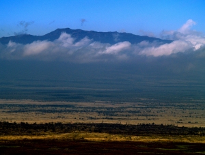
A view from the summit of Hualalai to Mauna Loa Hawaii Photo by Donald B MacGowan

The Volcanoes of Hawaii Island

The Hawaiian Archipelago, part of the Hawaiian Island-Emperor Seamount chain, is the most isolated island group earth and is comprised entirely of volcanic islands and their fringing reefs.  The archipelago was formed as one of the Earth’s great tectonic plates, the Pacific Plate, moved steadily northwest over a stationary plume of molten material welling up from the Earth’s mantle, called a “hot spot”.

New at iTunes: Hawaii Dream Vacation iPhone/iPod Touch App Puts the Magic of Hawaii in the Palm of Your Hand. Interactive maps, GPS and WiFi enabled, dozens of videos…available at iTunes or www.tourguidehawaii.com.

Fumes bellow from skylights in an active lava tube on Kilauea Volcano, Hawaii Photo by Kelly Kuchman

Creating a chain of volcanic islands that, today, stretches from the Aleutian Islands to the Big Island of Hawaii, this hotspot gave rise to at least 129 separate volcanoes in the past 86 million years.  There are 19 islands and atolls, and dozens of separate islets, seamounts, reefs and shoals in the Hawaiian Island portion of this chain, stretching from Kure Atoll to Hawaii Island (please go here for a complete discussion of the geologic history of the Hawaiian Islands).

New at iTunes: Hawaii Dream Vacation iPhone/iPod Touch App Puts the Magic of Hawaii in the Palm of Your Hand. Interactive maps, GPS and WiFi enabled, dozens of videos…available at iTunes or www.tourguidehawaii.com.

Halema'uma'u Crater and Eruption on Kilauea, Hawaii Photo by Donnie MacGowan

Hawai’i is the youngest island in the Archipelago and first began forming about a million years ago as volcanic vents opened above the mantle “hot spot” on the ocean bottom and molten lava began pouring onto the sea floor. Over the centuries, the making of the Big Island as we know it today eventually entailed the growth and conjoining of six separate volcanoes, building all the way up from the seafloor, some 18,000 feet below the ocean’s surface.  These volcanoes, from northwest to southeast, are named Mahukona, Kohala, Mauna Kea, Hualalai, Mauna Loa and Kilauea, and become younger as one moves north to south.

New at iTunes: Hawaii Dream Vacation iPhone/iPod Touch App Puts the Magic of Hawaii in the Palm of Your Hand. Interactive maps, GPS and WiFi enabled, dozens of videos…available at iTunes or www.tourguidehawaii.com.

Lava Flowing Into the Sea at Waikupanaha, Hawaii Photo by Donald B MacGowan

Mahukona Volcano, just off the Big Island’s northwest coast, was the first volcano to start forming. Now submerged beneath the surface of the ocean because it is sinking into the Earth’s crust under its own vast weight, Mahukona is no longer visible.  As the Pacific Plate slowly continued moving northwestward over the hotspot, the location of the rising magma moved relatively southeastward, and through time the rest of the Big Island volcanoes formed along that path.

New at iTunes: Hawaii Dream Vacation iPhone/iPod Touch App Puts the Magic of Hawaii in the Palm of Your Hand. Interactive maps, GPS and WiFi enabled, dozens of videos…available at iTunes or www.tourguidehawaii.com.

Kohala Mountain from the slopes of Mauna Kea Photo by Donald B MacGowan

After Mahukona, Kohala Volcano, the precursor to today’s Kohala Mountain, erupted next.  As Kohala Volcano emerged from the sea and joined with Mahukona, a much larger Big Island began forming. With continued movement of the Pacific Plate, the center of volcanism migrated on to Mauna Kea and Hualalai, the middle-aged volcanoes, and finally on to Mauna Loa and Kilauea, which are the youngest volcanoes on the island.  Over the geologically short time of several hundred thousand years, these volcanoes erupted thousands of thin flows which spread over, and built upon, older flows; each volcano growing until it finally emerged from the sea. As time went on, lava flows from one volcano began to overlap flows from other, nearby volcanoes and eventually the peaks coalesced into a single island, the Big Island.

New at iTunes: Hawaii Dream Vacation iPhone/iPod Touch App Puts the Magic of Hawaii in the Palm of Your Hand. Interactive maps, GPS and WiFi enabled, dozens of videos…available at iTunes or www.tourguidehawaii.com.

Lava from Kilauea flows into the sea at La'epuki, Hawaii Photo by Donald B MacGowan

In geologically recent times, a new volcano, Lo’ihi, began forming about 18 miles off the southeast coast of the Big Island.  In time, Loihi may join its mass with that of Kilauea, again changing the size and shape of the Big Island.  It is estimated that Lo’ihi, whose summit lies approximately 3,178 feet below the surface of the ocean today, will begin to protrude above the surface in about 10,000 years.

New at iTunes: Hawaii Dream Vacation iPhone/iPod Touch App Puts the Magic of Hawaii in the Palm of Your Hand. Interactive maps, GPS and WiFi enabled, dozens of videos…available at iTunes or www.tourguidehawaii.com.

Hualalai Volcano from Saddle Road, Hawaii Photo by Donald B MacGowan

Currently, the remnants of Mahukona and Kohala volcanoes are completely extinct; Hualalai and Mauna Kea are considered dormant and Mauna Loa, Kilauea and Loihi are still very active.   This means that eruptions of Mahukona and Kohala are not at all likely. Eruptions of Mauna Kea and Hualalai are probable at some time in the future, though the major phase of mountain building is over for these volcanoes.  Movement of the Pacific Plate has moved both Hualalai and Mauna Kea off the hot spot so only remnants of liquid magma reside beneath them. These late-stage, mature Hawaiian volcanoes experience violent, explosive eruptions which are spectacular but comparatively small, volume-wise.  Late-stage Hawaiian volcanic eruptions are characterized by crater-forming explosions, tephra-cone building and ash ejecting events.

New at iTunes: Hawaii Dream Vacation iPhone/iPod Touch App Puts the Magic of Hawaii in the Palm of Your Hand. Interactive maps, GPS and WiFi enabled, dozens of videos…available at iTunes or www.tourguidehawaii.com.

Mauna Loa from Bird Park in Hawaii Volcanoes National Park: Photo by Donald B MacGowan

Mauna Loa and Kilauea are both considered active volcanoes. Although inflation and dilation events are common on the summit of Mauna Loa, it has not erupted since 1984; Mauna Loa could, however, erupt at any time.  Since 1833 when accurate records began to be kept, there have been 33 eruptions of Mauna Loa, making it one of the most active volcanoes on earth.  Its name means “long mountain”, and Mauna Loa is capable of erupting huge amounts of lava in a very short time, dwarfing the current output of Kilauea.  The most massive mountain on earth, this prolific effusion of molten rock accounts for Mauna Loa’s vast bulk.

New at iTunes: Hawaii Dream Vacation iPhone/iPod Touch App Puts the Magic of Hawaii in the Palm of Your Hand. Interactive maps, GPS and WiFi enabled, dozens of videos…available at iTunes or www.tourguidehawaii.com.

Kilauea eruption in Halema'uma'u Crater at night, Hawaii Volcanoes National Park: Photo by Donald B MacGowan

Kilauea, once believed to be a mere satellite vent on Mauna Loa, is known to be a separate and distinct volcano with its own, geologically separate magma chamber and subterranean plumbing. Nearly half a million years old, Kilauea’s most recent eruption has been continuous since 1983 making it currently the world’s most active volcano. Indeed, between 1983 and 2009 about 700 acres of new land were produced by lava flows from Kilauea.  Articles on how to see the active lava flows on Kilauea can be found here and here. A detailed guide to enjoying Hawaii Volcanoes National Park, featuring Kilauea and Mauna Loa Volcanoes can be found here.

New at iTunes: Hawaii Dream Vacation iPhone/iPod Touch App Puts the Magic of Hawaii in the Palm of Your Hand. Interactive maps, GPS and WiFi enabled, dozens of videos…available at iTunes or www.tourguidehawaii.com.

Kilauea buried the town of Kalapana in the early 1990s and formed Kaimu Black, Hawaii: Photo by Donald B MacGowan

Because the time-scale of human experience is virtually instantaneous compared to the aeons-long march of geologic history, there is continuing human drama, a tension, between short-sighted humans attempting to establish roads, villages and towns, and the ongoing geologic processes of the landscapes they choose to inhabit.  In very recent decades, the towns of Kapoho, Kalapana and Kaimu have been inundated, destroyed and buried by Kilauea Volcano (please see a related article on the death and rebirth of Kalapana, here).  As more people move to Hawaii, more such drama is inevitable.

New at iTunes: Hawaii Dream Vacation iPhone/iPod Touch App Puts the Magic of Hawaii in the Palm of Your Hand. Interactive maps, GPS and WiFi enabled, dozens of videos…available at iTunes or www.tourguidehawaii.com.

Mauna Loa floats above the fields of Kohala, Hawaii Photo by Donald B MacGowan

The evolution of Hawaiian volcanoes continues even after the major phase of eruptive activity subsides. There are great differences, obvious to even the most casual observer, between the elongated, fluted ridge-like shape of Kohala Mountain and the lower angled slopes of Mauna Loa and Kilauea.  Likewise, steep-sided Mauna Kea has a greatly different physical aspect than does gently-sloped, shield-shaped Mauna Loa.  These differences are accounted for by the differences in their relative ages, and thus eruptive and erosive stages.

New at iTunes: Hawaii Dream Vacation iPhone/iPod Touch App Puts the Magic of Hawaii in the Palm of Your Hand. Interactive maps, GPS and WiFi enabled, dozens of videos…available at iTunes or www.tourguidehawaii.com.

The steeper, crater-poked slopes of Hualalai indicate it has moved on to the later stages of volcanism Photo by Donald B MacGowan

Remembering that the angle of repose of Hawaiian lava is about 6 degrees, the shield-shaped, gentle slopes of Mauna Loa and Kilauea reflect the fact that they are quite young and are still in the shield-building stage, being built-up by successive flows of highly fluid lava.  The much steeper flanks of Hualalai and Mauna Kea volcanoes are due to the late-stage, explosive eruptions, to erosion and to ashfall which piles up much more steeply than the flowing lava.  The fluted ridges of Kohala volcano result from the deep dissection of the once shield-shaped slopes of the original volcano by streams and surface flow of water.  The distinctive steep valleys and great cliffs seen on the north and east sides of Kohala Volcano result from later process of normal faulting and giant landslides (see further discussion in an article about Waipi’o Valley, here).

New at iTunes: Hawaii Dream Vacation iPhone/iPod Touch App Puts the Magic of Hawaii in the Palm of Your Hand. Interactive maps, GPS and WiFi enabled, dozens of videos…available at iTunes or www.tourguidehawaii.com.

Glacial cirques and moraines along the Mauna Kea summit ridge, Hawaii: Photo by Donnie MacGowan

Another process, operative in the geologically recent past, has served to shape the slopes of the volcanoes of the Big Island, at least those which are or great height.  Glaciers covered the summit of Mauna Kea (and possibly Mauna Loa) three times between 200,000 and 13,000 years ago, leaving behind many glacial features such as cirques, u-shaped valleys and scoured bedrock; surviving into the present is a remnant rock glacier near the summit of Mauna Kea (a related article on the summit of Mauna Kea and the Hawaiian Snow Goddess, Poliahu, can be found here; details on exploring Mauna Kea can be found here).  Any evidence on Mauna Loa of ice-age glaciers has been covered by recent eruptions.

New at iTunes: Hawaii Dream Vacation iPhone/iPod Touch App Puts the Magic of Hawaii in the Palm of Your Hand. Interactive maps, GPS and WiFi enabled, dozens of videos…available at iTunes or www.tourguidehawaii.com.New at iTunes: Hawaii Dream Vacation iPhone/iPod Touch App Puts the Magic of Hawaii in the Palm of Your Hand. Interactive maps, GPS and WiFi enabled, dozens of videos…available at iTunes or www.tourguidehawaii.com.

Kohala Volcano is subsiding, cut by enormous valleys and giant cliff-forming landslides, Hawaii: Photo by Donald B MacGowan

Simultaneously with the ongoing eruptions and island building, due to their enormous mass, the great volcanoes of the Hawaiian Chain begin to subside into the oceanic crust.  After the majority of eruptions cease, with cooling and with a great amount of time, they eventually disappear beneath the surface of the sea completely, as Mahukona Volcano already has.

New at iTunes: Hawaii Dream Vacation iPhone/iPod Touch App Puts the Magic of Hawaii in the Palm of Your Hand. Interactive maps, GPS and WiFi enabled, dozens of videos…available at iTunes or www.tourguidehawaii.com.

Originally carved above sea level, these 500-year old petroglyphs at Keauhou today are awash due to subsidence of Hualalai Volcano: Photo by Donald B MacGowan

Today, the Big Island of Hawai’i comprises more than twice the area of all the other Hawaiian Islands combined.  It’s size is not anomalous, however, considering the geologic history of the archipelago. All the other Hawaiian Islands experienced the same pattern of volcanic eruption, growth and coalescence, as well as the gradual subsidence and submersion that Hawaii Island has, and thus at one time may have been as large as the Big Island.  Indeed, geologists have demonstrated that Maui at one time formed a single landmass, known as Maui Nui or “Big Maui”, with the islands of Lana’i, Moloka’i, and Kaho’olawe.  Continued subsidence submerged the larger landmass, leaving the four, smaller islands above the ocean surface. Ultimately, this will happen to the Big Island, as well.

New at iTunes: Hawaii Dream Vacation iPhone/iPod Touch App Puts the Magic of Hawaii in the Palm of Your Hand. Interactive maps, GPS and WiFi enabled, dozens of videos…available at iTunes or www.tourguidehawaii.com.

Looking from Mauna Kea summit to Mauna Loa, Hawaii: Photo by Donald B MacGowan

The relentless movement of the Pacific Plate carries it, with the all the islands piggy-backed, inexorably northward to the Aleutian Trench, where it is subducted underneath the North American Plate, melted, and recycled as volcanic material in the Aleutian Island volcanoes.  The Emperor Seamounts are currently undergoing such destruction, and, the evolution of the Hawaiian-Emperor Chain is such that, eventually this fate also awaits the Big Island…but not for tens of millions of years.

New at iTunes: Hawaii Dream Vacation iPhone/iPod Touch App Puts the Magic of Hawaii in the Palm of Your Hand. Interactive maps, GPS and WiFi enabled, dozens of videos…available at iTunes or www.tourguidehawaii.com.

Magical Sunset at the lava ocean entry at Waikupanaha, Hawaii Photo by Donald B MacGowan

Given the ephemeral nature of this precious island, this geologic certainty should serve to make us love and treasure the Big Island more deeply, as well as to spur us to protect and preserve it more completely.

New at iTunes: Hawaii Dream Vacation iPhone/iPod Touch App Puts the Magic of Hawaii in the Palm of Your Hand. Interactive maps, GPS and WiFi enabled, dozens of videos…available at iTunes or www.tourguidehawaii.com.

Silent sunset descends upon Hawaii Island at Kahalu'u Beach: Photo by Donald B MacGowan

The best of Tour Guide Hawaii’s free content about traveling to, and exploring, the Big island, can be found here.

New at iTunes: Hawaii Dream Vacation iPhone/iPod Touch App Puts the Magic of Hawaii in the Palm of Your Hand. Interactive maps, GPS and WiFi enabled, dozens of videos…available at iTunes or www.tourguidehawaii.com.

Near the summit of Kohala Mountain, Photo by Donnie MacGowan

For more information on traveling to Hawaii in general and on touring the Big Island in particular, please also visit www.tourguidehawaii.com and www.tourguidehawaii.blogspot.com.

All media copyright 2010 by Donald B. MacGowan. All rights reserved.

New at iTunes: Hawaii Dream Vacation iPhone/iPod Touch App Puts the Magic of Hawaii in the Palm of Your Hand. Interactive maps, GPS and WiFi enabled, dozens of videos…available at iTunes or www.tourguidehawaii.com.

Full moon over Mauna Kea, Hawaii Photo by Donald B MacGowan

by Donald B. MacGowan

New at iTunes: Hawaii Dream Vacation iPhone/iPod Touch App Puts the Magic of Hawaii in the Palm of Your Hand. Interactive maps, GPS and WiFi enabled, dozens of videos…available at iTunes or www.tourguidehawaii.com.

Lava flows at Hawaii Volcanoes National Park: Photo by Donald B MacGowan

There are many wondrous, enigmatic and fascinating attractions on the Big Island of Hawaii, some better known than others, many out of the way and generally off the beaten track. Tour Guide Hawaii has produced an encyclopedic collection of the most up-to-date information, presented as short GPS-cued videos, in an app downloadable to iPhone and iPod Touch that covers the entire Big Island, highlighting the popular and the uncrowded, the famous and the secluded, the adventurous and the relaxing.

Hawai’i Volcanoes National Park

New at iTunes: Hawaii Dream Vacation iPhone/iPod Touch App Puts the Magic of Hawaii in the Palm of Your Hand. Interactive maps, GPS and WiFi enabled, dozens of videos…available at iTunes or www.tourguidehawaii.com.

Hale'ma'uma'u eruption from Steaming Bluff, Hawaii Volcanoes National Park: Photo By Donald B MacGowan

Hawai’i Volcanoes National Park is a magical, spiritual, wondrous, strange and beautiful place. The Park comprises a land of great contrasts and contradictions ranging from dry as dust desert to teeming tropical jungle; from frigid sub-arctic wasteland to steaming black sand beaches and rivers of flowing lava. Easily the most captivating part of any trip to The Big Island, most people don’t think to schedule enough time to explore this amazing place and wind-up hurrying through, wishing they’d saved more time to see all the wonders of the goddess’s home. Established in 1916, the Park is almost half a million acres in area, about the size of O’ahu, but lots more interesting.

New at iTunes: Hawaii Dream Vacation iPhone/iPod Touch App Puts the Magic of Hawaii in the Palm of Your Hand. Interactive maps, GPS and WiFi enabled, dozens of videos…available at iTunes or www.tourguidehawaii.com.

Pu'u O'o Vent on Kilauea in Hawaii Volcanoes National Park: Photo by Shannon Walker

The star attractions in the Park are a pair of active volcanoes; Mauna Loa is the largest mountain on earth and Kilauea is most active volcano on earth. However, there are numerous other wonders from lava tubes to crawl down, black sand beaches with sea turtles to watch, mysterious petroglyph fields to explore, tropical jungles to hike through, endangered bird species to find, happy-face spiders to amuse and an otherworldly volcanic landscape so fresh it’s still steaming. In places it’s so fresh it’s still flowing.

New at iTunes: Hawaii Dream Vacation iPhone/iPod Touch App Puts the Magic of Hawaii in the Palm of Your Hand. Interactive maps, GPS and WiFi enabled, dozens of videos…available at iTunes or www.tourguidehawaii.com.

As if someone left the door to Hades ajar, Halema'uma'u as seen from Jagger Museum, Hawaii Volcanoes National Park: Photo by Donald B MacGowan

At Hawaii Volcanoes National Park you can tour by car, take a commercial bus tour, explore by bike, hike the most amazing and finest trails on the island over cinder cones, calderas and deserts on 140 miles of spectacularly diverse trails, wander the smoking lava fields, stand in the rain in a kipuka fern forest or climb to icy heights of a volcanic summit. You can even sit back, relax and just enjoy the view or you can peruse the best collection of art for sale in the entire state at the world-renowned Volcano Art Center.

New at iTunes: Hawaii Dream Vacation iPhone/iPod Touch App Puts the Magic of Hawaii in the Palm of Your Hand. Interactive maps, GPS and WiFi enabled, dozens of videos…available at iTunes or www.tourguidehawaii.com.

Hiking to the lava flows, Hawaii Volcanoes National Park: Photo by Donald B MacGowan

Seeing the eruptions, the flowing lava, the mystery and magic of the Earth remaking herself before your very eyes, is the first thing most visitor’s think about when they contemplate visiting Hawaii Volcanoes National Park. Although the Park is about much more than just the current eruptions, seeing the flowing lava is certainly the most dramatic and memorable part of any visit. Currently, Kilauea Volcano is undergoing two eruptions, one in Halema’uma’u Crater in the Kilauea Caldera and one along its East Rift.

New at iTunes: Hawaii Dream Vacation iPhone/iPod Touch App Puts the Magic of Hawaii in the Palm of Your Hand. Interactive maps, GPS and WiFi enabled, dozens of videos…available at iTunes or www.tourguidehawaii.com.

Halema'uma'u Crater, Jagger Museum Hawaii Volcanoes National Park: Photo by Donald B MacGowan

The Halema’uma’u eruption involves the formation of a lava lake within the crater itself, although the lake is covered by a roof of hardened rock and is not visible to the visitor. The eruption has produced a lot of gas, steam and some ash that form a magnificent eruption cloud over the crater, best viewed from the Jagger museum. The eruption cloud has a magnificent orange glow at night, from the molten rock below, which is best seen after dark from Jagger Museum. Due to toxic gas emissions and the danger from the eruption itself, Crater Rim Drive has been closed around the south and east sections of Kilauea Caldera from Jagger Museum to the junction with Chain of Craters Road.

 New at iTunes: Hawaii Dream Vacation iPhone/iPod Touch App Puts the Magic of Hawaii in the Palm of Your Hand. Interactive maps, GPS and WiFi enabled, dozens of videos…available at iTunes or www.tourguidehawaii.com.

Aerial view of Pu'u O'o Vent on Kilauea, Hawaii Volcanoes National Park: Photo by Shannon Walker

The east rift eruption is the one which produces the magnificent lava streams and fantastic explosions where the lava enters the ocean. Over the years, the lava flows wander back and forth across a lava plain of about nine miles breadth. Where lava is currently flowing makes a difference in how you approach it and where you see it; to get details on current eruptive and flow activity, you may call the National Park Eruption Hotline at 808.985.6000 or the County of Hawaii Eruption Information hotline at 808.961.8093. When lava flows enter the sea within the Park, it is possible to hike directly to them and observe them. Detailed information on seeing the lava flows from within the park can be found here. When lava is flowing on County of Hawaii land north and east of the Park, you must drive to Waikupanaha, outside Kalapana, and see it from the Hawaii County Lava Viewing Area; detailed information about seeing the lava at this location is here.

 New at iTunes: Hawaii Dream Vacation iPhone/iPod Touch App Puts the Magic of Hawaii in the Palm of Your Hand. Interactive maps, GPS and WiFi enabled, dozens of videos…available at iTunes or www.tourguidehawaii.com.

Sea arches, cliffs and wild ocean at the end of Chain of Craters Road, Hawaii Volcanoes National Park: Photo by Donald B MacGowan

Open 24 hours a day, 365 days a year, the Park Entrance is above 4000 feet altitude and frequently chilly and wet; bring warm clothes and a rain jacket. Remember this if you’re tired of roasting on the beach, a day in the cool mist of the mountain fern forests may be just the thing to put the zing back in your Hawai’i vacation!

 New at iTunes: Hawaii Dream Vacation iPhone/iPod Touch App Puts the Magic of Hawaii in the Palm of Your Hand. Interactive maps, GPS and WiFi enabled, dozens of videos…available at iTunes or www.tourguidehawaii.com.

Summer Rainbow at Kealakomo, Hawaii Volcanoes National Park: Photo by Donald B MacGowan

If you’ve never been here before, you’ve certainly never seen anything like this…and you may never get another chance. Be sure to allow plenty of time to see this fabulous, beautiful, mysterious place.   A good introduction to the geologic history of the Hawaii Islands in general can be found here, and the volcanoes of Hawaii Island, in particular, can be found here.

 New at iTunes: Hawaii Dream Vacation iPhone/iPod Touch App Puts the Magic of Hawaii in the Palm of Your Hand. Interactive maps, GPS and WiFi enabled, dozens of videos…available at iTunes or www.tourguidehawaii.com.

Anthropomorphic couple, Pu'u Loa Petroglyph Field, Hawaii Volcanoes National Park: Photo by Donald B MacGowan

General Information: Hawaii Volcanoes National Park is open 24 hours a day, 365 days a year. During daylight hours, an access fee is charged. The Visitor Center has a 24-hour information line at 808.985.7017 and there is a 24-hour eruption hotline at 808.985.6000. Within the Park tune to A.M. radio 530 for continuous information broadcast.

New at iTunes: Hawaii Dream Vacation iPhone/iPod Touch App Puts the Magic of Hawaii in the Palm of Your Hand. Interactive maps, GPS and WiFi enabled, dozens of videos…available at iTunes or www.tourguidehawaii.com.

Kilauea Crater and Eruption of Halema'uma'u, Hawaii Volcanoes National Park: Photo by Donald B MacGowan

New at iTunes: Hawaii Dream Vacation iPhone/iPod Touch App Puts the Magic of Hawaii in the Palm of Your Hand. Interactive maps, GPS and WiFi enabled, dozens of videos…available at iTunes or www.tourguidehawaii.com.

Pu'u Pua'i from across Kilauea Iki Crater, Hawaii Volcanoes National Park: Photo by Donald B MacGowan

Within the Park, two main roads serve as scenic drives showcasing the wide variety of climates, vegetation, landforms and other wonders; Crater Rim Drive and Chain of Craters Road.

New at iTunes: Hawaii Dream Vacation iPhone/iPod Touch App Puts the Magic of Hawaii in the Palm of Your Hand. Interactive maps, GPS and WiFi enabled, dozens of videos…available at iTunes or www.tourguidehawaii.com.

Inside Thurston Lava Tube, Hawaii Volcanoes National Park: Photo by Donald B MacGowan

Crater Rim Drive circumnavigates Kilauea Caldera (as well as Halema’uma’u Crater, home of the Goddess Pele) in 11 intriguing miles. Although the drive can be made in less than 40 minutes, one is urged to schedule at least three hours to adequately cover the wonders and marvels along its path. Individual sites along Crater Rim Drive are described in detail elsewhere, but this incredible road, which serves as a great introduction to the Park, runs through and connects the Volcano House, the newly remodeled Kilauea Visitor’s Center, the Volcano Art Center, Sulfur Banks and Steaming Bluff, the informative and well-done Jagger Museum and Hawaii Volcano Observatory, numerous caldera overlook points including overlooks of Halema’uma’u Crater, Devastation Trail, Pu’u Pua’i, Kilauea Iki Crater which has perhaps the finest hiking trail in the Park trail and the justly famous Thurston Lava Tube.

New at iTunes: Hawaii Dream Vacation iPhone/iPod Touch App Puts the Magic of Hawaii in the Palm of Your Hand. Interactive maps, GPS and WiFi enabled, dozens of videos…available at iTunes or www.tourguidehawaii.com.

A remnant of the Naulu Forest remains inside the 1972 flows from Mauna Ulu at Alanui Kahiko, Hawaii Volcanoes National Park: Photo by Donald B MacGowan

The other scenic drive, Chain of Craters Road, takes off from Crater Rim Drive near the Devastation Trail and swoops down the volcano over 4000 feet to the ocean. In about twenty miles it dead-ends where lava flowed over the road in 2004. The road roughly parallels the active East Rift Zone (hence all those craters) and winds steeply down the Holei Pali through alternating basalt desert and thick ohi’a, fern and orchid forests, giving staggering vistas of the coastline below.

New at iTunes: Hawaii Dream Vacation iPhone/iPod Touch App Puts the Magic of Hawaii in the Palm of Your Hand. Interactive maps, GPS and WiFi enabled, dozens of videos…available at iTunes or www.tourguidehawaii.com.

Sunset at Mau Loa O Mauna Ulu, with Mauna Ulu in the background Hawaii Volcanoes National Park: Photo by Donald B MacGowan

Along this road, in addition to numerous craters and pits, is the turn-off to Hilina Pali Road, a five mile drive to one of the most spectacular views in the State of Hawaii. Mauna Ulu, which last erupted in 1976, is along this road and the hike up this cone is one of the most amazing, and awe inspiring, anywhere. Kealakomo Overlook has incredible views out over the lava plain and coast below the Holei Pali and, after descending the Pali in long swooping curves, the road passes the parking area for Pu’u Loa Petroglyph field, the greatest concentration of petroglyphs in Polynesia. The road then heads along the sea cliffs, with waves booming and billowing over them, to Holei Sea Arch and its dead end in the recent lava flow. At the end of Chain of Craters Road are other activities that many visors miss, such as mountain biking, hiking, fabulous bird watching among other; more information can be found here.

New at iTunes: Hawaii Dream Vacation iPhone/iPod Touch App Puts the Magic of Hawaii in the Palm of Your Hand. Interactive maps, GPS and WiFi enabled, dozens of videos…available at iTunes or www.tourguidehawaii.com.

Hiking to the lava, Hawaii Volcanoes National Park Photo by Donald B MacGowan

Even when several miles away, from the end of Chain of Craters Road the lava flows look invitingly close and one is tempted to dash out and look at this wonder of nature…but the march is over rough terrain, dry and hot and likely much farther than it looks. Before venturing out to the lava flows, absolutely review the information on lava viewing here…it may save your life; it will certainly ensure your hike is much more enjoyable.

New at iTunes: Hawaii Dream Vacation iPhone/iPod Touch App Puts the Magic of Hawaii in the Palm of Your Hand. Interactive maps, GPS and WiFi enabled, dozens of videos…available at iTunes or www.tourguidehawaii.com.

Mauna Loa from Mauna Loa Road, Hawaii Volcanoes National Park: Photo by Donald B MacGowan

Two subsidiary roads, Mauna Loa Road and Hilina Pali Road, allow the visitor access so some of the less-traveled, fabulous backcountry of the park. West of the Main Entrance, Mauna Loa Road travels uphill through forest and grass land on the slopes of the world’s largest mountain, Mauna Loa; more information can be found here.

New at iTunes: Hawaii Dream Vacation iPhone/iPod Touch App Puts the Magic of Hawaii in the Palm of Your Hand. Interactive maps, GPS and WiFi enabled, dozens of videos…available at iTunes or www.tourguidehawaii.com.

Looking southwest from the Hilina Pali, Hawaii Volcanoes National Park: Photo by Donald B MacGowan

Hilina Pali Road takes off from Chain of Craters road and penetrates nine miles into the volcanic wilderness just below the summit of Kilauea Volcano to amazing coastal views on top of the Hilina Pali. More information on Hilina Pali Road can be found here.

New at iTunes: Hawaii Dream Vacation iPhone/iPod Touch App Puts the Magic of Hawaii in the Palm of Your Hand. Interactive maps, GPS and WiFi enabled, dozens of videos…available at iTunes or www.tourguidehawaii.com.

Volcano General Store, Ka'u Hawaii: Photo by Donald B MacGowan

Remember that the only gas available near the Park is in the village of Volcano immediately east of the Park’s main entrance. It is wise to fill-up before entering the Park. No matter what your plans may be, you are likely to spend more time and use more gas in the Park than you had originally intended. Yes, it’s that good.

New at iTunes: Hawaii Dream Vacation iPhone/iPod Touch App Puts the Magic of Hawaii in the Palm of Your Hand. Interactive maps, GPS and WiFi enabled, dozens of videos…available at iTunes or www.tourguidehawaii.com.

Halema'uma'u Crater from the back door of Volcano House, Hawaii Volcanoes National Park: Photo by Donald B MacGowan

Food is generally only available in the Park at Volcano House, but there are a number of restaurants and shops in Volcano Village to buy food and drinks…best to do this when you get gas. Occasionally, Volcano House operates a small sundries and snack wagon at the end of Chain of Craters Road, but it is best not to count on this being open

New at iTunes: Hawaii Dream Vacation iPhone/iPod Touch App Puts the Magic of Hawaii in the Palm of Your Hand. Interactive maps, GPS and WiFi enabled, dozens of videos…available at iTunes or www.tourguidehawaii.com.

Hikers on Kilauea Iki Crater Trail, Hawaii Volcanoes National Park: Photo by Donald B MacGowan

Fees: Access fees for Hawaii Volcanoes National Park for hikers, bikers and motorcyclists are $5.00; vehicles are charged $10.00. This charge entitles the payer to 5 days unlimited access to the Park. One can also buy a Hawaii National Park Pass for $20.00 good for one year at all National Park sites on the Big Island and Maui. For $50.00 one can buy a Golden Eagle National Park Pass, good for one year at any National Park in the country. U.S. citizens over 62 years of age can purchase a Golden Age Passport for $10.00 that entitles them to free access to all National Parks for life. Disabled U.S. citizens may obtain a free, lifetime Golden Access Pass good at all National Parks in the country.

New at iTunes: Hawaii Dream Vacation iPhone/iPod Touch App Puts the Magic of Hawaii in the Palm of Your Hand. Interactive maps, GPS and WiFi enabled, dozens of videos…available at iTunes or www.tourguidehawaii.com.

Dawn lights up the Mauna Kea Summit Observatories from Kilauea Crater Overlook, Hawaii Volcanoes National Park Photo by Donald B MacGowan

Parking: parking is clearly marked in various areas of interest; do not park along the side of the road, on trails or other unmarked places.

New at iTunes: Hawaii Dream Vacation iPhone/iPod Touch App Puts the Magic of Hawaii in the Palm of Your Hand. Interactive maps, GPS and WiFi enabled, dozens of videos…available at iTunes or www.tourguidehawaii.com.

Wildflowers at Volcano Village, Ka'u Hawaii: Photo by Donald B MacGowan

Public toilets: facilities exist at the Visitor’s Center, Volcano House, Volcano Art Center, Jagger Museum, Thurston Lava Tube and Namakani Paio Campground. Water is generally available to tourists at only these locations as well. Pit toilets (but no water) are available at Kipuka Puaulu on Mauna Loa Road, Kilauea Overlook, Mauna Ulu, Hilina Pali Overlook and Kulanaokuaiki Campground on the Hilina Pali Road and at the end of Chain of Craters Road. In the backcountry, water is available in catchment basins at some of the shelters and huts, but you should check with Backcountry Rangers on availability first. There are no lakes or streams in the National Park whatsoever.

New at iTunes: Hawaii Dream Vacation iPhone/iPod Touch App Puts the Magic of Hawaii in the Palm of Your Hand. Interactive maps, GPS and WiFi enabled, dozens of videos…available at iTunes or www.tourguidehawaii.com.

Young vulcanologist and his umbrella, Puna Hawaii Photo by Donald B MacGowan

Climate: The climate at Hawaii Volcanoes National Park is, to say the least, variable in the extreme. From the icy alpine summit of Mauna Loa at almost 14,000 feet to the tropical coastline of La’epuki and Halape at sea level, to tropical fern forests at Nahuku, to the dusty, ash and lava covered scrub of the Ka’u Desert. One may enter the Park at 4,200 feet near the summit of Kilauea in a driving sleet storm or freezing fog only to find oneself in the baking tropic desert of Holei forty minutes later. Expect rain, warm and cold; expect sun, warm and cold, and bring the appropriate clothing for all

https://lovingthebigisland.wordpress.com/2010/01/11/what-sunglasses-should-i-buy-to-go-to-hawaii/

Don't forget your camera! Puna, Hawaii Photo by Donald B MacGowan

In addition to weather and temperature that is unpredictable, changeable and baffling, remember our intense tropical sunlight is made only more intense at altitude. Sunscreen, sunglasses and a sun hat are mandatory…in fact, it is so important we have written separate articles on the use of sunscreen in Hawaii and on sunglasses in Hawaii. Too many visitors ignore warning about our fierce tropical sun and wind-up with a vacation-ruining sunburn or headaches and eye-burn from the intense light; please review that information.

https://lovingthebigisland.wordpress.com/2010/01/11/what-sunglasses-should-i-buy-to-go-to-hawaii/

The Devastation Trail Path and Pu'u Pua'i, Hawaii Volcanoes National Park: Photo by Donald B MacGowan

Disabled Access: Special attention has been paid to access by disabled persons to many of the less easily seen wonders in the Park at all levels. Handrails and ropes line trails to the Steam Vents and Halema’uma’u trails. Others, such as Devastation Trail and Crater Rim Trail along Waldron Ledge and some of the shorter trails are wheelchair accessible. The Visitor Center, Jagger Museum, Volcano House and Volcano Art Center are all fully handicap accessible. Unfortunately, the flowing lava can only be seen by a long hike or from the air.

https://lovingthebigisland.wordpress.com/2010/03/16/exploring-hawaii-volcanoes-national-park-kulanaokuaiki-campground/

Camping at Namakani Paio Campground, Hawaii Volcanoes National Park: Photo by Donald B MacGowan

Camping: Camping cabins are available for a nominal fee at Namakani Paio Campground just west of the Park Entrance. Free tent camping is available at both there and at Kulanaokuaiki Campground on Hilina Pali Road inside the Park; however, no water and only pit toilets are available at the latter. There are numerous hike-in campgrounds requiring permits along the many trails in the Park; for locations, permits, availability and regulations, contact the Backcountry Office at 808.985.6017.

To see the new iPhone/iPod Touch App, please visit http://www.tourguidehawaii.com/iphone.html.

New at iTunes: Hawaii Dream Vacation iPhone/iPod Touch App Puts  the Magic of Hawaii in the Palm of Your Hand. Interactive maps, GPS and  WiFi enabled, dozens of videos…available at iTunes or  www.tourguidehawaii.com.
Lava ocean entry, Hawaii: Photo by Donnie MacGowan

The best of Tour Guide Hawaii’s free content about traveling to, and exploring, the Big island, can be found here.

For more information on traveling to Hawaii in general and on touring the Big Island in particular, please also visit www.tourguidehawaii.com and www.tourguidehawaii.blogspot.com.
All media copyright 2010 by Donald B. MacGowan. All rights reserved.

New at iTunes: Hawaii Dream Vacation iPhone/iPod Touch App Puts  the Magic of Hawaii in the Palm of Your Hand. Interactive maps, GPS and  WiFi enabled, dozens of videos…available at iTunes or  www.tourguidehawaii.com.

Lava ocean entry, Hawaii: Graphic from Photo by Donnie MacGowan

by Donald B. MacGowan

New at iTunes: Hawaii Dream Vacation iPhone/iPod Touch App Puts the Magic of Hawaii in the Palm of Your Hand. Interactive maps, GPS and WiFi enabled, dozens of videos…available at iTunes or www.tourguidehawaii.com.

Lava enters the sea, Hawaii: Graphic From Photo by Donnie MacGowan

There are many wondrous, enigmatic and fascinating attractions on the Big Island of Hawaii, some better known than others, many out of the way and generally off the beaten track. Tour Guide Hawaii has produced an encyclopedic collection of the most up-to-date information, presented as short GPS-cued videos, in an app downloadable to iPhone and iPod Touch that covers the entire Big Island, highlighting the popular and the uncrowded, the famous and the secluded, the adventurous and the relaxing.

Lava Viewing at Hawai’i Volcanoes National Park

New at iTunes: Hawaii Dream Vacation iPhone/iPod Touch App Puts the Magic of Hawaii in the Palm of Your Hand. Interactive maps, GPS and WiFi enabled, dozens of videos…available at iTunes or www.tourguidehawaii.com.

Hiking to the lava flows, Hawaii Volcanoes National Park: Photo by Donald B MacGowan

Can you believe this? It’s absolutely outstanding and amazing! You can actually walk right up to flowing lava here; see a volcano erupt before your eyes and the molten rock pour into the sea. This has to be one of the four or five most exciting, amazing, wonderful, mystical experiences on earth…you must not miss this!

New at iTunes: Hawaii Dream Vacation iPhone/iPod Touch App Puts the Magic of Hawaii in the Palm of Your Hand. Interactive maps, GPS and WiFi enabled, dozens of videos…available at iTunes or www.tourguidehawaii.com.

Pu'u O'o Vent on Kilauea in Hawaii Volcanoes National Park: Photo by Shannon Walker

Mauna Loa is active but not currently erupting. The summit area is slowly inflating, filling with magma and the flanks are subject to frequent minor earthquakes, but no obvious activity is apparent to the visitor. Kilauea, the most active volcano on Earth, started its current eruptive phase in 1983, the longest eruption in history. Since then it has ejected almost 3 billion cubic meters of lava. Flowing from various vents in the rift, most notably Pu’u O’o and Kupaianaha, in streams and tubes at over 1000 degrees Celsius, much of the lava makes its way into the sea in fiery, steamy explosions or the incredible incongruity of glowing hot lava pouring directly into the sea with little more apparent than a mere bubbling of the water.

New at iTunes: Hawaii Dream Vacation iPhone/iPod Touch App Puts the Magic of Hawaii in the Palm of Your Hand. Interactive maps, GPS and WiFi enabled, dozens of videos…available at iTunes or www.tourguidehawaii.com.

Helicopter and Volcanic Explosion Plume, Hawaii: Photo by Donnie MacGowan

Since the flow of lava over the moonscape plains and into the roiling sea can be seen nowhere else on earth, it is certainly the most exciting, unique and moving highlight of any trip to Hawai’i. People stand at the edge of the flow and weep at the majesty and mystery of the earth remaking itself; it is wondrous, remarkable and unforgettable. Although surface flows and breakouts are frequent and common, there is no guarantee that over any given trip to the Big Island they will be visible or easily accessible to the casual visitor. Before planning a hike to see the lava, check with the Rangers at Hawaii Volcanoes National Park for information on the hike length and location of surface flows and a review of safety information. Eruption information is available from the Park Service at 808.985.6000.

New at iTunes: Hawaii Dream Vacation iPhone/iPod Touch App Puts the Magic of Hawaii in the Palm of Your Hand. Interactive maps, GPS and WiFi enabled, dozens of videos…available at iTunes or www.tourguidehawaii.com.

Hikers going to see the flowing lava past the end of Chain of Craters Road, Hawaii Volcanoes National Park: Photo by Donnie MacGowan

Over the months and years, the lava river issuing from Pu’u O’o winds its way back and forth across the lava plain of about 9 miles breadth, sometimes flowing into the sea within Hawaii Volcanoes National Park, sometime outside the eastern margin of the Park on County of Hawaii land, sometimes ponding behind the low lava hills for weeks at a time without entering the ocean at all. When you check with the rangers about flow conditions, they can tell you the best way to approach these flows.

New at iTunes: Hawaii Dream Vacation iPhone/iPod Touch App Puts the Magic of Hawaii in the Palm of Your Hand. Interactive maps, GPS and WiFi enabled, dozens of videos…available at iTunes or www.tourguidehawaii.com.

Volcanic explosions as seen from the end of Chain of Craters Road, Hawaii Volcanoes National Park: Photo by Donald B MacGowan

If the flows are toward the more western margin and within the Hawaii Volcanoes National Park, the best approach is to drive to the end of Chain of Craters Road in the Park and then hike in. This hike can be of a few minutes, or a few hours, duration, depending upon how far away the lava ocean entry is. Talk to the rangers beforehand so you can come prepared. The hike is over an uneven, rough surface, hot during the day, even when it rains, cold at night and navigation can sometimes be counterintuitive. When lava is flowing in the park, parking can be monstrous at the end of Chain of Craters Road; please go here for more details about visiting the end of the road.

New at iTunes: Hawaii Dream Vacation iPhone/iPod Touch App Puts the Magic of Hawaii in the Palm of Your Hand. Interactive maps, GPS and WiFi enabled, dozens of videos…available at iTunes or www.tourguidehawaii.com.

Hiking to the lava ocean entry, Hawaii: Photo by Donald MacGowan

The trail at first is marked with cairns and reflectors, but after a few hundred meters you are on your own to navigate the basalt wilderness. The good news is, even if the hike is a couple hours duration, when the lava flow is in the National Park, you are allowed to walk right up to it; this is not true if the lava is flowing in the more eastern margin, onto County of Hawaii land. In this case, viewing is from a County of Hawaii-maintained viewing platform at Waikupanaha. Information on viewing the lava flows from County of Hawaii land is available here and from the County of Hawaii at 808.961.8093.

New at iTunes: Hawaii Dream Vacation iPhone/iPod Touch App Puts the Magic of Hawaii in the Palm of Your Hand. Interactive maps, GPS and WiFi enabled, dozens of videos…available at iTunes or www.tourguidehawaii.com.

Rain squalls are common at lava ocean entries in Hawaii: Photo by Donnie MacGowan

Whether you approach the lava flows from the west or the east, bring at least 2 quarts of water, a flashlight for hiking out in the dark, camera, food, first aid kit and a light rain jacket; wear a sun hat, sturdy hiking shoes, long pants and a long-sleeved shirt–those rocks are sharp! Sun glasses and sunscreen are a must here; in fact, they are so important in tropical Hawaii, we ask you please go here and here for information on skin and eye protection. Over the years, we have found a stout hiking stick and an umbrella to be of good use as well. Since photos and video are most spectacular at night, it is wise to bring a camera tripod.

New at iTunes: Hawaii Dream Vacation iPhone/iPod Touch App Puts the Magic of Hawaii in the Palm of Your Hand. Interactive maps, GPS and WiFi enabled, dozens of videos…available at iTunes or www.tourguidehawaii.com.

Littoral explosion plume, Hawaii: Photo by Donnie MacGowan

The lava seems to glow with only a dull petulance during the day and may be less than inspiring until nightfall brings it alive and the madly glowing, fiery goddess within is revealed. Thus knowledgeable hikers plan their hike to commence in the afternoon, reaching their destination at dusk, and then hike back in the dark. Check your flashlights before you leave the car and replace weak batteries. Remember that you are hiking on a highly active volcano, if flowing streams of lava strand you, no rescue is practical or possible; plan, take care and pay strict attention accordingly.

New at iTunes: Hawaii Dream Vacation iPhone/iPod Touch App Puts the Magic of Hawaii in the Palm of Your Hand. Interactive maps, GPS and WiFi enabled, dozens of videos…available at iTunes or www.tourguidehawaii.com.

Hiking to the lava flows, Hawaii Volcanoes National Park: Photo by Donald B MacGowan

Obviously, the lava is lethally hot and sometimes flowing mere inches below seeming solid ground; a stick or ski pole used as a probe helps you determine what is dangerous ground and what is merely “hot and squishy” but otherwise safe to walk on. This is also why you should wear boots, not running shoes or sandals—it only takes having your sneakers catch fire once to drive this point home. When in hot terrain, never stop moving your feet. Even when you are standing still to photograph, walk in place or you may find your shoes afire.

New at iTunes: Hawaii Dream Vacation iPhone/iPod Touch App Puts the Magic of Hawaii in the Palm of Your Hand. Interactive maps, GPS and WiFi enabled, dozens of videos…available at iTunes or www.tourguidehawaii.com.

Warning signs at the end of Chain of Craters Road, Hawaii Volcanoes National Park: Photo by Donald B MacGowan

There are other dangers to hiking on the lava plain that might not be obvious to the casual visitor. The steam clouds generated by the lava entering the sea contain fine, glassy particulate material as well as sulfuric and hydrochloric acids in concentration high enough to aggravate the very young and old, expectant mothers and people with respiratory and cardiac conditions. Over the past 20 years, a few adventurous people venturing too close to vents or the sea entries have asphyxiated from toxic gasses.

New at iTunes: Hawaii Dream Vacation iPhone/iPod Touch App Puts the Magic of Hawaii in the Palm of Your Hand. Interactive maps, GPS and WiFi enabled, dozens of videos…available at iTunes or www.tourguidehawaii.com.

Volcanic fumes, end of Chain of Craters Road, Hawaii Volcanoes National Park: Photo by Donald B MacGowan

The ocean near the lava entries is superheated and waves lapping on inviting black sand beaches can be scalding hot. One brave (foolhardy?) surfer wanted to be filmed surfing in front of the lava flows and was badly scalded for his efforts. Where explosive, the meeting of molten rock and sea can explode large, searing hot rocks hundreds of feet in the air and throw boiling water, splashing everywhere.

New at iTunes: Hawaii Dream Vacation iPhone/iPod Touch App Puts the Magic of Hawaii in the Palm of Your Hand. Interactive maps, GPS and WiFi enabled, dozens of videos…available at iTunes or www.tourguidehawaii.com.

Lava flowing just below the surface burns vegetation at the surface, Hawaii: Photo by Donald B MacGowan

Methane explosions occur with no notice, dozens if not a hundred feet ahead of flows, flinging huge blocks hundreds of feet. Unstable benches that build up into the sea, and upon which the unwary hike and pause to photograph the scenery, are prone to collapse, carrying all into the sea. Such collapses can cause local tidal waves which scour the landscape clean of everything as they pass. Thin lava crusts can hide lava tubes, caves, hollows and holes into which hikers occasionally fall and are caught.

New at iTunes: Hawaii Dream Vacation iPhone/iPod Touch App Puts the Magic of Hawaii in the Palm of Your Hand. Interactive maps, GPS and WiFi enabled, dozens of videos…available at iTunes or www.tourguidehawaii.com.

Skylights along a lava tube on Kilauea Hawaii: Photo by Kelly Kuchman

A volcano is a naturally highly seismically active area and earthquakes are common (there are over 1200 measurable earthquakes a week on the Big Island). Less common, but certainly a constant threat, are local tsunamis generated by these earthquakes. The Park Service has roughly marked the trail to the lava; follow it closely, turning around frequently to acquaint yourself with landmarks for the hike back.

Be sure to take extra film or memory cards for your camera and remember to wipe down all cameras, eyeglasses, binoculars, optics and electronics after your visit; the salt and volcano effluent-laden atmosphere is highly corrosive. Batteries may be drained faster than expected due to the high heat near the lava; bring extra for cameras and flashlights.

New at iTunes: Hawaii Dream Vacation iPhone/iPod Touch App Puts the Magic of Hawaii in the Palm of Your Hand. Interactive maps, GPS and WiFi enabled, dozens of videos…available at iTunes or www.tourguidehawaii.com.

Kupaianaha Vent on Kilauea, Hawaii Volcanoes National Park: Photo by Donald B MacGowan

Despite the inherent dangers of hiking over liquid rock, steaming and unstable ground along the ever-restless sea, very few hikers are injured here, even fewer are killed. This is only because people enter the goddess’s home with a sense of awe and great caution, and the Rangers are very good about instilling fear and trepidation into the hearts of those who think themselves otherwise immune to the mortal dangers presented here. If you go, remain cautious and vigilant, plan for adversity, think ahead and pay attention. The rewards for this are a moving and amazing experience few ever have, a memory of mystery, awe and wonder to treasure always.

New at iTunes: Hawaii Dream Vacation iPhone/iPod Touch App Puts the Magic of Hawaii in the Palm of Your Hand. Interactive maps, GPS and WiFi enabled, dozens of videos…available at iTunes or www.tourguidehawaii.com.

Lava Stream, Hawaii: Photo by Donald B MacGowan

If you are planning on viewing the lava at night, be sure to remember that there may be no open gas stations or restaurants when you depart the Park until you reach either Kona or Hilo…plan accordingly, think ahead. Stay safe…stay awesome.

New at iTunes: Hawaii Dream Vacation iPhone/iPod Touch App Puts the Magic of Hawaii in the Palm of Your Hand. Interactive maps, GPS and WiFi enabled, dozens of videos…available at iTunes or www.tourguidehawaii.com.

Littoral explosion plume from the end of Chain of Craters Road, Hawaii Volcanoes National Park: Photo by Donald B MacGowan

To see the new iPhone/iPod Touch App, please visit http://www.tourguidehawaii.com/iphone.html.

New at iTunes: Hawaii Dream Vacation iPhone/iPod Touch App Puts the Magic of Hawaii in the Palm of Your Hand. Interactive maps, GPS and WiFi enabled, dozens of videos…available at iTunes or www.tourguidehawaii.com.

Lava ocean entry, Hawaii: Photo by Donnie MacGowan

The best of Tour Guide Hawaii’s free content about traveling to, and exploring, the Big island, can be found here.

For more information on traveling to Hawaii in general and on touring the Big Island in particular, please also visit www.tourguidehawaii.com and www.tourguidehawaii.blogspot.com.
All media copyright 2010 by Donald B. MacGowan. All rights reserved.

New at iTunes: Hawaii Dream Vacation iPhone/iPod Touch App Puts the Magic of Hawaii in the Palm of Your Hand. Interactive maps, GPS and WiFi enabled, dozens of videos…available at iTunes or www.tourguidehawaii.com.

Lava ocean entry, Hawaii: Graphic from Photo by Donnie MacGowan

by Donald B. MacGowan

New at iTunes: Hawaii Dream Vacation iPhone/iPod Touch App Puts the Magic of Hawaii in the Palm of Your Hand. Interactive maps, GPS and WiFi enabled, dozens of videos…available at iTunes or www.tourguidehawaii.com.

Halema'uma'u eruption from Steaming Bluff, Hawaii Volcanoes National Park: Graphic Photo By Donald B MacGowan

There are many wondrous, enigmatic and fascinating attractions on the Big Island of Hawaii, some better known than others, many out of the way and generally off the beaten track. Tour Guide Hawaii has produced an encyclopedic collection of the most up-to-date information, presented as short GPS-cued videos, in an app downloadable to iPhone and iPod Touch that covers the entire Big Island, highlighting the popular and the uncrowded, the famous and the secluded, the adventurous and the relaxing.

Crater Rim Drive

New at iTunes: Hawaii Dream Vacation iPhone/iPod Touch App Puts the Magic of Hawaii in the Palm of Your Hand. Interactive maps, GPS and WiFi enabled, dozens of videos…available at iTunes or www.tourguidehawaii.com.

Kilauea Crater and Eruption of Halema'uma'u, Hawaii Volcanoes National Park: Photo by Donald B MacGowan

A fine introduction to the wonders of Hawaii Volcanoes National Park, Crater Rim Drive circles the summit caldera of Kilauea Volcano, including Halema’uma’u Crater, the home of Madame Pele. The drive runs 11 fabulous and amazing miles through arid, barren volcanic desert, ohi’a forest and grassland and lush fern jungle. The most interesting sites along the drive are the Visitor’s Center, Jagger Museum, Halema’uma’u Crater, Kilauea Iki Crater, Devastation Trail and Thurston Lava Tube.

New at iTunes: Hawaii Dream Vacation iPhone/iPod Touch App Puts the Magic of Hawaii in the Palm of Your Hand. Interactive maps, GPS and WiFi enabled, dozens of videos…available at iTunes or www.tourguidehawaii.com.

Mauna Loa from Crater Rim Drive, Hawaii Volcanoes National Park: Photo by Donald B MacGowan

Currently, because of the eruption in Halema’uma’u Crater, Chain of Craters Road is closed from Jagger Museum, south past Halema’uma’u Crater Overlook to the junction with Chain of Craters Road at Devastation Trail. This means that you cannot drive through the interior of Kilauea Caldera and will miss such sites as Southwest Rift, Halema’uma’u Crater Overlook and Keanakako’i Crater, as well as many of the more interesting recent lava flows and ash fall surfaces. However, this allows you to concentrate more fully on other sites.

New at iTunes: Hawaii Dream Vacation iPhone/iPod Touch App Puts the Magic of Hawaii in the Palm of Your Hand. Interactive maps, GPS and WiFi enabled, dozens of videos…available at iTunes or www.tourguidehawaii.com.

Halema'uma'u Crater from Kilauea Overlook, Hawaii Volcanoes National Park: Photo by Donald B MacGowan

We recommend that, after entering the park at the Main Gate, you stop and get oriented at the Visitor’s Center, then drive to Jagger Museum through the amazing high-altitude, Ka’u Desert scrubland. Many people find the volcanic barrens disturbingly empty and void of life, but if you look closely, this starkly beautiful desert is quickly being re-colonized by plants. After visiting the Museum, turn around and come back down Crater Rim Drive toward the main gate. Along this section of road are several fascinating stops, such as Steaming Bluffs/Sulfur Banks, Kilauea Crater Overlook, the Volcano Art Center, Volcano House and the hike to Waldron Ledge.

New at iTunes: Hawaii Dream Vacation iPhone/iPod Touch App Puts the Magic of Hawaii in the Palm of Your Hand. Interactive maps, GPS and WiFi enabled, dozens of videos…available at iTunes or www.tourguidehawaii.com.

The Halema'uma'u eruption in Kilauea Caldera at night, Hawaii Volcanoes National Park: Photo by Donald B MacGowan

Be sure to return to Jagger Museum after dark if you have the opportunity to watch the Hadean glow of the Halema’uma’u Eruption…it is as if someone left the door to the Fires of Hell ajar and you can glimpse inside.

New at iTunes: Hawaii Dream Vacation iPhone/iPod Touch App Puts the Magic of Hawaii in the Palm of Your Hand. Interactive maps, GPS and WiFi enabled, dozens of videos…available at iTunes or www.tourguidehawaii.com.

A misty day on Crater Rim Drive, Hawaii Volcanoes National Park: Photo by Donald B MacGowan

Continuing on Chain of Craters Road as it passes the Main Gate, you dive into the wet side of Kilauea Caldera and the two-tiered ohi’a/tree-fern forest, a dense and a seeming impenetrable jungle that teams with flowers, birds and exotic plants. Along this salient of roadway are several not-to-be-missed stops such as the Kilauea Iki Crater Overlook, Kilauea Iki Hiking Trail, Thurston Lava Tube, Pu’u Pua’i and the Devastation Trail. In addition to the beautiful and startling scenery, this part of the drive allows you to get a better idea of how Hawaii’s amazing volcano are born, evolve, and what their inner plumbing looks like. We highly recommend both the walk through Thurston Lava Tube and the hike through Kilauea Iki Crater.

New at iTunes: Hawaii Dream Vacation iPhone/iPod Touch App Puts the Magic of Hawaii in the Palm of Your Hand. Interactive maps, GPS and WiFi enabled, dozens of videos…available at iTunes or www.tourguidehawaii.com.

Kilauea Iki Overlook, Hawaii Volcanoes National Park Photo by Donnie MacGowan

This tour along Chain of Craters Road can be made in under 40 minutes. However, one should allow at least three hours (more if you are hiking any of the delightful trails) to explore this fantastic place; if you have never been here before, you certainly have never seen anything like it.

New at iTunes: Hawaii Dream Vacation iPhone/iPod Touch App Puts the Magic of Hawaii in the Palm of Your Hand. Interactive maps, GPS and WiFi enabled, dozens of videos…available at iTunes or www.tourguidehawaii.com.

The Devastation Trail at Hawaii Volcanoes National Park: Photo by Donald B MacGowan

Many people who plan to rush through the Park find themselves utterly engrossed, wind up spending much more time (and gas) than they planned here. In fact, many extemporaneously change their plans and cut time from some other attraction. Best plan to spend sufficient time here in the first place.

No services are available along Crater Rim Drive.

New at iTunes: Hawaii Dream Vacation iPhone/iPod Touch App Puts the Magic of Hawaii in the Palm of Your Hand. Interactive maps, GPS and WiFi enabled, dozens of videos…available at iTunes or www.tourguidehawaii.com.

Maus Family Entering Thurston Lava Tube, Hawaii Volcanoes National Park: Photo by Uncle Donnie MacGowan

To see the new iPhone/iPod Touch App, please visit http://www.tourguidehawaii.com/iphone.html.

New at iTunes: Hawaii Dream Vacation iPhone/iPod Touch App Puts the Magic of Hawaii in the Palm of Your Hand. Interactive maps, GPS and WiFi enabled, dozens of videos…available at iTunes or www.tourguidehawaii.com.

Crater Rim Drive is closed at Jagger Museum due to the Halema'uma'u eruption, Hawaii Volcanoes National Park: Photo by Donald B MacGowan

The best of Tour Guide Hawaii’s free content about traveling to, and exploring, the Big island, can be found here.

For more information on traveling to Hawaii in general and on touring the Big Island in particular, please also visit www.tourguidehawaii.com and www.tourguidehawaii.blogspot.com.
All media copyright 2010 by Donald B. MacGowan. All rights reserved.

New at iTunes: Hawaii Dream Vacation iPhone/iPod Touch App Puts the Magic of Hawaii in the Palm of Your Hand. Interactive maps, GPS and WiFi enabled, dozens of videos…available at iTunes or www.tourguidehawaii.com.

The two-tiered forest along Crater Rim Drive, Hawaii Volcanoes National Park: Graphic from Photo by Donald B MacGowan
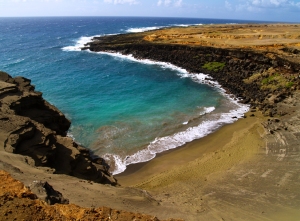
by Donald B. MacGowan

New at iTunes: Hawaii Dream Vacation iPhone/iPod Touch App Puts the Magic of Hawaii in the Palm of Your Hand. Interactive maps, GPS and WiFi enabled, dozens of videos…available at iTunes or www.tourguidehawaii.com.

Halema'uma'u Crater, Hawaii Volcanoes National Park: Graphic from Photo by Donald B MacGowan
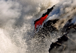
There are many wondrous, enigmatic and fascinating attractions on the Big Island of Hawaii, some better known than others, many out of the way and generally off the beaten track. Tour Guide Hawaii has produced an encyclopedic collection of the most up-to-date information, presented as short GPS-cued videos, in an app downloadable to iPhone and iPod Touch that covers the entire Big Island, highlighting the popular and the uncrowded, the famous and the secluded, the adventurous and the relaxing.

Halema’uma’u Crater Overlook

New at iTunes: Hawaii Dream Vacation iPhone/iPod Touch App Puts the Magic of Hawaii in the Palm of Your Hand. Interactive maps, GPS and WiFi enabled, dozens of videos…available at iTunes or www.tourguidehawaii.com.

Mauna Loa behind Halema'uma'u Crater: Photo by Donald B MacGowan

Breathtaking, awe-inspiring, sacred. Clearly overcome with awe and wonder, when he visited Kilauea a century and a half ago, Mark Twain remarked aptly: “…here was room for the imagination to work!”

New at iTunes: Hawaii Dream Vacation iPhone/iPod Touch App Puts the Magic of Hawaii in the Palm of Your Hand. Interactive maps, GPS and WiFi enabled, dozens of videos…available at iTunes or www.tourguidehawaii.com.

As if someone left the door to Hades ajar, Halema'uma'u as seen from Jagger Museum, Hawaii Volcanoes National Park: Photo by Donald B

A spectacular eruption has been underway in Halema’uma’u Crater since March 19, 2008. Because of this, Crater Rim Drive is closed at Jagger Museum and at the junction with Chain of Crater Road, so the Halema’uma’u Overlook is inaccessible. Great viewing of the eruption can be had from Jagger Museum; views of the ash cloud at night, lit up with the glow of molten rock from below the surface of Halema’uma’u, are particularly exciting. Please go here to learn more about this eruption.

New at iTunes: Hawaii Dream Vacation iPhone/iPod Touch App Puts the Magic of Hawaii in the Palm of Your Hand. Interactive maps, GPS and WiFi enabled, dozens of videos…available at iTunes or www.tourguidehawaii.com.

Appeasing the goddess at Halema'uma'u Crater, Hawaii Volcanoes National Park: Photo by Donald B MacGowan

The Hawai’ians revered the area around Halema’uma’u Crater as the home of the volcano Goddess, Madame Pele, who journeyed from Tahiti to Ni’ihau and Kau’ai before settling down at Halema’uma’u. For generations Hawai’ian Kahuna came here to divine the future, hold rituals, make sacrifices and appease the goddess with offerings. Commoners among the native Hawai’ians were not allowed within sight of the sacred grounds. Continuing into modern times on several ceremonial days each year (in times of eruptive quiescence), modern Hawai’ians gather on the crater floor to perform hula dances and other rituals to appease the goddess Pele.

Offereings to the goddess at Halema'uma'u Crater, Hawaii Volcanoes National Park: Photo by Donald B MacGowan

Steam fumaroles at Halema'uma'u, Hawaii Volcanoes National Park: Photo by Donald B MacGowan

Today, a large parking lot and several trailheads converge at the junction of the two crown jewels of Hawai’i Volcanoes National Park, Kilauea Caldera and inside it, the more recent center of eruptive activity, Halema’uma’u crater. Not many years ago, there was an active lava lake in Halema’uma’u Crater, which was first documented by Europeans in 1823 by William Ellis. Over the past 230-some years of recorded history, more the 20 major eruptions have taken place here.

Offereings to the goddess at Halema'uma'u Crater, Hawaii Volcanoes National Park: Photo by Donald B MacGowan

New life clings to the edge of Halema'uma'u Crater, Hawaii Volcanoes National Park: Photo by Donald B MacGowan

In 1924 an explosive eruption shattered Halema’uma’u Crater, doubling its size and the lava lake drained. A spectacular fire-fountain eruption occurred inside Halema’uma’u in 1974, and the crater floor has risen and fallen a couple thousand feet over time from more than 1300 feet deep to over-flowing into Kilauea Crater.

Offereings to the goddess at Halema'uma'u Crater, Hawaii Volcanoes National Park: Photo by Donald B MacGowan

Kilauea Crater and Eruption of Halema'uma'u from Kilauea Overlook, Hawaii Volcanoes National Park: Photo by Donald B MacGowan

Currently, Halema’uma’u Crater is a robust 300 feet deep and 3000 feet across; even so, it is almost lost inside the lager and deeper Kilauea Crater. Although covered with a hard crust of frozen lava, both craters still steam and smolder and the volcanic heat flowing up through them is still very evident, even on a hot day. A whiff of sulfurous gases emanating from the many steam vents is also evident to the modern visitor; a century and a half ago, Mark Twain commented: “…the smell of sulfur is strong, but not unpleasant to a sinner!”

Offereings to the goddess at Halema'uma'u Crater, Hawaii Volcanoes National Park: Photo by Donald B MacGowan

Bradford MacGowan and Liz Maus at Kilauea Caldera, Hawaii Volcanoes National Park: Photo by Donald B MacGowan

Many natives, kama’aina and tourists alike pause here at the overlook to offer the goddess gifts of food, flowers, gin or feathers wrapped in leaves.

The easy, half mile walk around the overlook is well worth the thirty or so minutes it will take. This hike requires no special equipment or preparation. For a longer hike, taking off from the Halema’uma’u Trail at a bout ½ mile, the Byron Ledge Trail follows a ledge system above the crater floor 3 miles to the Devastation Trail and ultimately to Kilauea Iki Crater; this is best done as a car-shuttle hike. Another wonderful hike, though dry, hot and challenging, is the 3.5 mile trek across Kilauea Caldera leads back to the Volcano House, which takes 2 hours of steady hiking. These two latter trips require you to take plenty of water, rain gear, suncream, a map and compass (and the knowledge to use them), to wear sturdy hiking shoes or boots and to be in fairly good physical condition. As always when hiking in the Park, it is wise to avoid the noonday sun, and afternoon showers, particularly along the crater rims are common.

New at iTunes: Hawaii Dream Vacation iPhone/iPod Touch App Puts the Magic of Hawaii in the Palm of Your Hand. Interactive maps, GPS and WiFi enabled, dozens of videos…available at iTunes or www.tourguidehawaii.com.

Along the Halema'uma'u Overlook Trail, Hawaii Volcanoes National Park: Photo by Donald B MacGowan

Remember to wipe all gear down and to clean the lenses of cameras, binoculars and glasses after visiting the crater; the volcano smog has a corrosive effect upon precision optics and electronics.

New at iTunes: Hawaii Dream Vacation iPhone/iPod Touch App Puts the Magic of Hawaii in the Palm of Your Hand. Interactive maps, GPS and WiFi enabled, dozens of videos…available at iTunes or www.tourguidehawaii.com.

Aerial view of Halema'uma'u Crater in Kilauea Caldera, Hawaii Volcanoes National Park: Photo by Donald B MacGowan

To see the new iPhone/iPod Touch App, please visit http://www.tourguidehawaii.com/iphone.html.

The best of Tour Guide Hawaii’s free content about traveling to, and exploring, the Big island, can be found here.

New at iTunes: Hawaii Dream Vacation iPhone/iPod Touch App Puts the Magic of Hawaii in the Palm of Your Hand. Interactive maps, GPS and WiFi enabled, dozens of videos…available at iTunes or www.tourguidehawaii.com.

Amy and Amanda Maus at Halema'uma'u Overlook, Hawaii Volcanoes National Park: Photo by Donald B MacGowan


For more information on traveling to Hawaii in general and on touring the Big Island in particular, please also visit www.tourguidehawaii.com and www.tourguidehawaii.blogspot.com.
All media copyright 2010 by Donald B. MacGowan. All rights reserved

New at iTunes: Hawaii Dream Vacation iPhone/iPod Touch App Puts the Magic of Hawaii in the Palm of Your Hand. Interactive maps, GPS and WiFi enabled, dozens of videos…available at iTunes or www.tourguidehawaii.com.

Appeasing the goddess at Halema'uma'u Crater, Hawaii Volcanoes National Park: Graphic from Photo by Donald B MacGowan
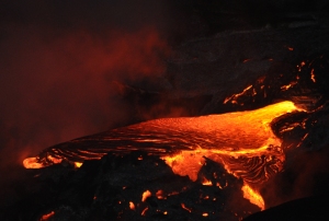
by Donald B. MacGowan

New at iTunes: Hawaii Dream Vacation iPhone/iPod Touch App Puts the Magic of Hawaii in the Palm of Your Hand. Interactive maps, GPS and WiFi enabled, dozens of videos…available at iTunes or www.tourguidehawaii.com.

The Halema'uma'u eruption from Waldron Ledge Overlook, Hawaii Volcanoes National Park: Graphic from Photo by Donald B MacGowan

There are many wondrous, enigmatic and fascinating attractions on the Big Island of Hawaii, some better known than others, many out of the way and generally off the beaten track. Tour Guide Hawaii has produced an encyclopedic collection of the most up-to-date information, presented as short GPS-cued videos, in an app downloadable to iPhone and iPod Touch that covers the entire Big Island, highlighting the popular and the uncrowded, the famous and the secluded, the adventurous and the relaxing.

Waldron Ledge Overlook Hike

New at iTunes: Hawaii Dream Vacation iPhone/iPod Touch App Puts the Magic of Hawaii in the Palm of Your Hand. Interactive maps, GPS and WiFi enabled, dozens of videos…available at iTunes or www.tourguidehawaii.com.

Frank Burgess along the way to Waldron Ledge Overlook, Hawaii Volcanoes National Park: Photo by Donald B MacGowan

A short, 20 minute-or-so hike on a section of Crater Rim Drive abandoned after an earthquake made the crater edge unstable. Strolling through lush fern and o’hia forest brings one to spectacular views of the Kilauea Caldera, Waldron Ledge and Pu’u Pai at the mouth of Kilauea Iki Crater. This hike is one of the few places where bicycles are allowed, and the generally shaded road makes for a pleasant, but short, ride or hike. This trail is a great way to get away from noise and traffic and experience the lush, high altitude fern forest firsthand.

New at iTunes: Hawaii Dream Vacation iPhone/iPod Touch App Puts the Magic of Hawaii in the Palm of Your Hand. Interactive maps, GPS and WiFi enabled, dozens of videos…available at iTunes or www.tourguidehawaii.com.

Although beautiful, this kind of wild ginger is an invasive pest, Waldron Ledge at Hawaii Volcanoes National Park: Photo by Donald B MacGowan

The overlook at Waldron Ledge is a particularly spectacular place, perched on the edge of the vast wasteland of Kilauea Caldera. It’s a good place to observe the current eruption in Halema’uma’u, especially early in the morning when the rising sun lights up the eruption cloud, or in the evening when the setting sun shines through it.

New at iTunes: Hawaii Dream Vacation iPhone/iPod Touch App Puts the Magic of Hawaii in the Palm of Your Hand. Interactive maps, GPS and WiFi enabled, dozens of videos…available at iTunes or www.tourguidehawaii.com.

The edge of Kilauea Caldera from Waldron Ledge Overlook, Hawaii Volcanoes National Park: Photo by Donald B MacGowan

No services are available once you leave the area of the Visitor’s Center and Volcano House.

To see the new iPhone/iPod Touch App, please visit http://www.tourguidehawaii.com/iphone.html.

New at iTunes: Hawaii Dream Vacation iPhone/iPod Touch App Puts the Magic of Hawaii in the Palm of Your Hand. Interactive maps, GPS and WiFi enabled, dozens of videos…available at iTunes or www.tourguidehawaii.com.

Kilauea Caldera from Waldron Ledge Overlook, Hawaii Volcanoes National Park: Photo by Donald B MacGowan

The best of Tour Guide Hawaii’s free content about traveling to, and exploring, the Big island, can be found here.

For more information on traveling to Hawaii in general and on touring the Big Island in particular, please also visit www.tourguidehawaii.com and www.tourguidehawaii.blogspot.com.
All media copyright 2010 by Donald B. MacGowan. All rights reserved

New at iTunes: Hawaii Dream Vacation iPhone/iPod Touch App Puts the Magic of Hawaii in the Palm of Your Hand. Interactive maps, GPS and WiFi enabled, dozens of videos…available at iTunes or www.tourguidehawaii.com.

Pu'u Pua'i from Waldron Ledge Trail, Hawaii Volcanoes National Park: Graphic from Photo by Donald B MacGowan
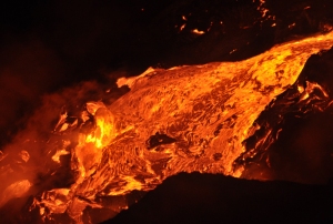
by Donald B. MacGowan

New at iTunes: Hawaii Dream Vacation iPhone/iPod Touch App Puts the Magic of Hawaii in the Palm of Your Hand. Interactive maps, GPS and WiFi enabled, dozens of videos…available at iTunes or www.tourguidehawaii.com.

Southwest Rift presents a Mars-like geography, Hawaii Volcanoes National Park: Graphic from Photo by Donald B MacGowan
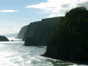
There are many wondrous, enigmatic and fascinating attractions on the Big Island of Hawaii, some better known than others, many out of the way and generally off the beaten track. Tour Guide Hawaii has produced an encyclopedic collection of the most up-to-date information, presented as short GPS-cued videos, in an app downloadable to iPhone and iPod Touch that covers the entire Big Island, highlighting the popular and the uncrowded, the famous and the secluded, the adventurous and the relaxing.

Southwest Rift

New at iTunes: Hawaii Dream Vacation iPhone/iPod Touch App Puts the Magic of Hawaii in the Palm of Your Hand. Interactive maps, GPS and WiFi enabled, dozens of videos…available at iTunes or www.tourguidehawaii.com.

Fissures at the Southwest Rift, Hawaii Volcanoes National Park: Photo by Donald B MacGowan
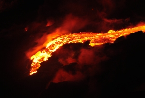
A major fissure, or crack, extending across the volcano from its summit out to the coast and down to the sub-sea root of the volcano, the Southwest Rift crosses Crater Rim Drive in the vicinity of the HVO. It is worth the time to stop along the road here and check out this natural weakness, a fissure and vent that goes all the way to the heart of the volcano.

This roadside pullout is infamous for having been featured in an episode of the Discovery Channel television series “Man vs Wild”. Pretending to be dozens of miles in the forbidding volcanic backcountry of Kilauea, Bear Grylls leaps foolishly about the fissures like a gecko on crack, just a few meters from the roadway. In one scene you can actually see car traffic on the highway right behind him. Viewer outrage was so vehement at this obvious, and odious, fraud that the episode is no longer available on DVD.

New at iTunes: Hawaii Dream Vacation iPhone/iPod Touch App Puts the Magic of Hawaii in the Palm of Your Hand. Interactive maps, GPS and WiFi enabled, dozens of videos…available at iTunes or www.tourguidehawaii.com.

A Lava flow that poured over the side of the open fissure at Southwest Rift, Hawaii Volcanoes National Park: Photo by Donald B MacGowan
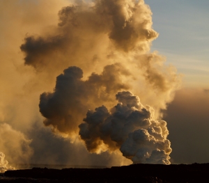
NOTE: Currently The Southwest Rift is inaccessible, as a portion of Chain of Craters Road has been closed due to the current eruption in Halema’uma’u Crater.

To see the new iPhone/iPod Touch App, please visit http://www.tourguidehawaii.com/iphone.html.
The best of Tour Guide Hawaii’s free content about traveling to, and exploring, the Big island, can be found here.
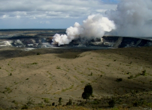
For more information on traveling to Hawaii in general and on touring the Big Island in particular, please also visit www.tourguidehawaii.com and www.tourguidehawaii.blogspot.com.
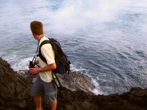
All media copyright 2010 by Donald B. MacGowan. All rights reserved

New at iTunes: Hawaii Dream Vacation iPhone/iPod Touch App Puts the Magic of Hawaii in the Palm of Your Hand. Interactive maps, GPS and WiFi enabled, dozens of videos…available at iTunes or www.tourguidehawaii.com.

Aerial view of the Southwest Rift and Halema'uma'u, Hawaii Volcanoes National Park: Photo by Aelbert Aehegma