There are many wondrous, enigmatic and fascinating attractions on the Big Island of Hawaii, some better known than others, many out of the way and generally off the beaten track. Tour Guide Hawaii has produced an encyclopedic collection of the most up-to-date information, presented as short GPS-cued videos, in an app downloadable to iPhone and iPod Touch that covers the entire Big Island, highlighting the popular and the uncrowded, the famous and the secluded, the adventurous and the relaxing.
The Volcanoes of Hawaii Island
The Hawaiian Archipelago, part of the Hawaiian Island-Emperor Seamount chain, is the most isolated island group earth and is comprised entirely of volcanic islands and their fringing reefs. The archipelago was formed as one of the Earth’s great tectonic plates, the Pacific Plate, moved steadily northwest over a stationary plume of molten material welling up from the Earth’s mantle, called a “hot spot”.
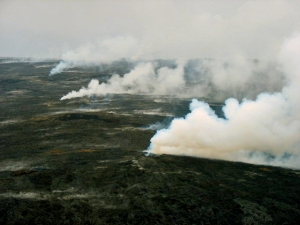
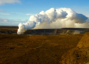
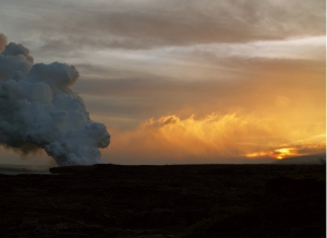
Fumes bellow from skylights in an active lava tube on Kilauea Volcano, Hawaii Photo by Kelly Kuchman
Creating a chain of volcanic islands that, today, stretches from the Aleutian Islands to the Big Island of Hawaii, this hotspot gave rise to at least 129 separate volcanoes in the past 86 million years. There are 19 islands and atolls, and dozens of separate islets, seamounts, reefs and shoals in the Hawaiian Island portion of this chain, stretching from Kure Atoll to Hawaii Island (please go here for a complete discussion of the geologic history of the Hawaiian Islands).
Hawai’i is the youngest island in the Archipelago and first began forming about a million years ago as volcanic vents opened above the mantle “hot spot” on the ocean bottom and molten lava began pouring onto the sea floor. Over the centuries, the making of the Big Island as we know it today eventually entailed the growth and conjoining of six separate volcanoes, building all the way up from the seafloor, some 18,000 feet below the ocean’s surface. These volcanoes, from northwest to southeast, are named Mahukona, Kohala, Mauna Kea, Hualalai, Mauna Loa and Kilauea, and become younger as one moves north to south.
Mahukona Volcano, just off the Big Island’s northwest coast, was the first volcano to start forming. Now submerged beneath the surface of the ocean because it is sinking into the Earth’s crust under its own vast weight, Mahukona is no longer visible. As the Pacific Plate slowly continued moving northwestward over the hotspot, the location of the rising magma moved relatively southeastward, and through time the rest of the Big Island volcanoes formed along that path.
After Mahukona, Kohala Volcano, the precursor to today’s Kohala Mountain, erupted next. As Kohala Volcano emerged from the sea and joined with Mahukona, a much larger Big Island began forming. With continued movement of the Pacific Plate, the center of volcanism migrated on to Mauna Kea and Hualalai, the middle-aged volcanoes, and finally on to Mauna Loa and Kilauea, which are the youngest volcanoes on the island. Over the geologically short time of several hundred thousand years, these volcanoes erupted thousands of thin flows which spread over, and built upon, older flows; each volcano growing until it finally emerged from the sea. As time went on, lava flows from one volcano began to overlap flows from other, nearby volcanoes and eventually the peaks coalesced into a single island, the Big Island.
In geologically recent times, a new volcano, Lo’ihi, began forming about 18 miles off the southeast coast of the Big Island. In time, Loihi may join its mass with that of Kilauea, again changing the size and shape of the Big Island. It is estimated that Lo’ihi, whose summit lies approximately 3,178 feet below the surface of the ocean today, will begin to protrude above the surface in about 10,000 years.
Currently, the remnants of Mahukona and Kohala volcanoes are completely extinct; Hualalai and Mauna Kea are considered dormant and Mauna Loa, Kilauea and Loihi are still very active. This means that eruptions of Mahukona and Kohala are not at all likely. Eruptions of Mauna Kea and Hualalai are probable at some time in the future, though the major phase of mountain building is over for these volcanoes. Movement of the Pacific Plate has moved both Hualalai and Mauna Kea off the hot spot so only remnants of liquid magma reside beneath them. These late-stage, mature Hawaiian volcanoes experience violent, explosive eruptions which are spectacular but comparatively small, volume-wise. Late-stage Hawaiian volcanic eruptions are characterized by crater-forming explosions, tephra-cone building and ash ejecting events.
Mauna Loa and Kilauea are both considered active volcanoes. Although inflation and dilation events are common on the summit of Mauna Loa, it has not erupted since 1984; Mauna Loa could, however, erupt at any time. Since 1833 when accurate records began to be kept, there have been 33 eruptions of Mauna Loa, making it one of the most active volcanoes on earth. Its name means “long mountain”, and Mauna Loa is capable of erupting huge amounts of lava in a very short time, dwarfing the current output of Kilauea. The most massive mountain on earth, this prolific effusion of molten rock accounts for Mauna Loa’s vast bulk.
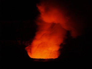
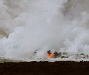
Kilauea eruption in Halema'uma'u Crater at night, Hawaii Volcanoes National Park: Photo by Donald B MacGowan
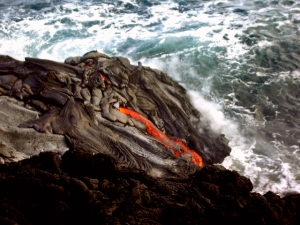
Kilauea, once believed to be a mere satellite vent on Mauna Loa, is known to be a separate and distinct volcano with its own, geologically separate magma chamber and subterranean plumbing. Nearly half a million years old, Kilauea’s most recent eruption has been continuous since 1983 making it currently the world’s most active volcano. Indeed, between 1983 and 2009 about 700 acres of new land were produced by lava flows from Kilauea. Articles on how to see the active lava flows on Kilauea can be found here and here. A detailed guide to enjoying Hawaii Volcanoes National Park, featuring Kilauea and Mauna Loa Volcanoes can be found here.
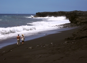
Kilauea buried the town of Kalapana in the early 1990s and formed Kaimu Black, Hawaii: Photo by Donald B MacGowan
Because the time-scale of human experience is virtually instantaneous compared to the aeons-long march of geologic history, there is continuing human drama, a tension, between short-sighted humans attempting to establish roads, villages and towns, and the ongoing geologic processes of the landscapes they choose to inhabit. In very recent decades, the towns of Kapoho, Kalapana and Kaimu have been inundated, destroyed and buried by Kilauea Volcano (please see a related article on the death and rebirth of Kalapana, here). As more people move to Hawaii, more such drama is inevitable.
The evolution of Hawaiian volcanoes continues even after the major phase of eruptive activity subsides. There are great differences, obvious to even the most casual observer, between the elongated, fluted ridge-like shape of Kohala Mountain and the lower angled slopes of Mauna Loa and Kilauea. Likewise, steep-sided Mauna Kea has a greatly different physical aspect than does gently-sloped, shield-shaped Mauna Loa. These differences are accounted for by the differences in their relative ages, and thus eruptive and erosive stages.
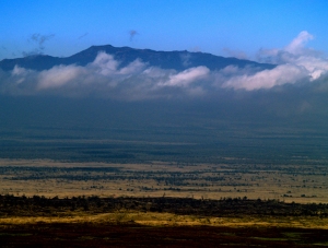
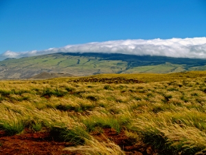
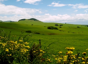
The steeper, crater-poked slopes of Hualalai indicate it has moved on to the later stages of volcanism Photo by Donald B MacGowan
Remembering that the angle of repose of Hawaiian lava is about 6 degrees, the shield-shaped, gentle slopes of Mauna Loa and Kilauea reflect the fact that they are quite young and are still in the shield-building stage, being built-up by successive flows of highly fluid lava. The much steeper flanks of Hualalai and Mauna Kea volcanoes are due to the late-stage, explosive eruptions, to erosion and to ashfall which piles up much more steeply than the flowing lava. The fluted ridges of Kohala volcano result from the deep dissection of the once shield-shaped slopes of the original volcano by streams and surface flow of water. The distinctive steep valleys and great cliffs seen on the north and east sides of Kohala Volcano result from later process of normal faulting and giant landslides (see further discussion in an article about Waipi’o Valley, here).
Another process, operative in the geologically recent past, has served to shape the slopes of the volcanoes of the Big Island, at least those which are or great height. Glaciers covered the summit of Mauna Kea (and possibly Mauna Loa) three times between 200,000 and 13,000 years ago, leaving behind many glacial features such as cirques, u-shaped valleys and scoured bedrock; surviving into the present is a remnant rock glacier near the summit of Mauna Kea (a related article on the summit of Mauna Kea and the Hawaiian Snow Goddess, Poliahu, can be found here; details on exploring Mauna Kea can be found here). Any evidence on Mauna Loa of ice-age glaciers has been covered by recent eruptions.
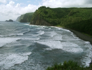
Kohala Volcano is subsiding, cut by enormous valleys and giant cliff-forming landslides, Hawaii: Photo by Donald B MacGowan
Simultaneously with the ongoing eruptions and island building, due to their enormous mass, the great volcanoes of the Hawaiian Chain begin to subside into the oceanic crust. After the majority of eruptions cease, with cooling and with a great amount of time, they eventually disappear beneath the surface of the sea completely, as Mahukona Volcano already has.
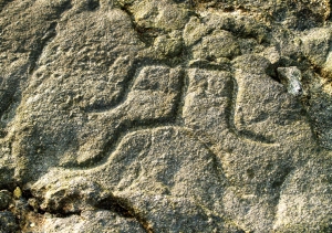
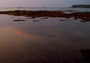
Originally carved above sea level, these 500-year old petroglyphs at Keauhou today are awash due to subsidence of Hualalai Volcano: Photo by Donald B MacGowan
Today, the Big Island of Hawai’i comprises more than twice the area of all the other Hawaiian Islands combined. It’s size is not anomalous, however, considering the geologic history of the archipelago. All the other Hawaiian Islands experienced the same pattern of volcanic eruption, growth and coalescence, as well as the gradual subsidence and submersion that Hawaii Island has, and thus at one time may have been as large as the Big Island. Indeed, geologists have demonstrated that Maui at one time formed a single landmass, known as Maui Nui or “Big Maui”, with the islands of Lana’i, Moloka’i, and Kaho’olawe. Continued subsidence submerged the larger landmass, leaving the four, smaller islands above the ocean surface. Ultimately, this will happen to the Big Island, as well.
The relentless movement of the Pacific Plate carries it, with the all the islands piggy-backed, inexorably northward to the Aleutian Trench, where it is subducted underneath the North American Plate, melted, and recycled as volcanic material in the Aleutian Island volcanoes. The Emperor Seamounts are currently undergoing such destruction, and, the evolution of the Hawaiian-Emperor Chain is such that, eventually this fate also awaits the Big Island…but not for tens of millions of years.
Given the ephemeral nature of this precious island, this geologic certainty should serve to make us love and treasure the Big Island more deeply, as well as to spur us to protect and preserve it more completely.
The best of Tour Guide Hawaii’s free content about traveling to, and exploring, the Big island, can be found here.
For more information on traveling to Hawaii in general and on touring the Big Island in particular, please also visit www.tourguidehawaii.com and www.tourguidehawaii.blogspot.com.
All media copyright 2010 by Donald B. MacGowan. All rights reserved.


4 Trackbacks/Pingbacks
[…] The Volcanoes of Hawaii Island: Mahukona, Kohala, Mauna Kea, Hualalai, Mauna Loa « Lovingthebi… on 17 May 2010 at 9:57 […]
[…] The Volcanoes of Hawaii Island: Mahukona, Kohala, Mauna Kea, Hualalai, Mauna Loa: https://lovingthebigisland.wordpress.com/2010/05/17/the-volcanoes-of-hawaii-island-mahukona-kohala-m… […]
[…] east in Puna at Waikupanaha can be found here and here respectively. A general outline of the volcanoes of Hawaii Island is presented here, a brief discussion on the differences between a’a and pahoehoe lavas can […]
[…] The Volcanoes of Hawaii Island: Mahukona, Kohala, Mauna Kea, Hualalai, Mauna Loa: https://lovingthebigisland.wordpress.com/2010/05/17/the-volcanoes-of-hawaii-island-mahukona-kohala-m… […]