Skip navigation

Tag Archives: photography

by Donald B. MacGowan

Sometimes lost in the shuffle between visiting the mile-long sugar-sand beaches of Kohala and the spectacular snorkeling at the Kona-side beaches, the southern beaches of Hawaii Island are by no means second class, poor cousins. Beautiful and alluring in their own right, many are highly unique, offering unusual conditions and rare scenery, all are well worth visiting and none are more than a couple hours drive from Kona or Hilo. Here is a smattering of the best of the Southern Beaches of Hawaii Island. All these beaches are a bit off the beaten track and, with the exception of Punalu’u, aren’t on any standard tour of the island. Many of these are remote, none are crowded.

We always advise visitors to be careful with their possessions and leave no valuable in the cars. The locals are friendly and open, so let your smile be your passport and talk story with them; open yourself to an adventure that only begins with getting to know the people of Hawai’i and visiting their beaches.

Mahana Green Sand Beach (see video)

The Beautiful Green Sand Beach at South Point of the Island of Hawaii is Reached by an Easy 2 1/4 Mile Hike: Photo by Donald B. MacGowan

The Beautiful Green Sand Beach at South Point of the Island of Hawaii is Reached by an Easy 2 1/4 Mile Hike: Photo by Donald B. MacGowan

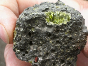
Absolutely unique to the island of Hawai’i, beautiful and strange, are the handful of green sand beaches composed of crystals of the semi-precious mineral olivine (also known as peridot). The green sand beach at South Point is the best known, largest and most accessible of these. The sand grains on this beach are formed from olivine crystals weathering out of the lava and cinders from the cone over an eruptive vent that has been partially breached by the sea. The beach lies in the interior of the cone, and the somewhat protected cove formed by the remnant of the cone makes for a wonderful swimming/snorkeling spot. Be very wary of currents and do not go out far nor in at all if the surf is high or there are strong winds. The bizarre color of the water shrieks for color photographs, particularly underwater photographs taken while snorkeling.

To get here take the South Point Exit from the Hawaii Belt Road between Ocean View and Na’alehu; drive to South Point and, where the road splits, take the Mahana Boat Ramp  (left) branch of the road.  This road is dirt and broken pavement, but is quite good until the last couple hundred yards above the boat ramp.  Park in the obvious flat spot just above the boat ramp and be sure to leave no valuables in your car.  The 2 1/4 mile hike is along a terrible dirt road to the Green Sand Beach; the gate at the start of the road may or may be locked…just walk around it. Road conditions along the road to the beach vary dramatically from week to week and the road becomes impassable with even a gentle rain; therefore we do not suggest driving it at all but enjoy the short, pleasant hike. The beach lies in the center of a cinder cone breached by the sea. Once you reach the edge of the cone the obvious trail goes over the side and along the interior wall, angling toward the beach,  Alternately, one can hike to the top pf the cone and pick your way down the steep cliff and sand slope (there are a set of stairs at the very top–then it gets tricky); this is very direct, but can be slippery and treacherous.  Be wary of rip tides and currents, do not swim beyond the protected reach of the bay.  Aren’t you glad you read this article before you came here?  Now that you are here you understand why I insisted you buy a disposable underwater camera and bring it…look at the color of that water!  There are no services or facilities here. At all. None. And a goodly long way to drive to get to any…plan and act accordingly.

Punalu’u Black Sand Beach Park (see video)

Bradford MacGowan Filming at Punalu'u Beach: Photo By Donnie MacGowan

Bradford MacGowan Filming at Punalu'u Beach: Photo By Donnie MacGowan

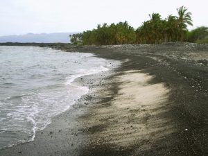
A truly remarkable place of great peace, beauty and spiritual healing, Punalu’u’s black sand-lined coves and beaches are world-renowned. Dozens of endangered Hawai’ian Green Sea Turtles swim the waters of Kuhua Bay, Ninole Cove and Punalu’u Harbor and frequently bask on Kaimu Beach here. The wildness of the ocean and the serenity of the freshwater fishpond and coconut palm-shaded beaches make this an ideal place to spend some soul-recharge time. Snorkeling, picnicking and camping, or just relaxing on the beach, are major destination pass-times here.

Punalu’u means “springs you swim to”; it is the abundance of these fresh water springs just offshore that makes swimming at Punalu’u so cold and this settlement site so important to the ancient Hawai’ians. In pre-contact times, due to the scarcity of fresh water along the Ka’u coast, Hawaiians would swim out into Kuhua Bay with stoppered gourds, dive down on top the springs, unstopper the gourds and, by upending them underwater, fill them with the fresh spring water emanating from the floor of the bay. These springs are one of the very few sources of fresh water on this entire end of the island.

Available services include water, picnic tables, restrooms, electrical outlets, and pavilions, parking; camping is by permit only. During peak tourist time, there is a souvenir stand with some packaged food items and canned drinks for sale. Due to chilly waters, off-shore winds, strong currents and a fearsome rip, swimmers and snorkelers should use caution when swimming at Punalu’u, but it’s hard to resist getting in and swimming with all those turtles.

Kaimu Black Sand Beach

Kaimu Black Sand Beach near the Village of Kalapana: Photo by Donald B. MacGowan

Kaimu Black Sand Beach near the Village of Kalapana: Photo by Donald B. MacGowan

The state’s newest black sand beach, Kaimu Beach, is a barren crescent of sand fronting an unforgiving expanse of lava from the 1990 flows. The old beach and the fishing village of Kalapana that stood along it are long gone, buried under 50-75 feet of lava. The palm trees growing along this trail are the result of one woman’s commitment not to allow her community, her beach, her culture to die under the lava. Planting thousands of palm sprouts, she encouraged her community, school children state wide and hundreds of others to plant the young trees. Today, the realization of her vision of rebirth is in the growing palm groves out on the barren lava plain. The trail to the new black sand beach is marked with these young palms.

Near the parking area along the path are exposed fossils, lava casts of palm trees and other plants…keep a sharp eye out, they are everywhere. Swimming is hazardous at the new beach, so is surfing, the ocean currents being strong and treacherous. But take some time to relax, wade, feel the sand beneath your feet and contemplate the drive of one dying woman to rebuild a world she loved from a devastation few of us can imagine. From the lava hillocks along the trail are nice views of the eruption plume at Pu’u O’o, on the flank of Kilauea as well as the steam clouds where the lave enters the sea at Waikupanaha. This is one of the few places where both can be seen easily and at the same time.

Kehena Beach
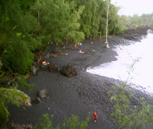
Kehena in Puna is a Gorgeous Gem of a Beach; Frequently Clothing Optional, There Is a Sense of Both Community and Welcome Here: Photo by Donnie MacGowan

Kehena in Puna is a Gorgeous Gem of a Beach; Frequently Clothing Optional, There Is a Sense of Both Community and Welcome Here: Photo by Donnie MacGowan

When the eruption of 1955 created this beautiful black sand beach, the County was swift to capitalize on it and, creating a wonderful beach park, built stone steps down the cliff to the beach. When the beach dropped a full 3 feet during an earthquake in 1975 the stairs were shattered. Like so much else around this island, these stairs were never rebuilt and today terminate about ten feet above the current level of the beach—if you want to get down to the beach, therefore, you must take the dirt path that goes out of the left side of the parking lot.

Once on the beach the first thing that may strike you is that many of the locals who frequent this park have forgotten to put on proper beach attire…or any other attire whatsoever, for that matter. The second thing that will strike you is what a lovely, wonderful spot this is. In the shade of palms and ironwood trees this primeval and idyllic beach is generally sunny even when the rest of Puna is rainy. Swimming here is great, but ocean currents are strong and dangerous not far from shore. The locals are friendly but frisky, so don’t leave valuables in your car.

Pohoiki Beach at Isaac Hale Beach Park

Looking Across Pohoiki Beach to Isaac Hale County Beach Park: Photo by Donald B. MacGowan

Looking Across Pohoiki Beach to Isaac Hale County Beach Park: Photo by Donald B. MacGowan

A lovely black sand beach with an expert surf break, Pohoiki Beach is one of the very few real beaches and boat ramps in Puna District; as such this park sees a lot of traffic. It is also the site of the best surfing and some of the wildest snorkeling and scuba diving in Puna. If you do get in the ocean here, go in left of the boat ramp—be alert to bodacious boat traffic (they won’t be alert for you) and for fairly dangerous ocean currents. Understandably, given the crowded nature of this small place, some locals are less than welcoming of visitors. Graciously share this ocean treasure with the residents, but and leave no valuables in your car.

A short path along the shoreline leads from the parking lot, past a house with abundant “No Trespassing” signs, just a few minutes stroll then turns about 20 yards into the jungle to a secluded, perfectly lovely natural hot spring that is wonderful for soaking. Locals usually don’t bother with swimwear here, you shouldn’t feel required to, either.

The facilities at Isaac Hale Park Beach Park have been recently rebuilt, refurbished, upgraded and expanded considerably—this once run-down park is now a quite well-appointed. The facilities include of expanded parking, soccer fields, picnic tables, showers and port-a-potties. Camping is allowed with a Hawaii County permit.

Kapoho Tide Pools

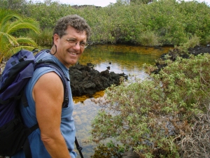
The Kapoho Tide Pools Offer a Unique, Fascinating Snorkeling Experience: Photo by Donnie MacGowan

The Kapoho Tide Pools Offer a Unique, Fascinating Snorkeling Experience: Photo by Donnie MacGowan

Stuffed with abundant sea life, this sprawling basin of lava tidal pools is a remarkable treasure for snorkelers of all abilities from the starkly frightened to the seasoned veteran. Moorish idols, yellow tangs, various wrasses and eels, sea urchins and sea cucumbers abound and there are even some nice corals in the deeper pools. The largest pool is called “Wai Opae”, which means “fresh water shrimp”. Keeping to the left of the main channel keeps one away from most of the ocean currents, which can be surprisingly strong, even in small reaches, where ponds empty into the ocean.

An amazing place to spend the day, Kapoho Tide Pools has wonderful snorkeling for people of all levels as well as other general beach activities, including just plain beach exploring, shell collecting, swimming and fishing. No real facilities exist here beyond the parking lot, so come prepared.
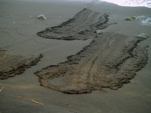
Hawaii's Beaches Offer Much More Than Just Sunbathing and Snorkeling--Many Are Associated With Cultural or Historical Sights and Have Intersting Tidepools and Wildlife.  Here, Endangered Green Sea Turtles Leave Enigmatic Tracks In The Sand At Punalu'u Beach: Photo by Donnie MacGowan

Hawaii's Beaches Offer Much More Than Just Sunbathing and Snorkeling--Many Are Associated With Cultural or Historical Sights and Have Interesting Tidepools and Wildlife. Here, Endangered Green Sea Turtles Leave Enigmatic Tracks In The Sand At Punalu'u Beach: Photo by Donnie MacGowan

For more information about traveling to Hawaii in general and exploring the Big Island in particular, please also visit www.tourguidehawaii.com and www.tourguidehawaii.blogspot.com. Information about the author can be found here.

All media copyright 2009 by Donald B. MacGowan

Reprinted from here.

2009—A year of noteworthy volcano anniversaries in Hawai`i

Thomas Jaggar (second from left) prepares to measure the temperature of the Halema`uma`u lava lake in 1917.  Pictured, left to right, Norton Twigg-Smith, Thomas Jaggar, Lorrin Thurston, Joe Monez, and Alex Lancaster.
Thomas Jaggar (second from left) prepares to measure the temperature of the Halema`uma`u lava lake in 1917. Pictured, left to right, Norton Twigg-Smith, Thomas Jaggar, Lorrin Thurston, Joe Monez, and Alex Lancaster.

Thomas A. Jaggar, founder of the Hawaiian Volcano Observatory (HVO), first visited Hawai`i 100 years ago during a decade-long period of exploration in which he witnessed first-hand the destructive power of volcanic processes.

His quest began in 1902, when Jaggar traveled to the West Indies just 13 days after two volcanoes there erupted with devastating consequences. The first eruption at La Soufriere on the island of Saint Vincent resulted in 1,500 deaths. It was followed only a few hours later by a second, more tragic, eruption at Mount Pelee on Martinique, in which 28,000 people perished. Jaggar’s experience at Martinique set the stage for his work on volcanoes and earthquakes during the next half century.

After Martinique, Jaggar’s expeditions took him to the scenes of earthquakes and volcanic eruptions in the Aleutians, Central America, and Japan. In 1908, an earthquake near Mount Etna in Italy killed 125,000 people. Following that natural disaster, Jaggar declared that “something must be done” to support systematic studies of volcanic and seismic activity.

The next year, in 1909, he traveled at his own expense to Hawai`i, where he determined that Kīlauea was to be the home of the first American volcano observatory. His vision was to “protect life and property on the basis of sound scientific achievement.”

In 1912, construction began on the new Hawaiian Volcano Observatory with support from Hawai`i businesses, private endowments through the Hawaiian Volcano Research Association, and funding from the Massachusetts Institute of Technology. HVO has since been managed by the U.S. Weather Bureau (1919-1924), U.S. Geological Survey (1924-1935), and National Park Service (1935-1947). The USGS became the permanent administrator of HVO in 1947.

In 2012, HVO will celebrate its centennial anniversary, a milestone made possible through the vision and efforts of Thomas A. Jaggar.

Today, in 2009, as we look back at Jaggar’s first visit to Kīlauea 100 years ago, we also reflect on the landmark anniversaries of several significant eruptions on Kīlauea and Mauna Loa:

25th1984 Mauna Loa summit and northeast rift zone eruption
40th — start of the 1969-74 Kīlauea east rift zone eruption (Mauna Ulu)
50th — 1959 Kīlauea summit eruption (Kīlauea Iki)
60th1949 Mauna Loa summit eruption
90th1919 Mauna Loa southwest rift zone eruption
150th1859 Mauna Loa northwest flank eruption

Aloha! I’m Donnie MacGowan and I live on the Big Island of Hawaii. Today, I’d like to take you to the top of Mauna Kea. At 13, 796 feet above sea level, Mauna Kea’s summit is the highest point in the State of Hawaii; since its base lies at 19000 feet below sea level, its has a base-to-summit height of 33,000 feet, making it the tallest mountain on earth. It’s also one of my most favorite places on earth.

Mauna Kea began forming on the sea floor about one million years ago. Its name means “White Mountain” in the Hawaiian language and it is snowcapped much of the winter, and the summit is covered with permafrost 35 feet deep. During the ice ages, Mauna Kea’s summit was glaciated 3 times, starting about 200000 years ago and ending only 11000 years ago. One can see the U-shaped valleys and cirques, striated bedrock, glacial tills covering the summit area and remnants of ice-damned lava flows from those times. There are even the remains of extinct rock glaciers near the summit.

The Visitor’s Information Station and summit are reached via a road which turns off Saddle Road at about 6600 feet elevation near the 28 mile marker and tortuously stumbles its way up the south side of Mauna Kea to the Visitor Information Station at about 9300 feet. The road, though steep, is paved to the Visitor’s Information Station.  Above that, the road is graded dirt for about 5 miles, returning to asphalt paving for the final sprint to the rim of the summit crater. Road conditions for the summit road are available at 808.935.6263.

The Visitor Information Station is open from 9 a.m. until 10 p.m. 365 days a year. Informational multimedia presentations, souvenirs, and some food items are available here, as well as clean restrooms and drinking water. Every evening after dark the center allows visitors to stargaze through several telescopes and informational talks by visiting scientists are occasionally scheduled. Saturday and Sunday the staff lead escorted summit field trips, but visitors must provide their own vehicle. Call 808.961.2180 for information. It is suggested that summit-bound visitors stop at the Visitor’s Information Station for at least half an hour before heading to the summit so they can acclimate. The rangers there can help you decide if you and your vehicle are fit for the trip to the summit.

A wonderful, easy road trip that includes a visit to the summit of Mauna Kea can be made a memorable part of any visit to the Big Island.  Directions for a 1-day scenic drive from Kailua Kona to the top of Mauna Kea and on to Hilo (with stops along the way) can be found here.  More information on the summit drive and hike is available here; information about the Hawaiian mythology surrounding Mauna Kea can be found here.

Produced by Donnie MacGowan; original musical score written and performed by Donald B. MacGowan; videography by Donnie MacGowan and Frank Burgess.

For more information on visiting Hawaii in general, or touring the Big Island in particular, please visit www.tourguidehawaii.com and www.tourguidehawaii.blogspot.com. Information about the author can be found here.

Reprinted from here.

Halema'uma'u 1952:

Halema'uma'u 1952:

A single low lava fountain emitted a steady stream of gas when photographed by Fred Rackle on July 21, 1952, when Halema`uma`u Crater was more than twice as deep as it is at present. View is to the southwest.

The HVO Web site was recently revamped to make access to our increasing number of Webcams easier for About 20 minutes before midnight on June 27, 1952, almost exactly 57 years ago, Mrs. John Fox walked from the living room of her home on the east rim of Kilauea caldera into an adjoining room. She was instantly startled by a loud, whistling roar coming through an open window. Running back into her living room, she saw a bright orange glow lighting the night sky.

At about the same time, just down the road at Kilauea Military Camp (KMC), Colonel B.W. Rushton pointed out the bright glow to Hawaiian Volcano Observatory (HVO) staff member John Forbes, who quickly called Gordon Macdonald, then Scientist-in-Charge of HVO.

When John Forbes arrived minutes later at HVO, on the edge of Kilauea caldera, he was greeted by the top of a huge lava fountain rising above the rim of Halema`uma`u. The crater was then nearly 245 m (800 ft) deep—more than twice its current depth from the rim to the crater’s floor. By the time Gordon Macdonald arrived at HVO some 10 minutes later, the fountain was no longer visible, but incandescent fragments could still be seen arcing out of the crater.

Quickly grabbing the necessary equipment, Macdonald and Forbes set out by car for Halema`uma`u Crater to make detailed observations. As they followed Crater Rim Drive down onto the western floor of Kilauea caldera—the section of road that is closed today due to ongoing summit activity—they encountered a choking, sulfurous fume cloud so thick that they could barely see the road.

The fall of tephra onto the road was so heavy that they were hard-pressed to keep the car moving forward as it plowed through the drifts of pumice. The hail of tephra onto the car, with pieces reaching up to 10 cm (4 inches) across, sand-blasted the car’s exterior to the point that it later had to be repainted and have its windshield replaced.

Pressing onward, Macdonald and Forbes passed through the tephra fall and quickly walked to the southeast rim of Halema`uma`u, reaching it about 10 minutes past midnight. When they peered into the crater, they saw a continuous line of lava fountains, 790 m (2,600 ft) in length, crossing the entire crater floor from southwest to northeast and extending part-way up the northeastern crater wall.

For the most part, the individual fountains were 15 to 30 m (50 to 100 ft) in height, but a fountain 120 m (400 ft) high jetted up near the bottom of the southwestern wall of the crater—probably a diminished version of the same fountain, at more than 245 m (800 ft) in height, seen minutes earlier from HVO.

Though views were poor due to the heavy fume, brief glimpses of the crater floor showed that older spatter cones on the floor of Halema`uma`u had already been buried beneath a rising lava lake. This suggested that more than 3 million cubic meters (4 million cubic yards) of lava were erupted in the first half-hour of the eruption. It would take about six days for Kilauea’s current east rift zone eruption to pump out that much lava today.

The eruption rate quickly declined after the initial outbreak, but lava fountains continued to play on the surface of the lava lake over the following weeks. By late summer 1952, activity had begun to decline, but the eruption persisted until November 10, when the last fountaining activity was observed.

Having erupted for 136 days, the 1952 summit eruption brought to an end, in grand fashion, any doubts as to whether or not Kilauea was still alive. Prior to 1952, Kilauea had been quiescent since October 1934, when the previous summit eruption had ended, and some had begun to think that Kilauea was dead. But frequent earthquakes and the occasional swelling and shrinking of the volcano over the intervening years told volcanologists otherwise. It was no great surprise, then, when the eruption finally occurred.

Followed by dozens of eruptions in the years since, the 1952 eruption undoubtedly ushered in the current era of volcanic activity at Kilauea. Today’s ongoing summit and east rift zone eruptions are just the most recent in the string of eruptions that have followed since Mrs. Fox was surprised by the glow outside her living room window.

Kīlauea Activity Update

Surface flows in the Royal Gardens subdivision may have stagnated early this past week in response to a deflation-inflation (DI) event at Kīlauea’s summit. Smoke continues to rise, however, from forested kipuka in the subdivision, indicating that at least some burning continues. At the coast, the Waikupanaha and Kupapa`u ocean entries remain active and continue to produce prominent plumes, accompanied by small littoral explosions, as lava spills into the ocean.

At Kīlauea’s summit, the vent within Halema`uma`u Crater is still emitting elevated amounts of volcanic gas, resulting in high concentrations of sulfur dioxide downwind. Glow from the vent was visible at night through the past week, and rare views into the vent by HVO scientists found that the lava surface is still present about 205 m (675 feet) below the floor of Halema`uma`u Crater.

No earthquakes beneath Hawai`i Island were reported felt this past week.

Visit our Web site (http://hvo.wr.usgs.gov) for detailed Kīlauea and Mauna Loa activity updates, recent volcano photos, recent earthquakes, and more; call (808) 967-8862 for a Kīlauea activity summary; email questions to askHVO@usgs.gov. Volcano Watch is a weekly article and activity update written by scientists at the U.S. Geological Survey’s Hawaiian Volcano Observatory.

For more information on traveling to Hawaii in general and exploring the Big Island’s volcanoes in particular, please also visit www.tourguidehawaii.com and www.tourguidehawaii.blogspot.com.

by Donnie MacGowan

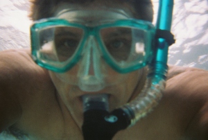
Donnie MacGowan Snorkeling at Kahalu'u Beach on the Big Island of Hawaii: Photo by Donnie MacGowan

Donnie MacGowan Snorkeling at Kahalu'u Beach on the Big Island of Hawaii: Photo by Donnie MacGowan

Whether you visit the Big Island for a few days, a couple weeks or a few months, you want to make the most of your time in Paradise.  With such a wide variety of natural and commercial attractions, it is natural for the visitor to get a little overwhelmed in the “Option Overload” and not be able to make a balanced and informed decision on what they want to do and how best to spend their time.

Bart Hunt Filming Fish at Kahalu'u Beach: Photo By Donnie MacGowan

Bart Hunt Filming Fish at Kahalu'u Beach: Photo By Donnie MacGowan

Even choosing activities you want to participate in…do you want to snorkel, hike, go on a whale watching tour?  We always recommend people do three basic things when they come to Hawaii: get in the air, go to a luau and get in the water.  By getting in the air you get a glimpse of how magnificent our island home is, it is the best way to watch the volcano erupt and it allows you to sort of “scout” the island to see where you might want to spend more time.  By going to a luau you get an introduction to Hawaiian culture and cuisine–you get a taste of what it means to live in Hawaii.  And by getting in the water you experience the magic wonder of our reefs and colorful fish, the calm and renewal from floating in our warm, turquoise waters and the thrill of exploring something new, different and a little wild.  We highly recommend you go snorkeling on your visit…but where do you go?  Do you want a snorkel beach for beginners, or a place that;s challenging to experience? Are you going simply to get in the water and see the fish or do you want a beach that’s also alive with fun people?  Are you looking for an experience that away from crowds, secluded and empty or one that’s exciting, but perhaps a little more tame?  Do you want to snorkel near your resort or one that’s at the end of a day of delicious wandering?

Liz Maus Snorkeling at Hounaunau Bay, Hawaii: Photo by Donnie MacGowan

Liz Maus Snorkeling at Hounaunau Bay, Hawaii: Photo by Donnie MacGowan

Ranked in order, with the best on top, are our picks of the best snorkeling spots on the Island of Hawaii.  We’ve tried to strike a balance in ranking these places since each is a gem in its own right, we’ve had to leave off many that are equally fine for their own reasons and of course, recommending some means that their popularity will increase and hence, they will become more crowded.  This list at least provides an excellent starting point for deciding where you want to spend you beach time.  When you arrive we ask that you treat these special places, and the people who live near them, with care, respect and aloha.

Two-Step Beach at Hounaunau Bay Has Some of the Finest Snorkeling in the World: Photo by Donald B. MacGowan

Two-Step Beach at Hounaunau Bay Has Some of the Finest Snorkeling in the World: Photo by Donald B. MacGowan

Two-Step Beach at Hounaunau Bay: Class Triple-A waters, stuffed with a wide variety of brilliant tropical fish, set in a calm and protected bay, and frequently visited by dolphins, this snorkeling area near the grounds of one of the most important Hawai’ian archeological sites is perhaps the most popular and one of the three top places to snorkel on the island.  It earns the top spot because of it’s easy accessibility.

Kealakekua Bay and Captain Cook Monument from Napo'opo'o: Photo by Donnie MacGowan

Kealakekua Bay and Captain Cook Monument from Napo'opo'o: Photo by Donnie MacGowan

Kealakekua Bay: Whether you hike or boat to Captain Cook Monument, or enter the bay to snorkel at the end of the road in Napo’opo’o, there is no place on earth that has better snorkeling or more fish than Kealakekua Bay.  Frequented by both dolphin and whale, protected, Class Triple A waters and a setting unmatched in beauty anywhere, this the premiere place for kayak-to-snorkel adventures on the island.  Arguably, this bay and the Hawaiian settlements that surround it, experienced the most momentous and important historical events yet to unfold in the human history of the state of Hawaii.

Kahalu'u Beach, Kona Hawaii: Photo by Donnie MacGowan

Kahalu'u Beach, Kona Hawaii: Photo by Donnie MacGowan

Kahalu’u Beach: Referred to by many visitors as “Snorkel Beach” Kahalu’u is centrally located along Ali’i Drive in Kailua Kona.  The welcoming waters are protected by a seawall and are amazingly warm, shallow and crystalline turquoise.  The safety and ease of conditions here, many resident turtles and abundant colorful fish and the great facilities make this a perfect place to learn to snorkel, or for the tried and true veteran to “get wet and meet the fish”.

Hookena Beach in South Kona Is a Fabulous Beach Plunked Down in the Middle of Real Old Hawaii: Photo by Donald B. MacGowan

Hookena Beach in South Kona Is a Fabulous Beach Plunked Down in the Middle of Real Old Hawaii: Photo by Donald B. MacGowan

Ho’okena Beach: Ho’okena Beach is a  fabulously beautiful beach park well off the beaten path, plunked down in the honest-to-gosh old Hawaiian village of Ho’okena. This beach has an amazing array of underwater topography populated by perhaps the greatest variety of reef fish n the island;  recently rebuilt, this park has fine facilities including a refreshment stand as well as snorkel and kayak rentals.  Ho’okena is a true snorkeler’s mecca.

Long, Lonely and Wholly Wonderful Makalawena Beach in Kekahai State Park: Photo by Donald MacGowan

Long, Lonely and Wholly Wonderful Makalawena Beach in Kekahai State Park: Photo by Donald MacGowan

Makalawena Beach: Perhaps the loveliest wilderness beach in Polynesia, Makalawena is the perfect sand crescent, beach backed by palms and iron wood trees with morning-glory-draped sand dunes.  A easy mile hike in from Kekaha Kai State Park keeps this beach uncrowded. Snorkeling here is better than perfect.  Simply drive to Kekaha Kai State Park and walk the well-marked trail north to the beach.

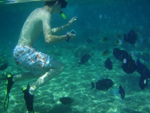
Bradford MacGowan Photographs a school of Humuhumuele'ele at Kahalu'u Beach: Photo by Donald MacGowan

Bradford MacGowan Photographs a school of Humuhumuele'ele at Kahalu'u Beach: Photo by Donald MacGowan

Before we leave the topic of Best Snorkeling Beaches on the Island of Hawaii, we’d like to impress upon you the need to be proactive in keeping these places special and how to make your experience the best it can be. The open ocean is not your resort pool and deserves immense respect from you–the ocean is the strongest natural force on earth. Never snorkel alone, never turn you back on the ocean. Drink lots and lots of water; no, drink even more. Never snorkel after having consumed alcohol. Ask the lifeguard about conditions, chat with people coming out of the water about what they liked best and what conditions are like.

Bradford MacGowan Snorkeling at Pu'u Honua O Hounaunau: Photo by Donald MacGowan

Bradford MacGowan Snorkeling at Pu'u Honua O Hounaunau: Photo by Donald MacGowan

.Gary Burton and his daughter snorkel at Hounaunau Bay: Photo by Donald MacGowan

Gary Burton and his daughter snorkel at Hounaunau Bay: Photo by Donald MacGowan

Please wear a hat and t-shirt to protect yourself from sunburn while in the water–never apply sunscreen just before entering the water,wait until you are done snorkeling and have rinsed off–sun-cream kills the coral and poisons the water.  When in the water, do not stand directly upon the coral to rest, do not touch the coral or the fish; never feed the fish or other marine animals.  Do not touch, approach, chase or harass the sea turtles, dolphins or whales–it’s not only dangerous, it’s illegal and will earn you a hefty fine.  Always obey posted warnings and the lifeguard; do not swim in windy conditions (dangerous) or murky water (sharks); be aware of currents and rip tides.

Amanda Maus Snorkeling at Kahalu'u Beach: Photo by Donald MacGowan

Amanda Maus Snorkeling at Kahalu'u Beach: Photo by Donald MacGowan

Get out before you feel tired, get out before you feel sunburned, get out before you get thirsty; get out before the wind comes up or the sun goes down; get out before you feel ready–you are more tired than you think.  Rinse yourself and your gear off after snorkeling and remember to apply sun-cream liberally and often–you are getting more sun than you think. Always pack out everything you brought with you and dispose of your litter (and that stuff the ignorant slob over there left, as well) appropriately.  These beaches get an enormous amount of pressure, try to leave Paradise a little nicer than you found it.

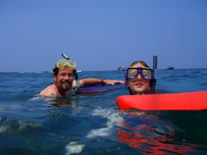
Laurie Maus Using a Boogie Board as a Floatie: Photo by Donnie MacGowan

Laurie Maus Using a Boogie Board as a Floatie: Photo by Donnie MacGowan

And for heaven’s sake, plunk-down ten bucks for a disposable underwater camera; in fact, buy two.  I promise you will kick yourself from now until you return to Hawaii if you don’t!  You will want to show the folks back home your snorkel adventures, which seem to always be the most memorable of any trip to Paradise. Trust me, any money you spend on disposable underwater cameras will be the best return on investment of any part of your Hawaii vacation.

Bart Hunt Snorkeling at Kahalu'u Bay: Photo by Donnie MacGowan

Bart Hunt Snorkeling at Kahalu'u Bay: Photo by Donnie MacGowan

For more information of traveling to Hawaii in general or exploring the Big Island in particular, please also visit www.tourguidehawaii.com and www.tourguidehawaii.blogspot.com .  Information about the author can be found here.

Monk seal at Honl's Beach near Kailua Kona: PHoto by Donald B. MacGowan

Monk seal at Honl's Beach near Kailua Kona: Photo by Donald B. MacGowan

All media copyright 2009 by Donald B. MacGowan.

by Donald B. MacGowan

Sometimes lost in the shuffle between visiting the mile-long sugar-sand beaches of Kohala and the spectacular snorkeling at the Kona-side beaches, the southern beaches of Hawaii Island are by no means second class, poor cousins. Beautiful and alluring in their own right, many are highly unique, offering unusual conditions and rare scenery, and all are well worth visiting. Here is a smattering of the best of the Southern Beaches of Hawaii Island. All these beaches are a bit off the beaten track and, with the exception of Punalu’u, aren’t on any standard tour of the island. Many of these are remote, none are crowded.

We always advise visitors to be careful with their possessions and leave no valuable in the cars. The locals are friendly and open, so smile, talk story with them and open yourself to an adventure that only begins with visiting the beaches.

Mahana Green Sand Beach

The Beautiful Green Sand Beach at South Point of the Island of Hawaii is Reached by an Easy 2 1/4 Mile Hike: Photo by Donald B. MacGowan

The Beautiful Green Sand Beach at South Point of the Island of Hawaii is Reached by an Easy 2 1/4 Mile Hike: Photo by Donald B. MacGowan

Absolutely unique to the island of Hawai’i, beautiful and strange, are the handful of green sand beaches composed of crystals of the semi-precious mineral olivine (also known as peridot). The green sand beach at South Point is the best known, largest and most accessible of these. The sand grains on this beach are formed from olivine crystals weathering out of the lava and cinders from the cone over an eruptive vent that has been partially breached by the sea. The beach lies in the interior of the cone, and the somewhat protected cove formed by the remnant of the cone makes for a wonderful swimming/snorkeling spot. Be very wary of currents and do not go out far nor in at all if the surf is high or there are strong winds. The bizarre color of the water shrieks for color photographs, particularly underwater photographs taken while snorkeling.

To get here drive to South Point and, when the road splits, take the Mahana Boat Ramp branch of the road. Park just above the boat ramp for the 2 1/4 mile hike to the Green Sand Beach. Road conditions along the road to the beach vary dramatically from week to week and the road becomes impassable with even a gentle rain; therefore we do not suggest driving it at all but enjoy the short, pleasant hike. There are no services or facilities here. At all. None. And a goodly long way to drive to get to any…plan and act accordingly.

Punalu’u Black Sand Beach Park

Bradford MacGowan Filming at Punalu'u Beach: Photo By Donnie MacGowan

Bradford MacGowan Filming at Punalu'u Beach: Photo By Donnie MacGowan

A truly remarkable place of great peace, beauty and spiritual healing, Punalu’u’s black sand-lined coves and beaches are world-renowned. Dozens of endangered Hawai’ian Green Sea Turtles swim the waters of Kuhua Bay, Ninole Cove and Punalu’u Harbor and frequently bask on Kaimu Beach here. The wildness of the ocean and the serenity of the freshwater fishpond and coconut palm-shaded beaches make this an ideal place to spend some soul-recharge time. Snorkeling, picnicking and camping, or just relaxing on the beach, are major destination pass-times here.

Punalu’u means “springs you swim to”; it is the abundance of these fresh water springs just offshore that makes swimming at Punalu’u so cold and this settlement site so important to the ancient Hawai’ians. In pre-contact times, due to the scarcity of fresh water along the Ka’u coast, Hawaiians would swim out into Kuhua Bay with stoppered gourds, dive down on top the springs, unstopper the gourds and, by upending them underwater, fill them with the fresh spring water emanating from the floor of the bay. These springs are one of the very few sources of fresh water on this entire end of the island.

Available services include water, picnic tables, restrooms, electrical outlets, and pavilions, parking; camping is by permit only. During peak tourist time, there is a souvenir stand with some packaged food items and canned drinks for sale. Due to chilly waters, off-shore winds, strong currents and a fearsome rip, swimmers and snorkelers should use caution when swimming at Punalu’u, but it’s hard to resist getting in and swimming with all those turtles.

Kaimu Black Sand Beach

Kaimu Black Sand Beach near the Village of Kalapana: Photo by Donald B. MacGowan

Kaimu Black Sand Beach near the Village of Kalapana: Photo by Donald B. MacGowan

The state’s newest black sand beach, Kaimu Beach, is a barren crescent of sand fronting an unforgiving expanse of lava from the 1990 flows. The old beach and the fishing village of Kalapana that stood along it are long gone, buried under 50-75 feet of lava. The palm trees growing along this trail are the result of one woman’s commitment not to allow her community, her beach, her culture to die under the lava. Planting thousands of palm sprouts, she encouraged her community, school children state wide and hundreds of others to plant the young trees. Today, the realization of her vision of rebirth is in the growing palm groves out on the barren lava plain. The trail to the new black sand beach is marked with these young palms.

Near the parking area along the path are exposed fossils, lava casts of palm trees and other plants…keep a sharp eye out, they are everywhere. Swimming is hazardous at the new beach, so is surfing, the ocean currents being strong and treacherous. But take some time to relax, wade, feel the sand beneath your feet and contemplate the drive of one dying woman to rebuild a world she loved from a devastation few of us can imagine. From the lava hillocks along the trail are nice views of the eruption plume at Pu’u O’o, on the flank of Kilauea as well as the steam clouds where the lave enters the sea at Waikupanaha. This is one of the few places where both can be seen easily and at the same time.

Kehena Beach

Kehena in Puna is a Gorgeous Gem of a Beach; Frequently Clothing Optional, There Is a Sense of Both Community and Welcome Here: Photo by Donnie MacGowan

Kehena in Puna is a Gorgeous Gem of a Beach; Frequently Clothing Optional, There Is a Sense of Both Community and Welcome Here: Photo by Donnie MacGowan

When the eruption of 1955 created this beautiful black sand beach, the County was swift to capitalize on it and, creating a wonderful beach park, built stone steps down the cliff to the beach. When the beach dropped a full 3 feet during an earthquake in 1975 the stairs were shattered. Like so much else around this island, these stairs were never rebuilt and today terminate about ten feet above the current level of the beach—if you want to get down to the beach, therefore, you must take the dirt path that goes out of the left side of the parking lot.

Once on the beach the first thing that may strike you is that many of the locals who frequent this park have forgotten to put on proper beach attire…or any other attire whatsoever, for that matter. The second thing that will strike you is what a lovely, wonderful spot this is. In the shade of palms and ironwood this wonderful beach is generally sunny even when the rest of Puna is rainy. Swimming here is great, but ocean currents are strong and dangerous not far from shore. The locals are friendly but frisky, so don’t leave valuables in your car.

Pohoiki Beach at Isaac Hale Beach Park

Looking Across Pohoiki Beach to Isaac Hale County Beach Park: Photo by Donald B. MacGowan

Looking Across Pohoiki Beach to Isaac Hale County Beach Park: Photo by Donald B. MacGowan

A lovely black sand beach with an expert surf break, Pohoiki Beach is one of the very few real beaches and boat ramps in Puna District; as such this park sees a lot of traffic. It is also the site of the best surfing and some of the wildest snorkeling and scuba diving in Puna. If you do get in the ocean here, go in left of the boat ramp—be alert to bodacious boat traffic (they won’t be alert for you) and for fairly dangerous ocean currents. Understandably, given the crowded nature of this small place, some locals are less than welcoming of visitors. Graciously share this ocean treasure with the residents, but and leave no valuables in your car.

A short path along the shoreline leads from the parking lot, past a house with abundant “No Trespassing” signs, just a few minutes stroll then turns about 20 yards into the jungle to a secluded, perfectly lovely natural hot spring that is wonderful for soaking. Locals usually don’t bother with swimwear here, you shouldn’t feel required to, either.

The facilities at Isaac Hale Park Beach Park have been recently rebuilt, refurbished, upgraded and expanded considerably—this once run-down park is now a quite well-appointed. The facilities include of expanded parking, soccer fields, picnic tables, showers and port-a-potties. Camping is allowed with a Hawaii County permit.

Kapoho Tide Pools

The Kapoho Tide Pools Offer a Unique, Fascinating Snorkeling Experience: Photo by Donnie MacGowan

The Kapoho Tide Pools Offer a Unique, Fascinating Snorkeling Experience: Photo by Donnie MacGowan

Stuffed with abundant sea life, this sprawling basin of lava tidal pools is a remarkable treasure for snorkelers of all abilities from the starkly frightened to the seasoned veteran. Moorish idols, yellow tangs, various wrasses and eels, sea urchins and sea cucumbers abound and there are even some nice corals in the deeper pools. The largest pool is called “Wai Opae”, which means “fresh water shrimp”. Keeping to the left of the main channel keeps one away from most of the ocean currents, which can be surprisingly strong, even in small channels, where ponds empty into the ocean.

An amazing place to spend the day, Kapoho Tide Pools has wonderful snorkeling for people of all levels as well as other general beach activities, including just plain beach exploring, shell collecting, swimming and fishing. No real facilities exist here beyond the parking lot, so come prepared.

Hawaii's Beaches Offer Much More Than Just Sunbathing and Snorkeling--Many Are Associated With Cultural or Historical Sights and Have Intersting Tidepools and Wildlife.  Here, Endangered Green Sea Turtles Leave Enigmatic Tracks In The Sand At Punalu'u Beach: Photo by Donnie MacGowan

Hawaii's Beaches Offer Much More Than Just Sunbathing and Snorkeling--Many Are Associated With Cultural or Historical Sights and Have Interesting Tidepools and Wildlife. Here, Endangered Green Sea Turtles Leave Enigmatic Tracks In The Sand At Punalu'u Beach: Photo by Donnie MacGowan

For more information about traveling to Hawaii in general and exploring the Big Island in particular, please also visit www.tourguidehawaii.com and www.tourguidehawaii.blogspot.com.  Information about the author can be found here.

All media copyright 2009 by Donald B. MacGowan
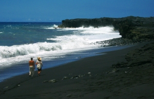
Historical Kona Heritage Corridor

Up-Country Kona is A Charming Amalgamation of True Old Hawaii and Counter Culture Weirdness--All With Stunning Views of the Ocean: Photo by Donnie MacGowan

Up-Country Kona is A Charming Amalgamation of True Old Hawaii and Whimsical Counter Culture Weirdness–All With Stunning Views of the Ocean: Photo by Donnie MacGowan

When the Kona Coast becomes too hot and humid upon a torrid afternoon, or post-littoral torpor sets in from sunbathing overindulgence at the beach, visitor’s to the Big Island Kona side should take a cue from locals and head up-country for the fresh, cool afternoon air. The Old Road, a 12 mile long remnant of the Mamalahoa Highway, runs through a beautiful slice of Old Hawai’i; coffee farms, fruit orchards, historical buildings, small towns and an old sugar mill grace the sunny slopes of Hualalai Volcano here.

Mauka, or Up-Country, Kona as this area is called, was once the beating financial heart of Hawai’i Island-along this road were built the first newspaper press, bottling company and telephone exchange on Hawai’i. Today, the road runs through the artist enclave of Holualoa, famed for its art galleries and coffeehouses. Sweeping views of the Kona coastline, the upper slopes of Hualalai Volcano and even Maui on vog-free days, make this road a trip a not to be missed treat. Let’s take a quick tour of the section of the Kona Heritage Corridor that runs along Highway 180 from it’s intersection with Highway 190 north through Holualoa, past the intersection with Highway 19 and into the town of Kainaliu.

Kona Mauka Offers Stunning Views Along The Coast and Of Sunsets: Photo by Donald B. MacGowan

Kona Mauka Offers Stunning Views Along The Coast and Of Sunsets: Photo by Donald B. MacGowan

M. Onizuka Store

Starting at the intersection of the Mamalahoa Highway (Hwy 180) and Highway 190 (Palani Road) and heading approximately South on the Mamalahoa Highway, one passes through tropical to temperate rainforest and comes to the verge of the cloud forest that softens the upper slopes of Hualalai Volcano. At about the 7 mile maker one passes the old M. Onizuka Store, the boyhood home of Astronaut Elisson Onizuka, who died in the Challenger space shuttle disaster. The M. Onizuka Store was founded in 1933 by Masamitsu Onizuka in 1933 who provided the residents of his community with general merchandise and means of transporting their purchases through the store’s one-man taxi service. Following her husband’s death, Mitsue Nagata Onizuka continued to run the store until the day she died in 1990. “May Peace On Earth Prevail” proclaims the post outside the residence where Elisson Onizuka, who had the honor of being the first astronaut of Japanese-American descent, grew up. History buffs are invited to explore Hawai’i’s rich involvement in man’s exploration of space at the Onizuka Space Museum at Kona International Airport.

Kona Mauka Was Once the Beating Financial Center of Hawaii Island:Photo by Donnie MacGowan

Kona Mauka Was Once the Beating Financial Center of Hawaii Island:Photo by Donnie MacGowan

K. Komo Store

Boasting but a few necessary concessions to the march of time, the charming comfort of the family store of yesteryear lives on in the form of the K. Komo Store. Gasoline, sundries and good conversation are always available at this for real slice of “Old Hawai’i”. Serving the people of Keopu since the early 1900’s, and operated by the third generation of Komo family, K. Komo Store still grows, roasts, brews and sells their own brand of coffee. The store is registered on the National Register of Historic Places.

Holualoa Town

When the Dryland Forest on the Slopes of Hualalai Volcano Open Up Near Holualoa Town, There Are Amazing Views of the Kona Coast

When the Dryland Forest on the Slopes of Hualalai Volcano Open Up Near Holualoa Town, There Are Amazing Views of the Kona Coast: Photo by Donald MacGowan

With a name that means “the long sled track”, its position at the apex of Kona coffee country and its modern day eclectic profusion of art galleries, schools and studios, it’s easy to see that Holualoa, once the bustling center of North Kona commerce, has been through some changes in the past 200 years. Initially, Hawai’ians grew taro and sweet potato in small family farm plots called “kuleana” around Holualoa. It is interesting to note that today the word “kuleana” in Hawai’ian pidgin has taken on the meaning of “personal responsibility”. In any case, early in the nineteenth century, Japanese, Portuguese and Chinese immigrants settled here and began planting large fields of oranges, breadfruit, coffee and cotton among other crops. A large sisal plantation for making ropes for sailing vessels was located just northwest of Holualoa…today, now-wild sisal plants, looking a bit alien with their tall, single stalk of blossoms, can be seen in profusion along Palani Road between Kailua and Kealekehe. Early in the 20th century the fields were turned over almost entirely to sugar production and Holualoa became the financial center of the Kona District. Luther Aungst established the Kona Telephone Co here in the 1890s, the first regional newspaper The Kona Echo was established at Holualoa by Dr. Harvey Hayashi, one of Kona’s first full time resident doctors. Many other schools, churches and industries, including the Kona Bottling Works, located here in the first half of the 20th century, but the collapse of the sugar industry brought financial doom that coffee growing only partially staved off. The community shrank drastically in population and commercial importance and by 1958 only about 1000 people lived in the Holualoa area. In a dreamy, upcountry Kona backwater, a community of artists, recluses, writers and seekers of the “Old Hawai’i Lifestyle” thrived here. Recently, an infusion of money from the newly invigorated “boutique coffee” industry has sparked a revival of commercial life in Holualoa, anchored in coffeehouses and art galleries.

Kona Sugar Company and West Hawai’i Railway Company

eKona Sugar Mill 2

The Jungle Has Nearly Reclaimed the Old Kona Sugar Mill Below Holualoa Town: Photo by Donnie MacGowan

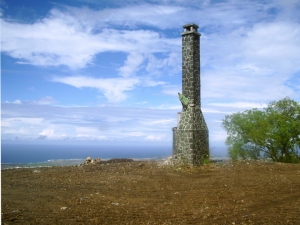
Such was the seductive lure of easy riches to be gained by growing sugar in Hawai’i at the beginning of the 20th Century, that investment capital for a large sugar plantation, sugar mill and railroad in Kona could be raised not once, but three times. The Kona Sugar Company plantation was established in 1899 and every available scrap of land was stripped of whatever crops had grown there previously and planted in cane. Although the sugar grew well enough above about 500 feet elevation, a notable lack of fresh water in Kona’s semi-arid landscape made Wai’aha Stream the only logical choice for the mill site. Unfortunately, the stream flow is vastly insufficient for year-round cane milling and the mill, built in 1901, went broke in 1903. Kona Sugar was bought by investors; renamed Kona Development Company, the plantation again went broke in 1916 and was in turn bought by investors in Tokyo. This group managed to eek out a profit until the industry imploded in 1926. Originally planned to run 30 miles, the railroad was only built to total length of 11 miles in the 27 years of sugar plantation operation. Work camps, communal baths, stables, workshops and all the requisite infrastructure of a giant agricultural plantation lay abandoned in the Mauka Kona countryside. During World War II, the U.S. Army used the mill site as a training camp to acclimate troops to warfare on their way to the tropical Pacific Theater. Fearing the tall smokestack of the mill would act as an artillery landmark for any invading forces, the Army pulled it down and Kona lost one of its first post-contact, industrial landmarks. Traces of the rail bed can still be seen from the top of Nani Kailua and Aloha Kona residential neighborhoods. Located just west of the town of Holualoa along Hualalai Road (the major intersection just south of town), near the intersection with Hienaloli Road, are impressive stone breastworks and trestles for the railroad. Built by hand but still strong today, the rail bed can be explored and hiked from here. Further up Hienaloli Road from the intersection with Hualalai Road, the old mill site remnants are still visible.

Keauhou Store

The Old Keauhou Store in the Kona Heritage Corridor: Photo by Donnie MacGowan

The Old Keauhou Store in the Kona Heritage Corridor: Photo by Donnie MacGowan

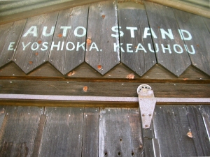
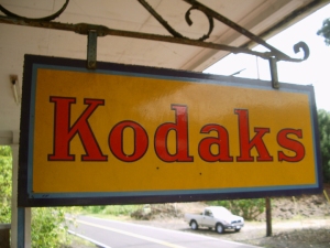
Originally Sasaki Store, Keauhou Store was founded by noted carpenter, coffee farmer and prominent local business man Yoshisuki Sasaki in 1919, and remains one of the great neighborhood stores of Kona. Run most recently by Yoshiuki’s son, Rikiyo, they once offered gas, sundries, fresh coffee and local produce; today, however, the Keauhou Store stands closed by the roadway, as traffic that used to pass by the front door now travels the makai highway. However, the front porch of Keauhou Store still serves as a gathering place for local coffee farmers and neighborhood children. A true remnant of Old Kona, Keauhou Store is worth a visit, especially to history buffs and photographers.Tong Wo Tong Cemetery

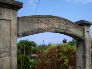
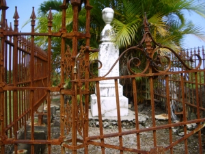
Although Chinese have lived in the Islands since the turn of the 19th Century, the first large scale immigration of Chinese came when they were brought over to work the cane fields in 1852. There was soon a burgeoning population of Chinese field workers and shopkeepers; by 1860 Chinese outnumbered Caucasians in Hawai’i. This community established the Tong Wo Tong Cemetery to honor their ancestors and commissioned Yoshisuki Sasaki, a noted local carpenter and prominent business man, to build the ornate gate in 1902. In English and Chinese the inscription on the gate reads “Tong Wo Tong Cemetery”.

Gateway to Tong Wo Tong Cemetery, Kona Heritage Corridor: Photo By Donald MacGowan

Gateway to Tong Wo Tong Cemetery, Kona Heritage Corridor: Photo By Donald MacGowan

Daifukuji Soto Mission

This Buddhist Temple has served the Mauka Kona community as a site for worship and retreat since opening on May 27, 1921. Reverend Kaiseki Kodama, who, since founding the first Kona Soto Mission in 1914, for years had held services at Hanato Store and other sites, planned the original mission building which was designed and built by Yoshisuki Sasakai. Reverend Hosokawa opened a Japanese Language School here in 1926; the school, living quarters and social hall all enlarged upon the original structure. The traditional Japanese music and dance-filled O Bon Festival is held here each July; visitors are welcome.

The Daifukuji Mission Near Kainaliu: Photo by Donnie MacGowan

The Daifukuji Mission Near Kainaliu: Photo by Donnie MacGowan

Lanakila Church/Kaona Uprising

Lanakila Church was the beginning and focal point for one of the strangest and more interesting episodes in Mauka Kona history during the latter half of the 19th Century. This, the last church built by the ubiquitous Reverend John D. Paris, was finished in 1867. Lanakila Church is still today a vibrantly strong, active parish of Congregationalists. The quiet country setting of this church gives little indication that it was in the center of a violent, deadly uprising in the late 1860s. Called the Kaona Uprising, the events of 1867 and 1868 comprised a perhaps natural reaction of the native Hawai’ians to having been so recently, and completely, dispossessed of their way of life, their naturist religion and their ancient traditions. The uprising started peaceably enough; in 1867 a man named Kaona introduced himself to the Reverend Paris, saying he had a great quantity of Hawai’ian Bibles he wished to distribute and asked permission to store them in the as-yet-unfinished Lanakila Church building. The Church elders assented and the Bibles were stored. However, Kaona and his followers tried to usurp the church building and its land for living space and at the pleas of Reverend Paris the Governor, Princess Ke’elikolani, eventually evicted them. Kaona moved his growing group of malcontents onto a neighbor’s property until rain and cold forced them to seek warmer lands downslope by the ocean. Growing more powerful with each new cult member, Kaona resisted the efforts of the local law enforcement, in the person of Sheriff Neville, to evict them, reportedly spitting on and destroying the first eviction order. Preaching Hellfire and Brimstone, and aided considerably by a rash of large earthquakes early in 1868, Kaona convinced his followers that he was the only true Prophet of God and that the earthquakes would destroy all but his most loyal followers. Sensing a mood of violence, Sheriff Neville determined to use force if necessary to evict Kaona and his band from their squatter’s camp. In the ensuing melee, Neville and one native policeman were killed. Kaona then whipped his band into a religious frenzy of blood lust, exhorting them to go forth, slay the white people and set fire to their farms and homes. Such was the violence and threat that the South Kona Magistrate organized a volunteer militia to for the protection of citizens, but the uprising wasn’t put down until the Steamer Kilauea brought troops from Honolulu to round up the violent mob several days later. Kaona was sentenced to 20 years imprisonment but was later pardoned and freed by King Kalakaua. He died a free man in Kona in 1883.

Graveyard at Lanakila Church, Kainaliu: Photo by Donald B. MacGowan

Graveyard at Lanakila Church, Kainaliu: Photo by Donald B. MacGowan

Aloha Theater

The Aloha Theater and its cafe, serve as a gathering place for the community and the home of independent, classic and second run films as well as the Hawaiian International Film Festival and various community events. Construction of the Aloha Theater began in 1929 and was finished in 1932, long before Hawai’i was a state. Starting life as a silent movie theater, it survived the changeover to ‘talkies’ as well as the great fire of 1948 that destroyed much of it’s side of town. Still in use today as a performing arts center by the Kona Association for the Performing Arts; their performances feature live music and dance as well as film. The Quonset-hut shaped original theater building and the original marquee still in use are very typical of the style used in other theaters of the plantation era in Hawaii. The Aloha Angel Café associated with the theater is a gustatory revelation and offers a wide-ranging menu of entrees, baked goods and deserts and is open daily for breakfast, lunch, and dinner.

The World Famous Aloha Theater and Aloha Angel Cafe in Kainaliu: Photo by Donnie MacGowan

The World Famous Aloha Theater and Aloha Angel Cafe in Kainaliu: Photo by Donnie MacGowan

Kainaliu Town

Napping gently on either side of the Hawaii Belt Road, Kainaliu Town is one of the principle commercial centers of Mauka Kona. Kainaliu grew up at the intersection of two donkey tracks which servicee the sugar, coffee and ranching industries, sometime after the construction of Lanakila Church in 1867. The star attraction in Kainaliu is, by far, the Aloha Theater and Aloha Angel Café. This historic and beautiful theater is still the center for stage productions of all kinds as well as cinematic shows; it is the centerpiece for the Kona Association for the Performing Arts (KAPA). Another of the towns interesting attractions is the amazing Oshima Grocery and Dry Goods Store (“If we don’t have it, you don’t need it”). In addition the town boasts numerous other businesses, galleries, furniture, thrift, herbal medicine shops as well as several wonderful restaurants and coffee houses. Donkey Balls has a candy factory that offers fun tours and tasty samples and Captain Cook Coffee has a roasting house right in town that gives weekday tours. When the weather turns wet in West Hawai’i, or you need a relief from the heat on the beach, a day spent browsing and eating in cool, shady Kainaliu is a real treat.

Kainaliu Town Is Full Of Interesting Boutiques, Shops and Restaurants: Photo By Donald MacGowan

Kainaliu Town Is Full Of Interesting Boutiques, Shops and Restaurants: Photo By Donald MacGowan

To celebrate the conclusion of our Historical Soirée, as long as you are in Kainaliu Town, you really ought to stop in for a cup of famous Kona Coffee at any one of a number of local coffee shops…not the harsh sameness of the ubiquitously monotonous Starbuck’s, each individually special Kona coffee cafe reflects the personality of the local growers and roasters who produce Kona Coffee, widely held to be the best in all the world. Also, the singular and exclusive galleries and stores in Kainaliu makes erfect shopping for completely unique gifts to take home.

Sunset Over Keauhou From the Kona Historic District: Photo by Donnie MacGowan

Sunset Over Keauhou From the Kona Historic District: Photo by Donnie MacGowan

For more information about touring Hawaii in general an exploring the Big Island in particular, please also visit www.tourguidehawaii.com and www.tourguidehawaii.blogspot.com.  Information about the author can be found here.

All media copyright 2009 by Donald B. MacGowan

Deeper and Deeper into Hawaii Volcanoes National Park

As you continue driving around and exploring Hawaii Volcanoes National Park you will find many great hiking and bicycling opportunities. Tour Guide has some 50 sights to see in the park and has details such as, parking, food and water and restroom facilities along the way.

One of the best day hikes in the park is the Kilauea Iki Crater Trail. This four mile round trip hike, about three hours at a nominal pace, will descend into the crater itself. From the floor of the crater, you will see fern, Ohia, and tropical rainforest crowding right up to the rim. The floor itself is stark desert, by comparison, as the trail takes you across and then up the other side. Make sure to bring plenty of water and maybe even some snacks for this hike.

To see even more of the parks wonders, we at Tour Guide suggest a drive down the Chain of Craters Road. This drive unlocks dozens more sights, hikes and vistas from high mountain rainforest to the barren lava landscapes and scenic ocean views below. Along this road are a number of overlooks for some fabulous photography. It ends at the sea where waves crash and spew against cliffs with steam clouds in the distance where lava reaches the ocean. Let’s see what this stunning area has to offer.

Lua Manu is a pit crater formed before written records were kept of the eruptive activity in the park. You will notice no cinder around the rim. This indicates no eruption here but a lava lake that formed inside the pit. As it drained, the pit collapsed, the latest of which was in 1974.

There are several more pit craters to see along this route and then you will come to Hilina Pali Road. This nine mile road takes you to some of the most magical views of the National Park. From forest down to the coast, the breathtaking scenery with leave you with the awe and majesty of Mother Nature and Madam Pele. For the hearty campers, Tour Guide will lead you to Kulanaokuaiki Campground. There are restrooms here but no water is available. At the end of Hilina Pali Road is an overlook not to be missed.

Back on Chain of Craters Road, Tour Guide brings you to Pauahi Crater, a large hourglass shaped crater that has held lava from many different flows over the years. Most recently, the 1979 earthquakes opened the south rift of the crater and issued steam and lava fountains. Though this episode only lasted one day, it was precursor to the current flows from Pu’u O’o in 1983 that destroyed hundreds of homes and businesses miles away in the Puna District.

Tour Guide will guide you to Kipuka Kahali’i. A kipuka is a hole or space where the lava surrounded forest or grassland but did not burn it. This one was partially devastated by the 1969 hot ash eruption of Mauna Ulu. The tallest trees survived and some hearty species of plants have returned.

For more information on visiting Hawaii in general and touring the Big Island in particular, please also visit www.tourguidehawaii.com and www.tourguidehawaii.blogspot.com.

This post has been expanded and updated here.

Across the Roof of Hawaii

Recent improvements to the Saddle Road make it no longer the grinding, intimidating drive it once was and open hundreds of square miles of unimaginably beautiful, strange and wondrous landscape to the Hawaii Island Visitor.

Approximate minimum time start to finish (to see every site): 12 hours

From Kona take Highway 190 to Highway 200 in 45 minutes of driving. Saddle Road, which cuts between the “saddle” of Mauna Loa on the south and Mauna Kea to the north, passes through ranch lands and the Pohakuloa Military Training Facility, for another 45 minutes, to the turn for Mauna Kea Access Road (John Burns Way). Nearby, Kipuka Huluhulu, or “shaggy hill”, is a 20 minute hike to the top and back. From here it is a 30 minute drive to the Mauna Kea Visitor Information Center. The small village is home to scientists and astronomers that work in the observatories and an amazing place to learn what their research tells us about our universe. Returning to Hwy 200, drive 45 minutes to the amazing Kaumana Cave lava tube, a short hike and a wonderful exploration. A further 30 minutes down Hwy 200 brings one to downtown Hilo, where there are shops, restaurants, fine museums, gorgeous waterfront beach parks and a fabulous Farmers Market. From Hilo, it is approximately three hours to return to Kailua Kona over Hwy 200; alternately one can take the faster though less scenic Hwy 19 to Waimea and then Hwy 190 into Kailua Kona, about a 2 1/2 hour drive.

Ahu'ena Heiau, Kailua Kona Hawaii: Photo by Donnie MacGowan

Ahu'ena Heiau, Kailua Kona Hawaii: Photo by Donnie MacGowan

Leg 1) In Kailua Kona, start at Ahu’ena Heiau; take Palani Road east to Hwy 190; take Hwy 190 to jct with Hwy 200, The Saddle Road

Ahu’ena Heiau and Kamakahonu Beach

Centuries ago the inhabitants of this region built a series of sacred temples, or heiaus, which were originally used for the purpose of sacrificing human beings to their war god, Kuka’ilimoku. This particular archeological site is called Ahu’ena Heiau, which in Hawaiian means “Hill of Fire”.

Built originally in the 15th century and rededicated by Kamehameha the Great in the early 1800s as the main temple of his capital, the current structures seen at Ahu’ena Heiau were re-built in 1975 under the auspices of the Bishop Museum with financial help from the Hotel King Kamehameha and are constructed to 1/3 the original scale. There are restrooms and showers located on the pier near the beach. Adjacent Old Kailua Town is a treasure of shops, restaurants and aloha.

Hualalai Volcano from Saddle Road, Big Island Hawaii: Photo by Donnie MacGowan

Hualalai Volcano from Saddle Road, Big Island Hawaii: Photo by Donnie MacGowan

Leg 2) Take Hwy 200, The Saddle Road, east to jct with John Burns Way (also called Mauna Kea Access Road).

Looking West from Highway 190 to Haualai Volcano Halfway between Kona and Waimea, Big Island of Hawaii: Photo by Donald B. MacGowan

Looking West from Highway 190 to Hualalai Volcano Halfway between Kona and Waimea, Big Island of Hawaii: Photo by Donald B. MacGowan

Saddle Road

Crossing the spectacular saddle between the towering bulk of the volcanoes Mauna Kea and Mauna Loa at about 6600 feet, The Saddle Road runs through brush, grass and forest lands, over lava fields and through some of the wildest and most breath-taking scenery on the Island. From this roadway, four of the 5 principal volcanoes that form The Big Island may be seen: Hualalai, Kohala, Mauna Loa, and Mauna Kea. Because the western half of the road is in notoriously poor condition and consists, in reality, of only one operable lane for much of its descent from the saddle to the Mamalahoa Highway.

However, this road provides the only road access to the Mauna Kea Summit Area and Visitor Information Center, Mauna Kea State Park, Pohakuloa Training Area, Mauna Kea Astronomical Observatory Complex, Waikii Ranch and the Kilohana Girl Scout Camp. The Saddle Road also provides the only access to thousands of acres of public forest and open grass lands. Connecting Hilo from about milepost 7.8 on the Hawai’i Belt Road to the Mamalahoa Highway approximately 6 miles south of Waimea, the Saddle Road is widely used by island residents for cross-island travel, despite its somewhat poor condition and undeserved, evil reputation.

Mauna Kea From Mauna Kea State Park; Note V-Shaped Stream Valleys and Glacial Cirques: Photo by Donald B. MacGowan

Mauna Kea From Mauna Kea State Park; Note V-Shaped Stream Valleys and Glacial Cirques: Photo by Donald B. MacGowan

The Saddle Road frequently has perfect weather, but also fairly routine are patches of intense rain, fog and high winds. It’s takes about 2 ½ to 3 hours straight driving time, depending upon weather, to make the full traverse from Kailua Kona to Hilo; however, one should be sure to leave time in the schedule to drive up to Mauna Kea Visitor Information Station or hike the Pu’u Huluhulu nature trails.

Along its entire 53 mile length between the turn-off from the highway just 6 miles west of Waimea and where it meets Hawaii Belt Road just north of Hilo, there is no gas and there are no services available; plan accordingly. Some food, water and restrooms may be available at the Mauna Kea Visitor Information Station which is a 30 minute drive up a side road off the Saddle Road about half way.

Kipuka Huluhulu from Saddle Road: Photo by Donald MacGowan

Kipuka Huluhulu from Saddle Road: Photo by Donald MacGowan

Leg 3) Off a Spur road at the jct of John Burns Way and Hwy 200, on the south side, is Kipuka Huluhulu (“Shaggy Hill”) Nene Sanctuary.

Pu’u Huluhulu Nature Trails/Kipuka Aina Hou

Frequently described as simultaneously the most noticeable and the most overlooked landmark along the Saddle Road, Kipuka Pu’u Huluhulu rises more than 200 feet out of the surrounding lava flows. It’s name meaning “furry hill”, this forested cinder cone has multiple trails winding up through rare native koa trees to breathtaking 360° views of Hualalai, Mauna Kea and Mauna Loa at the top, where you can also wander a meadow of native Hawaiian plants recently reintroduced in this protected natural habitat. By whatever trail, the summit of Kipuka Huluhulu is only about 20 minutes walk from the car.

Owing to the encapsulated nature of the kipuka, bird watching here is particularly fabulous; the Ā’akepa, Nene and the Ā’akiapola Ā’au, as well as the Kalij pheasants, pueo, i’o and turkeys are among the rare, endangered or just plain beautiful birds you will see here. The numerous roads and trails through the hundreds of square miles of adjacent lava flows makes for interesting, if hot and dry, mountain biking and hiking.

Parking and a unisex pit toilet are the only amenities available at Kipuka Pu’u Huluhulu.

Mauna Kea From Kipuka Huluhulu Nene Sanctuary: Photo by Donald MacGowan

Mauna Kea From Kipuka Huluhulu Nene Sanctuary: Photo by Donald MacGowan

Looking South from Mauna Loa to Mauna Kea from Near Lake Wai'au: Photo by Donnie MacGowan

Looking South from Mauna Loa to Mauna Kea from Near Lake Wai'au: Photo by Donnie MacGowan

Leg 4) Go north on John Burns Way to Mauna Kea Visitor Information Station.


Mauna Kea Visitor Information Station

The Visitor Information Station is open daily from 8 a.m. to 5 p.m. During the day there are interactive computer exhibits about Mauna Kea, the observatories and astronomical research, plus there are video presentations and nature trails to hike. Many evenings after dark National Park personnel and astronomers put on public programs and discuss what the latest astronomical findings tell us about the nature of our universe. The souvenir shop has some food items, including hot chocolate, coffee and hot soup, for sale.

Hikers on Mauna Kea Summit Looking at Mauna Loa Summit: Photo by Donnie MacGowan

Hikers on Mauna Kea Summit Looking at Mauna Loa Summit: Photo by Donnie MacGowan

Leg 5) John Burns Way to Mauna Kea Summit

Mauna Kea Summit

Before you decide to go to the summit of Mauna Kea, stop, think, plan. Are you prepared for cold and high altitude? Do you understand the nature and dangers of altitude sickness and UV radiation? Are you experienced at traveling icy dirt roads? Is you car safe for the trip (many car rental agencies on the island forbid you to drive this road)? The Rangers at the Visitor’s center can brief you on altitude sickness, UV radiation preparedness, the condition of the road and all other information you need to decide whether to visit the summit (see a video here).

Lake Wai'au--the Seventh Highest Lake in the US--Whose Name Means "Swirling Water", Perches Near the Summit of Mauna Kea On The Big Island of Hawaii: Photo by Donnie MacGowan

Lake Wai'au--the Seventh Highest Lake in the US--Whose Name Means "Swirling Water", Perches Near the Summit of Mauna Kea On The Big Island of Hawaii: Photo by Donnie MacGowan

The summit of Mauna Kea is truly an amazing place. Beautiful, awe-inspiring, 360 degree views of the entire Big Island, the summit is also culturally and religiously important to the native Hawai’ians and is home to several, world-class astronomical observatories and their support buildings. Because of the extremity of the altitude and the poor quality of the road above the Visitor’s Center, it is advised that extreme caution be exercised in deciding to visit Mauna Kea’s Summit. From the road’s end very near the summit, a short, 10 minute trail leads up Pu’u Weiku cinder cone to the actual mountain top and a Hawaiian religious shrine. Also near the summit is the 1-mile hike to Lake Waiau, the 7th highest lake in the US, as well as numerous archeological sites. Moving at altitude is strenuous, so conserve energy. Do not over-tax yourself, be sure to drink plenty of fluids and protect yourself from the sun, wind and cold. Leave the summit area and return to the paved road long before you are tired.

Kaumana Cave, Hilo Hawaii: Photo by Donnie MacGowan

Kaumana Cave, Hilo Hawaii: Photo by Donnie MacGowan

Leg 6) Return John Burns Way to Hwy 200; take Hwy 200 east to Kaumana Caves

Kaumana Caves

A skylight opening to 25-mile long Kaumana Cave is located at the county park near the 4-mile marker on the Hilo side of the Saddle Road. Concrete stairs take you down through the rain forest jungle to the bottom of a collapse pit forming two entrances to the cave. Most people are drawn to the entrance on the right, a large, opening leading to cavernous rooms. In this entrance, graffiti from hundreds of years ago to the present is preserved, scratched into the rocks. The entrance on the left, however, is more interesting, leading through squeezes and low spots to numerous rooms with fascinating speleo-architecture and cave formations. Both caves go to true dark in fewer than 300 feet in either direction. There are more than 2 miles of easily accessible, wild cave to explore here, but if you intend more than just a cursory inspection near the entrances, bring a hard hat, water and at least 3 sources of light. A quick tour of the caves takes fewer than 20 minutes.

Kaumana Cave's Skylight Entrance: Photo by Donnie MacGowan

Kaumana Cave's Skylight Entrance: Photo by Donnie MacGowan

Parking for the caves is located across the highway from the park; extreme care should be taken when crossing he road. Public restrooms, water and picnic tables are available at the park. As you approach Hilo from Kaumana Caves, Hwy 200 becomes variously called Kaumana Drive, then Wainuenue Avenue.

Astronomical Observatories on the Summit of Mauna Kea, From Downtown Hilo: Photo by Donnie MacGowan

Astronomical Observatories on the Summit of Mauna Kea, From Downtown Hilo: Photo by Donnie MacGowan

Leg 7) Take Hwy 200 into Hilo Town.

Hilo Town

Beautiful but wet, metropolitan but decrepit, bustling but laid back, Hilo is a lovely, maddening, heartbreaking, addictive study in contrasts. In can rain all day long for 50 days in a row, yet when the sun does shine, the views of Mauna Loa and Mauna Kea from the Lilioukalani Gardens, or of Hilo Bay as you drive down from the mountains, or the rain-forest and waterfall choked gulches with lovely beaches along the highway north of town, make Hilo one of the most truly, achingly-lovely spots on earth.

Hilo's Charming Bayfront Shops: Photo by Donald MacGowan

Hilo's Charming Bayfront Shops: Photo by Donald MacGowan

More laid back and sleepier than bustling Kailua Kona, Hilo is the largest town on the island, and the county seat. The Imiloa Astronomy Center of Hawaii, Tsunami Museum, Lyman House Missionary Museum and the Panaewa Rainforest Zoo are all wonderful places to learn about various aspects of Hawaii. There are numerous shopping districts, two large malls and the Historic Old Hilo downtown shops to browse through, a variety of sprawling green parks, a fabulous tropical arboretum right downtown and a mile-long black-sand beach fronting the bay to explore. Hilo’s Farmer’s Market is a “must see” for any visitor who is spending time on this side of the island.

Mauna Kea's Summit  from Highway 19 Near Waimea Town: Photo by Donald MacGowan

Mauna Kea's Summit from Highway 19 Near Waimea Town: Photo by Donald MacGowan

Leg 8) Return Wainuenue Avenue to Kaumana Drive to Hwy 200; take Hwy 200 west to jct with Hwy 190; take Hwy 190 west to Kailua Kona.

Trogdor at Keauhou Bay, Kona Hawaii: Photo by Donnie MacGowan

Trogdor at Keauhou Bay, Kona Hawaii: Photo by Donnie MacGowan

For more information on traveling to Hawaii in general and touring the Big Island in particular, please visit www.tourguidehawaii.com and www.tourguidehawaii.blogspot.com. Information about the author is available here.

All media copyright 2009 by Donald B. MacGowan
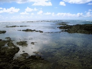

Hiking Ke-awa-iki Beach, the Golden Ponds, Pueo Bay and Weliweli Point, Kohala Hawaii

by Donnie MacGowan

Donnie MacGowan amongst the Golden Ponds of Ke-awa-iki, Big Island Hawaii: Photo by Bart Hunt

Donnie MacGowan amongst the Golden Ponds of Ke-awa-iki, Big Island Hawaii: Photo by Bart Hunt

Want to find a beautiful beach not even many locals know about?  Don’t mind walking about 15 minutes over a lava road and a’a?  This tiny mostly black-sand and gravel beach has good snorkeling on the south (left as you face the water) side, where there is still a pocket of white sand.

This Black and White Sand Piebald Beach is Aboslutely Unique on the Island of Hawaii...Maybe in the World: Photo by Donald MacGowan

This Black and White Sand Piebald Beach is Aboslutely Unique on the Island of Hawaii...Maybe in the World: Photo by Donald MacGowan

This unique black and white sand beach was created after the 1859 eruption of Mauna Loa, when lava reached the north end of the beach, where the black sand is today.  Further south along the beach, the recent black sand has not had time to thoroughly mix with the pre-existing white sand.

If one continues south there are numerous tide pools to explore.

The North End of Ke-awa-iki Beach Turns to a Delightfully Weird Moonscape: Photo by Donald B. MacGowan

The North End of Ke-awa-iki Beach Turns to a Delightfully Weird Moonscape: Photo by Donald B. MacGowan
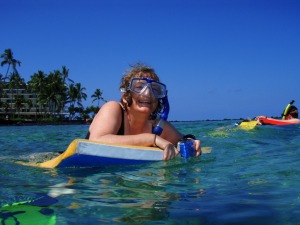
Hiking north, one passes along the wild and open Kohala Coastline to Pueo Bay (Pueo mean “owl” in Hawaiian), where many freshwater springs make the snorkeling interesting but weird, due to large temperature and salinity gradients. There are numerous trails to make your way back to the car or Ke-awa-iki Beach.

Bart Hunt and the Curious Lone Palm Tree a Keawaiki Beach, Hualalai Volcano in the Background: Photo by Donnie MacGowan

Bart Hunt and the Curious Lone Palm Tree a Keawaiki Beach, Hualalai Volcano in the Background: Photo by Donnie MacGowan

From Pueo Bay Looking North to Weliweli Point: Photo by Donald B. MacGowan
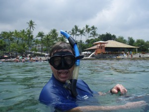
From Pueo Bay Looking North to Weliweli Point: Photo by Donald B. MacGowan

However, if one takes the trail running east behind Pueo Bay (intersection marked with coral), one comes to a pair of lovely golden pools, which can be seen for quite a distance, as they support a growth of hala trees.

Golden Ponds at Ke-awa-iki Spring Amazingly from the Seeming Lifeless A'a Lava Flow: Photo by Donnie MacGowan

Golden Ponds at Ke-awa-iki Spring Amazingly from the Seeming Lifeless A'a Lava Flow: Photo by Donnie MacGowan

A golden algae growing on the lava lends these pools their distinctive color.

Golden Algae Growing in the Hidden Freshwater Ponds at Ke-awa-iki: Photo by donald B. MacGowan

Golden Algae Growing in the Hidden Freshwater Ponds at Ke-awa-iki: Photo by donald B. MacGowan

If you bring an underwater camera, you can take spectacular photos of this gorgeous biologic wonder.

Golden Algae Growing in the Hidden Freshwater Ponds at Ke-awa-iki: Photo by Donald B. MacGowan
Golden Algae Growing in the Hidden Freshwater Ponds at Ke-awa-iki: Photo by Donald B. MacGowan
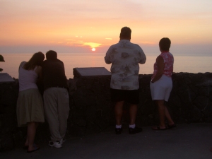
Feel free to frolic in the ponds before finishing the hike—just be sure not to damage the growth by walking on it too much.

Another interesting trail to thread are the many roads and trails leading to Weliweli Point from the Ponds or Pueo Bay, essentially just keep parallel to the coastline and they all converge at a private residence near the point–on clear days, unsurpassed views of Kohala Mountain and Haleakala on Maui can be seen here.

Weliweli to Haleakala on Maui: Photo by Donnie MacGowan
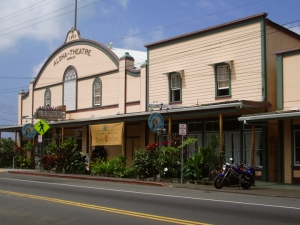
Weliweli to Haleakala on Maui: Photo by Donnie MacGowan

Return by taking the major dirt road back towards the highway, taking the millennia old King’s Trail south when that intersection is reached. Out in the a’a flow it’s hard to get lost, you can almost always see where you parked your car, and the trails all eventually lead there.

There is much to see here besides the beaches and the Golden Pons.

Bart Hunt at the Sacred Pond at Ke-awa-iki: Photo by Donald MacGowan
Bart Hunt at the Sacred Pond at Ke-awa-iki: Photo by Donald MacGowan

There are remains of ancient heiau (temples) and villages.

Bart Hunt Explores and Ancient Heiau (temple) at Ke-awa-iki: Photo by Donnie MacGowan

Bart Hunt Explores and Ancient Heiau (temple) at Ke-awa-iki: Photo by Donnie MacGowan

And although no green sand beach is know to have formed, vesicular basalts in the area around Weliweli Point have abundant olivine (peridot) crystals.

Olivine Phenocrysts in Vesicular Basalt Near Ke-awa-iki: Photo by Donald MacGowan

Olivine Phenocrysts in Vesicular Basalt Near Ke-awa-iki: Photo by Donald MacGowan

Depending on how you thread the trails, it’s approximately 4 miles, round trip.

To Find the wonders of Ke-awa-iki: Drive just north of Mile 79, park where boulders block a gravel road. Take gravel road/trail towards the ocean, hike along the road, fence and trail 15 minutes to Ke-awa-iki Beach.  No facilities.

A video about Ke-awa-iki is available here.

For more information about traveling around Hawaii in general and touring the Big Island in particular, please visit www.tourguidehawaii.com and www.tourguidehawaii.blogspot.com.

All media copyright 2009 by Donald B. MacGowan; all rights reserved.